
-
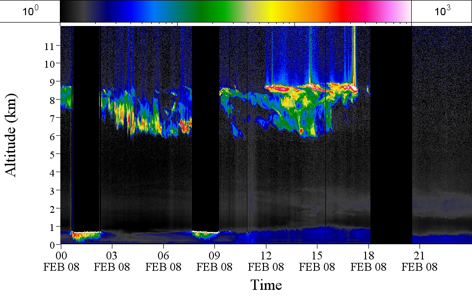
GPM GROUND VALIDATION AEROSOL AND WATER VAPOR LIDAR QUICKLOOKS GCPEX V1
The GPM Ground Validation Aerosol and Water Vapor Lidar Quicklooks GCPEx dataset contains imagery generated from the GPM Cold-season Precipitation Experiment (GCPEx) campaign... -
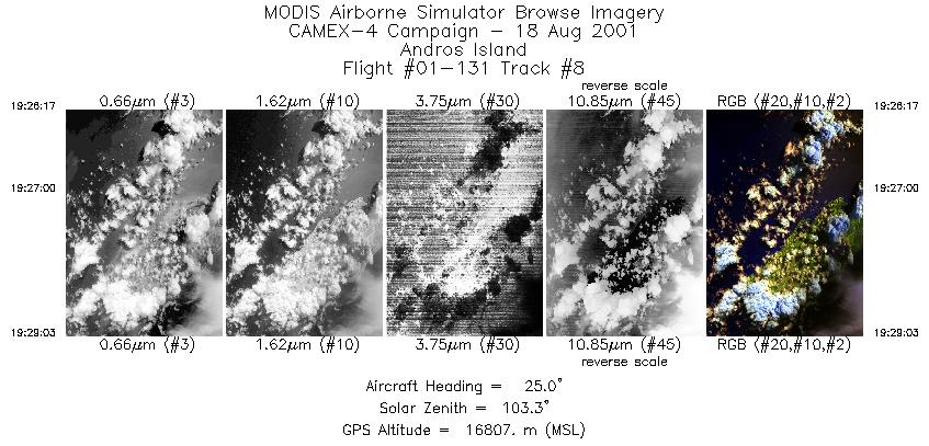
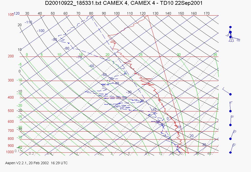
CAMEX-4 ER-2 MODIS AIRBORNE SIMULATOR (MAS) V1
The MODIS Airborne Simulator (MAS) is an airborne scanning spectrometer that acquires high spatial resolution imagery of cloud and surface features from its vantage point on-... -
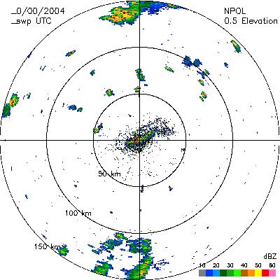
CAMEX-4 NASA PORTABLE S-BAND MULTIPARAMETER WX RESEARCH RADAR V1
The CAMEX-4 NASA Portable S-Band Multiparameter WX Research Radar dataset was collected by the NASA Portable S-band Multiparameter Weather Research Radar (NPOL), which is a... -
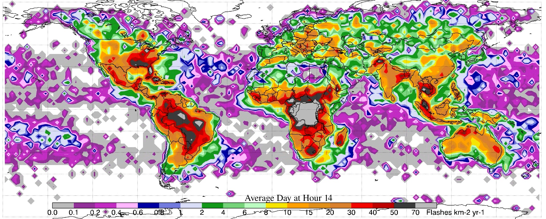
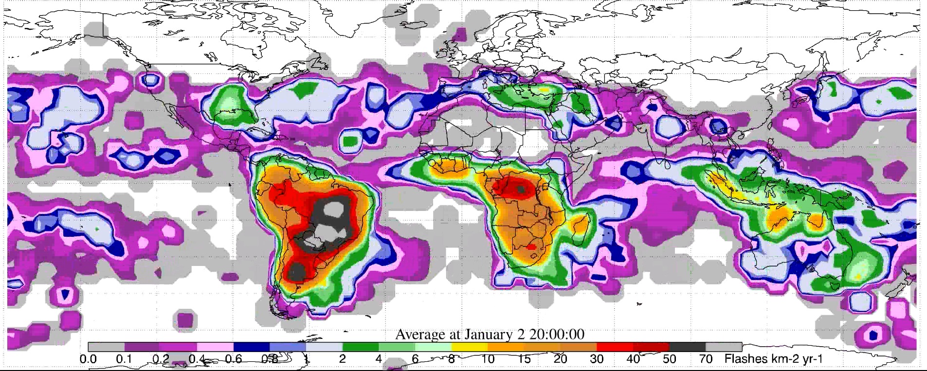
LIS/OTD 2.5 Degree Low Resolution Diurnal Climatology (LRDC) V2.3.2015
The LIS/OTD 2.5 Degree Low Resolution Diurnal Climatology (LRDC) contains a variety of gridded climatologies of total lightning flash rates obtained from two lightning detection... -
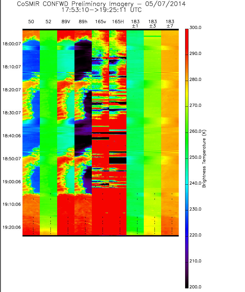
GPM GROUND VALIDATION CONICAL SCANNING MILLIMETER-WAVE IMAGING RADIOMETER (COSMIR) IPHEx V1
The GPM Ground Validation Conical Scanning Millimeter-wave Imaging Radiometer (CoSMIR) IPHEx dataset consists of brightness temperatures from 9 channels as measured by the... -
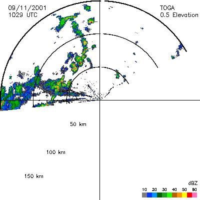
CAMEX-4 TOGA RADAR V1
The TOGA radar dataset consists of browse and radar data collected from the TOGA radar during the CAMEX-4 experiment. TOGA is a C-band linear polarized doppler radar using 500KW... -
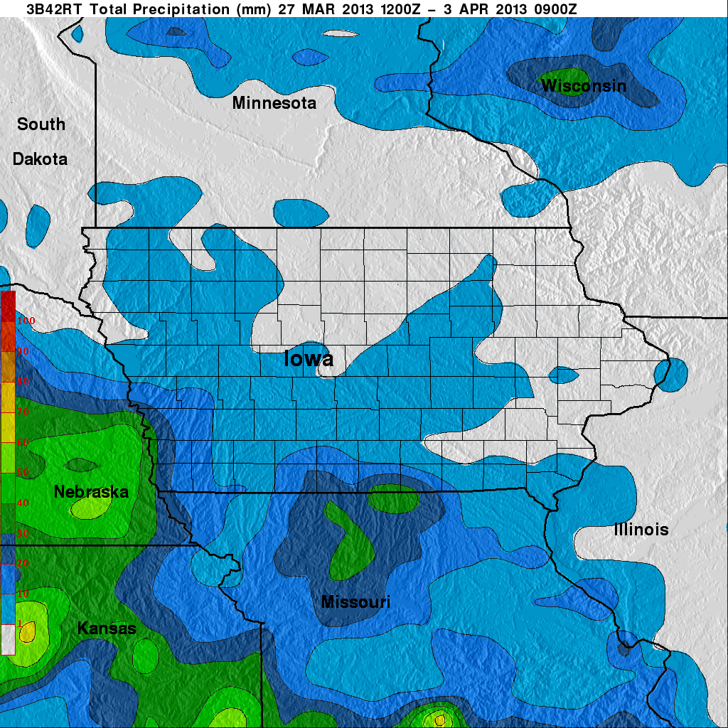
GPM Ground Validation Naval Research Laboratory (NRL) Near-Real Time Rain Rates IFloodS V1
The GPM Ground Validation Naval Research Laboratory (NRL) Near-Real Time Rain Rates IFloodS data product was created for the GPM Iowa Flood Studies (IFloodS) field campaign from... -
High Altitude MMIC Sounding Radiometer (HAMSR) CPEX-AW V1
The High Altitude MMIC Sounding Radiometer (HAMSR) CPEX-AW dataset includes measurements gathered by the HAMSR instrument during the Convective Processes Experiment – Aerosols... -
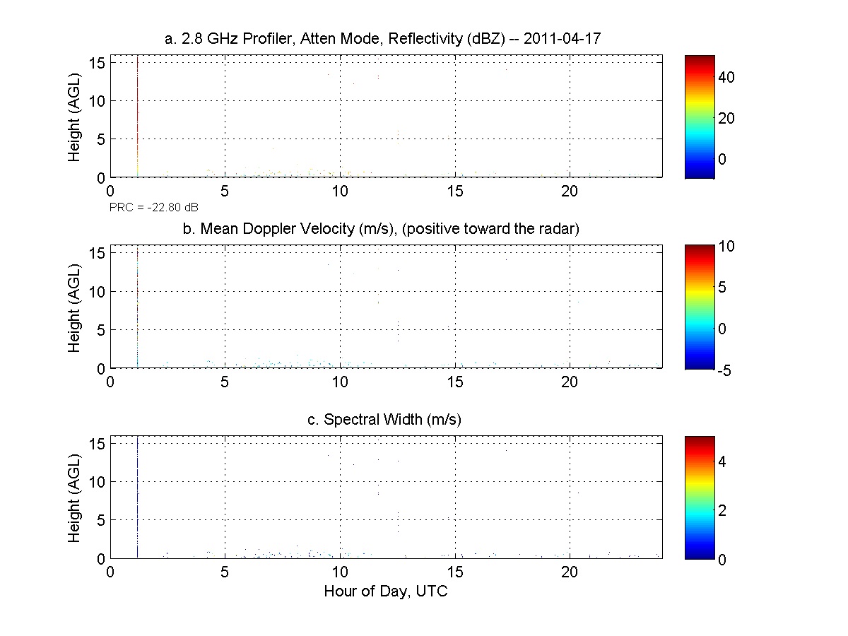
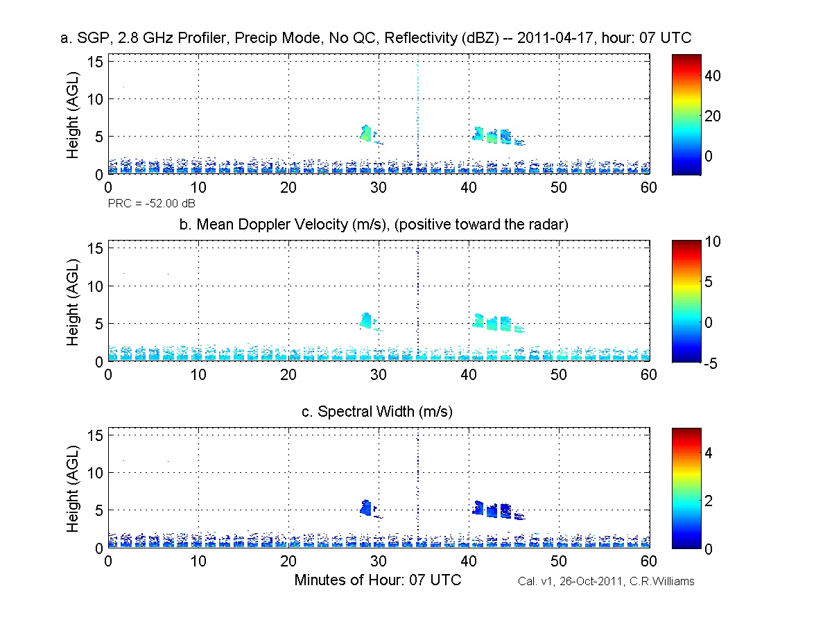
GPM GROUND VALIDATION NOAA S-BAND PROFILER ORIGINAL DWELL DATA MC3E V1
The GPM Ground Validation NOAA S-Band Profiler Original Dwell Data MC3E dataset was gathered during the Midlatitude Continental Convective Clouds Experiment (MC3E) in Oklahoma... -
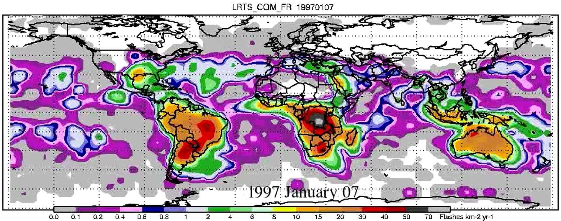
LIS/OTD 2.5 Degree Low Resolution Time Series (LRTS) V2.3.2015
The LIS/OTD 2.5 Degree Low Resolution Time Series (LRTS) contains a variety of gridded climatologies of total lightning flash rates obtained from two lightning detection sensors... -
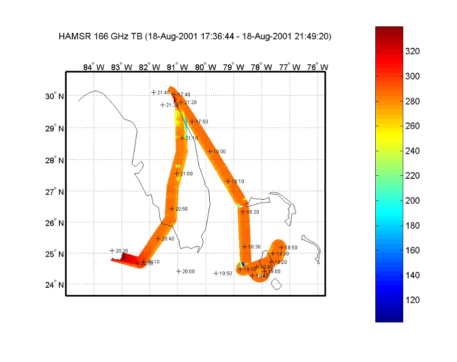
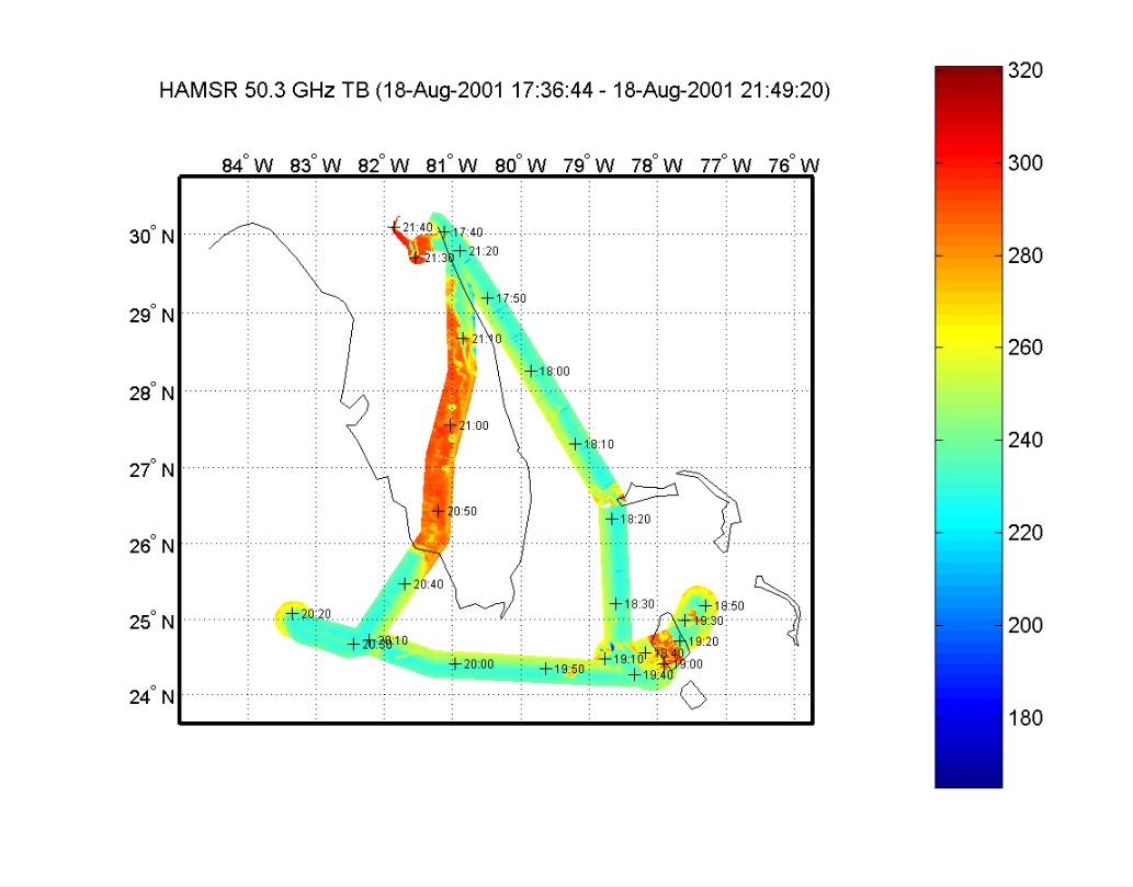
CAMEX-4 HIGH ALTITUDE MMIC SOUNDING RADIOMETER (HAMSR) V1
The CAMEX-4 High Altitude MMIC Sounding Radiometer (HAMSR) dataset was collected by the High Altitude Monolithic Microwave Integrated Circuit (MMIC) Sounding Radiometer (HAMSR),... -
LIS/OTD 2.5 Degree Low Resolution Annual Diurnal Climatology (LRADC) V2.3.2015
The LIS/OTD 2.5 Degree Low Resolution Annual Dirunal Climatology (LRADC) contains a variety of gridded climatologies of total lightning flash rates obtained from two lightning... -
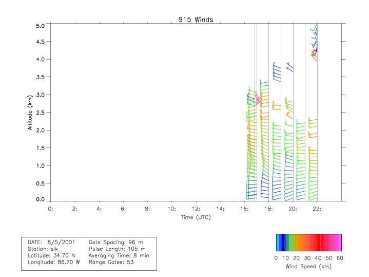
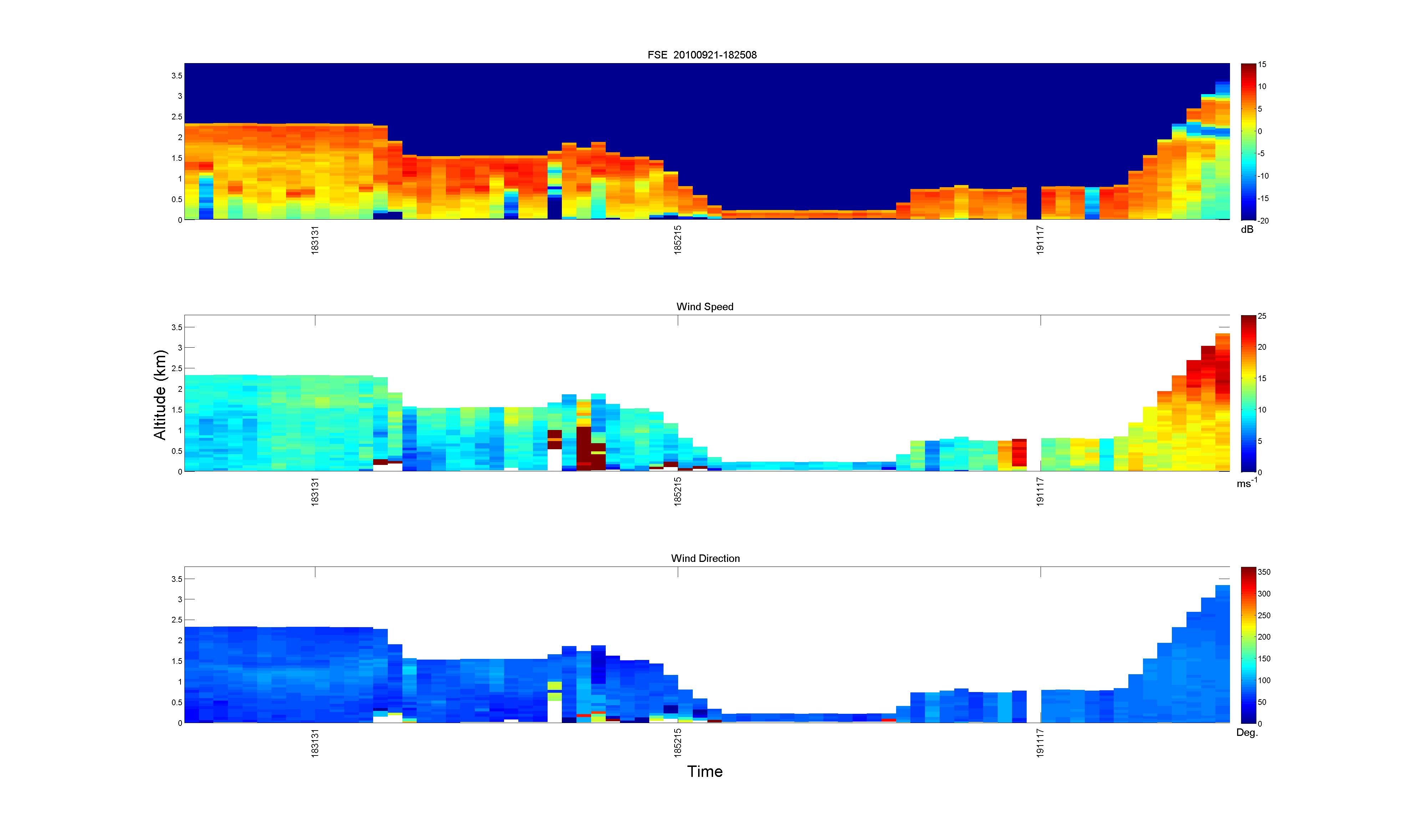
CAMEX-4 MIPS 915 MHZ DOPPLER WIND PROFILER V1
The CAMEX-4 MIPS 915 MHZ Doppler Wind Profiler dataset was collected by the University of Alabama in Huntsville (UAH) Mobile Integrated Profiling System (MIPS), which is a... -
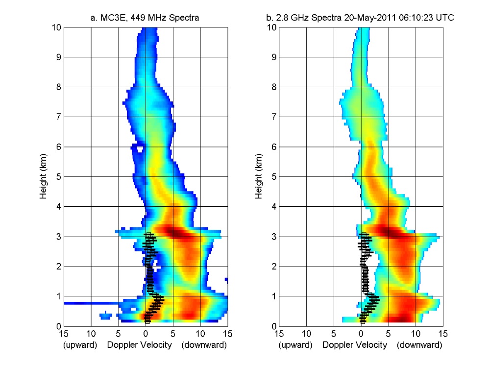
GPM GROUND VALIDATION NOAA UHF 449 PROFILER MC3E V1
The GPM Ground Validation NOAA UHF 449 Profiler MC3E dataset was collected during the NASA supported Midlatitude Continental Convective Clouds Experiment (MC3E). The overarching... -
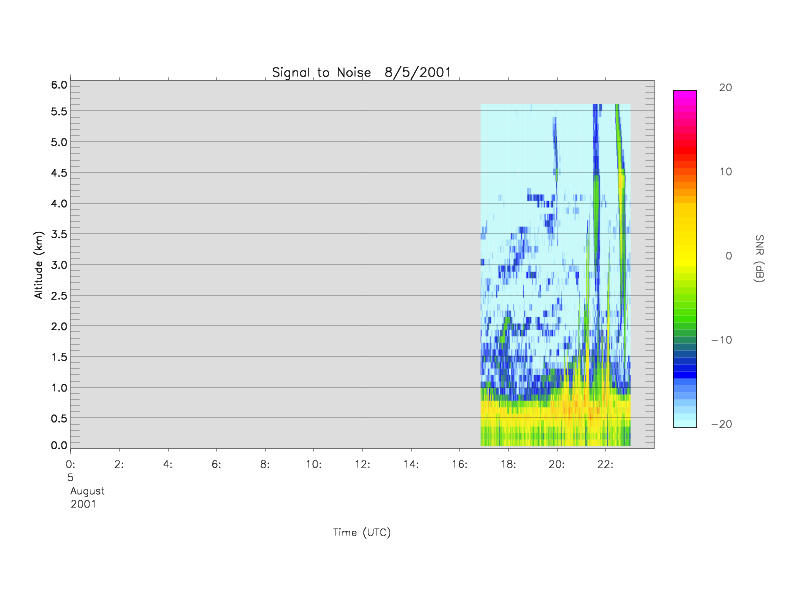
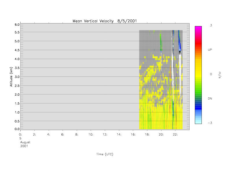
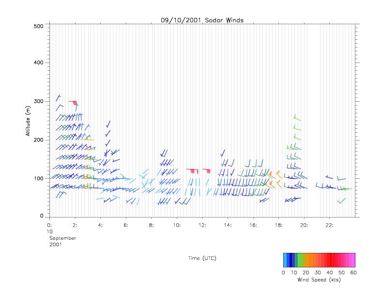
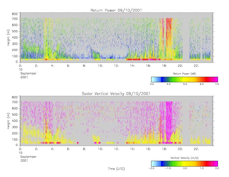
CAMEX-4 MIPS SODAR V1
The University of Alabama in Huntsville (UAH) Mobile Integrated Profiling System (MIPS) is a mobile atmospheric profiling system. It includes a 915 MHz Doppler profiler, lidar... -
GRIP DOPPLER AEROSOL WIND LIDAR (DAWN) V1
The GRIP Doppler Aerosol WiNd Lidar (DAWN) Dataset was collected by the Doppler Aerosol WiNd (DAWN), a pulsed lidar, which operated aboard a NASA DC-8 aircraft during the... -
CAMEX-4 ER-2 HIGH ALTITUDE DROPSONDE V1
The CAMEX-4 ER-2 High Altitude Dropsonde dataset was collected by the ER-2 High Altitude Dropsonde System (EHAD), which used dropwinsondes fitted with Global Positioning System... -
CAMEX-4 CVI CLOUD CONDENSED WATER CONTENT V1
The CAMEX-4 DC-8 Forward and NADIR Video dataset consists of DVDs which capture the forward and nadir views from the NASA DC-8 aircraft during CAMEX-4 flights. These videos... -
GPM Ground Validation Global Flood Monitoring System (GFMS) Flood Maps IFloodS V1
The GPM Ground Validation Global Flood Monitoring System (GFMS) Flood Maps IFloodS dataset contains global flood estimates on a 0.25 degree spatial resolution every 3 hours,... -
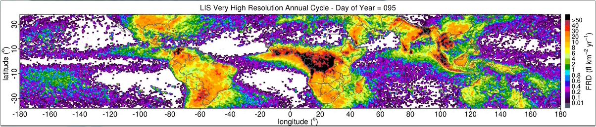
LIS 0.1 DEGREE VERY HIGH RESOLUTION GRIDDED LIGHTNING ANNUAL CLIMATOLOGY (VHRAC) V1
The LIS 0.1 Degree Very High Resolution Gridded Lightning Annual Climatology (VHRAC) dataset consists of gridded annual climatologies of total lightning flash rates seen by the...

Official websites use .gov
A
.gov website belongs to an official government
organization in the United States.
Secure .gov websites use HTTPS
A
lock (
) or https:// means you’ve safely connected to
the .gov website. Share sensitive information only on official,
secure websites.