
-
SBUV2/NOAA-16 Ozone (O3) Profile and Total Column Ozone 1 Month Zonal Mean L3 Global 5.0 degree Latitude Zones V1 (SBUV2N16L3zm) at GES DISC
The Solar Backscattered Ultraviolet (SBUV) from NOAA-16 Level-3 monthly zonal mean (MZM) product (SBUV2N16L3zm) is derived from the Level-2 retrieved ozone profiles. Ozone... -
HIRDLS/Aura Level 3 Geopotential Height 1deg Lat Zonal Fourier Coefficients V007 (H3ZFCGPH) at GES DISC
The "HIRDLS/Aura Level 3 Geopotential Height Zonal Fourier Coefficients" version 7 data product (H3ZFCGPH) contains the entire mission (~3 years) of HIRDLS data expressed as... -
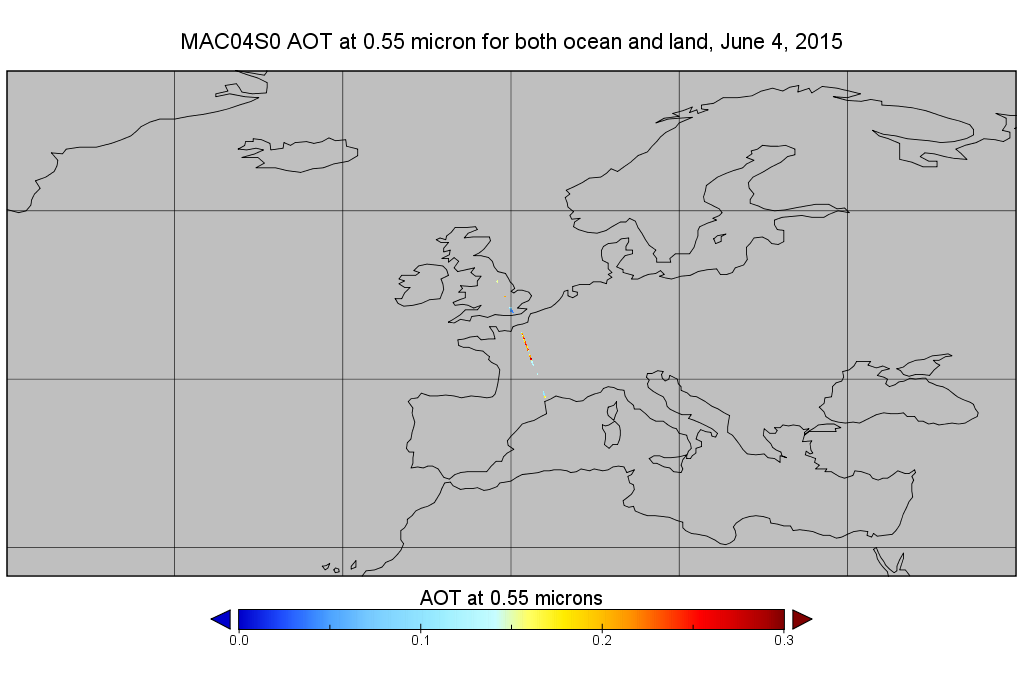
MODIS/Aqua Aerosol 10km 5-Min L2 Narrow Swath Subset along CloudSat V002 (MAC04S0) at GES DISC NGDA
This is the narrow-swath MODIS/Aqua subset along CloudSat field of view track. The goal of the narrow-swath subset is to select and return MODIS data that are within +-5 km... -
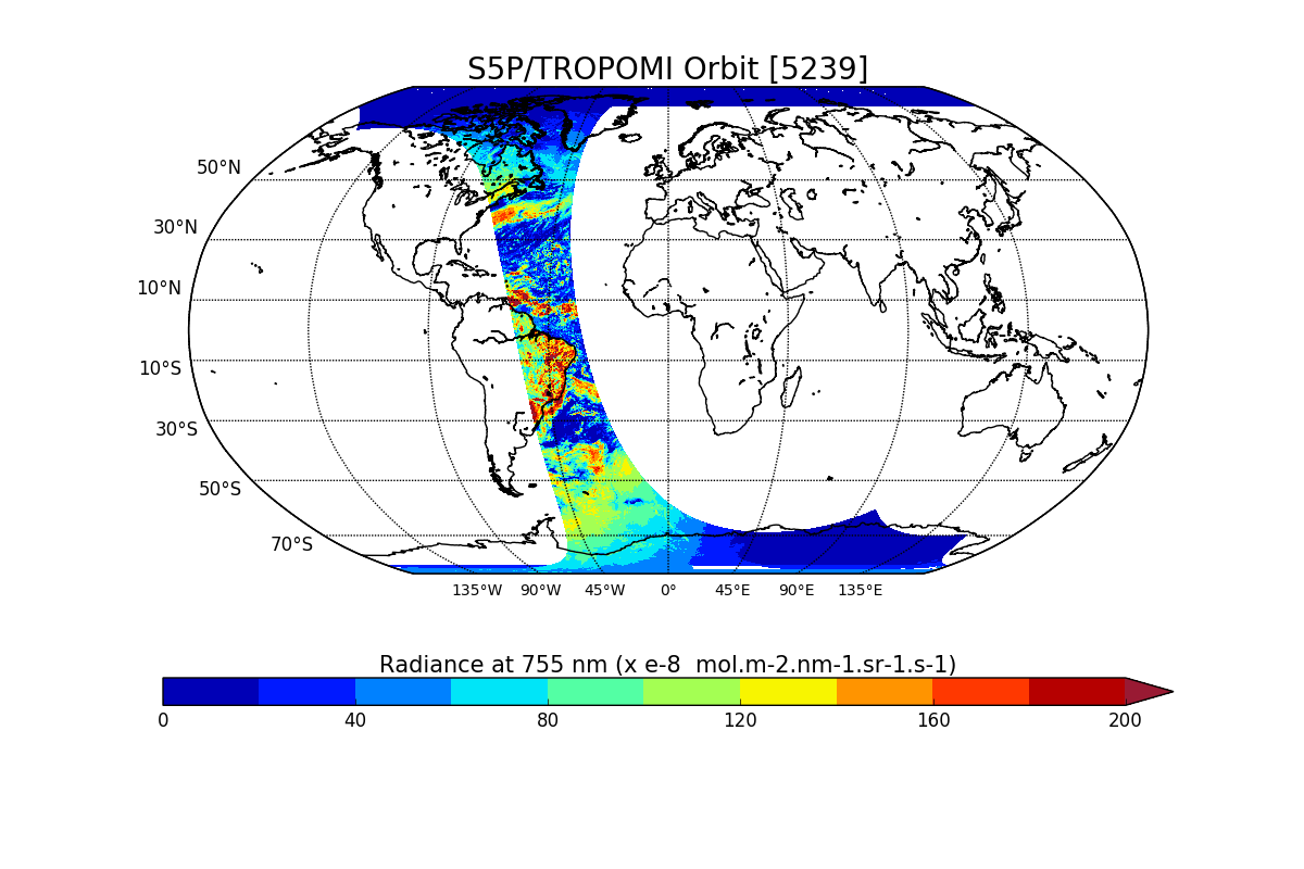
Sentinel-5P TROPOMI Radiance product band 6 (NIR detector) L1B V1 (S5P_L1B_RA_BD6) at GES DISC
Starting from August 6th in 2019, Sentinel-5P TROPOMI along-track high spatial resolution (~5.5km at nadir) has been implemented. For data after August 6th of 2019, please check... -
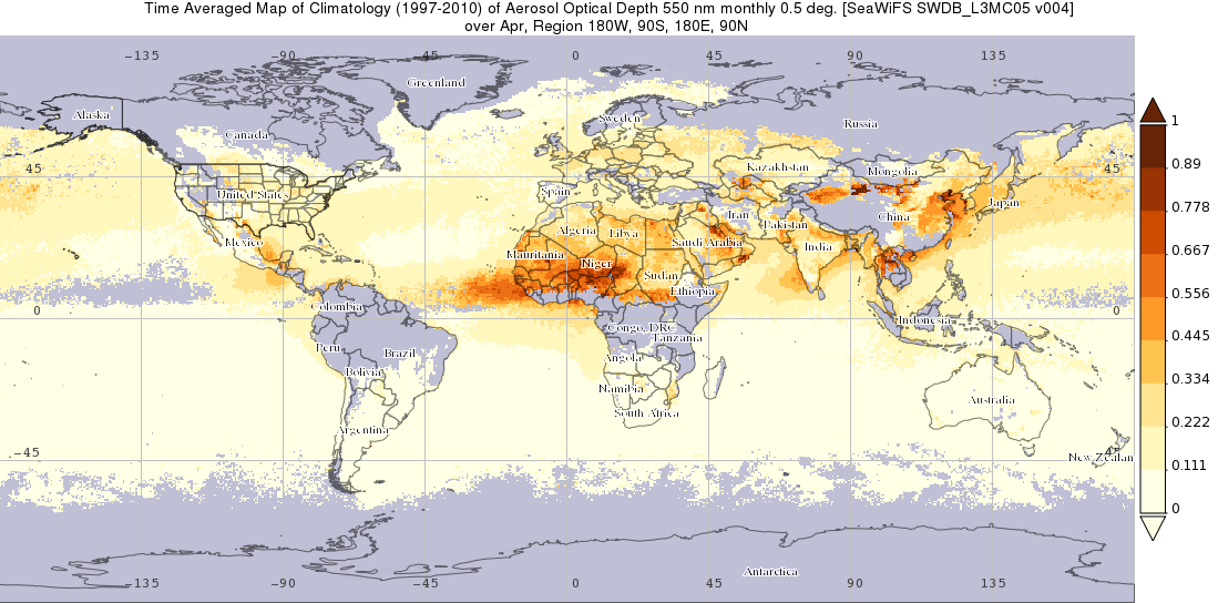
SeaWiFS Deep Blue Aerosol Optical Thickness Monthly Level 3 Climatology Data Gridded at 0.5 Degrees V004 (SWDB_L3MC05) at GES DISC
The SeaWiFS Deep Blue Level 3 monthly climatology product contains monthly global climatology gridded (0.5 x 0.5 deg) data derived from SeaWiFS Deep Blue Level 3 monthly gridded... -
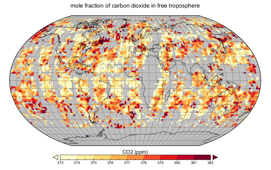
AIRS/Aqua L3 daily CO2 in the free troposphere (AIRS-only) 2.5 degrees x 2 degrees V005 (AIRS3C2D) at GES DISC
The Atmospheric Infrared Sounder (AIRS) is a grating spectrometer (R = 1200) aboard the second Earth Observing System (EOS) polar-orbiting platform, EOS Aqua. In combination... -
MLS/Aura Level 3 Daily Binned Water Vapor (H2O) Mixing Ratio on Zonal and Similar Grids V004 (ML3DZH2O) at GES DISC
ML3DZH2O is the EOS Aura Microwave Limb Sounder (MLS) daily binned on zonal and assorted vertical grids product for water vapor (H2O) derived from radiances measured primarily... -
CAR FIREACE Arctic Ice and Cloud Radiation L1 V1 (CAR_FIREACE_L1C) at GES DISC
The scientific objectives of FIRE/ACE are to study impact of Arctic clouds on radiation exchange between surface, atmosphere, and space, and the influence of surface... -
HAQES 3-Hourly Ensemble mean surface total PM2.5 concentration at census level, North America V1 (HAQES_NA_PM25_TOT_CENSUS) at GES DISC
This product provides HAQES 3-hourly ensemble mean surface total PM2.5 concentration at the census level over the continental United States (CONUS). The Hazardous Air Quality... -
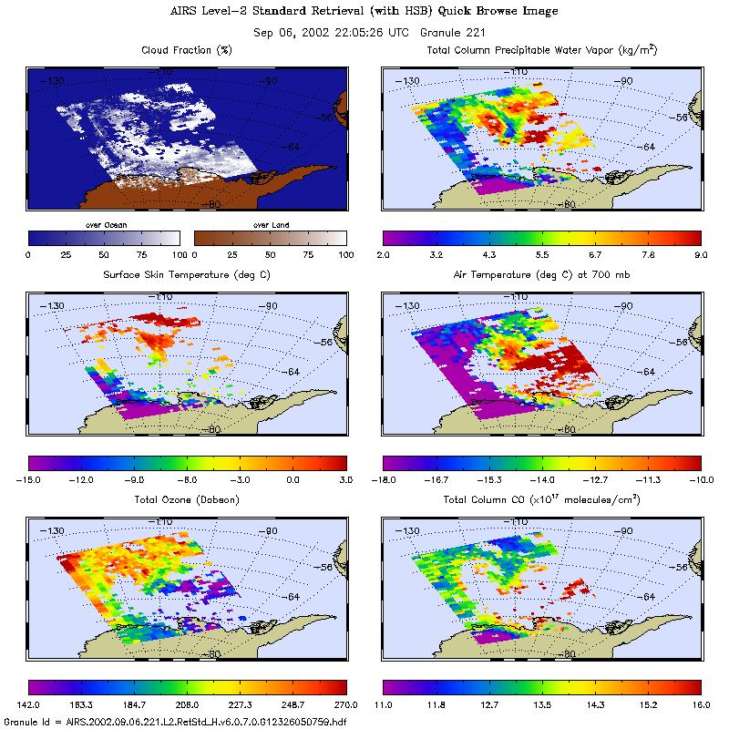
AIRS/Aqua L2 Standard Physical Retrieval (AIRS+AMSU+HSB) V006 (AIRH2RET) at GES DISC
The Atmospheric Infrared Sounder (AIRS) is a grating spectrometer (R = 1200) aboard the second Earth Observing System (EOS) polar-orbiting platform, EOS Aqua. In combination... -
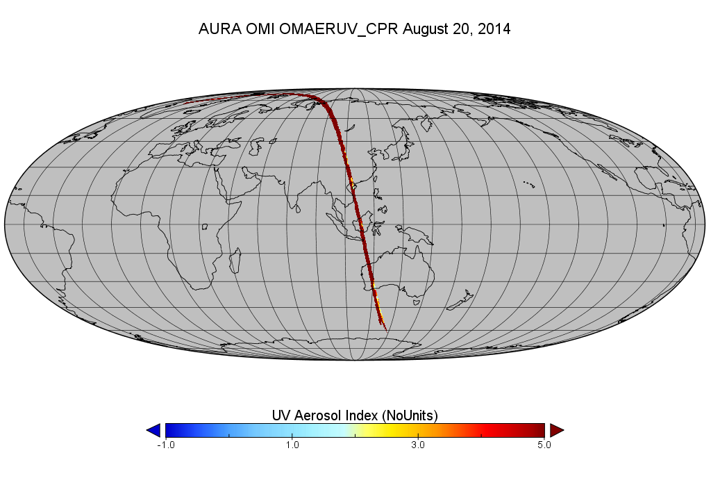
OMI/Aura Level 2 Near UV Aerosol Optical Depth and Single Scattering Albedo 200-m swath subset along CloudSat track V003 (OMAERUV_CPR) at GES DISC
This is a CloudSat-collocated subset of the original OMI product OMAERUV, for the purposes of the A-Train mission. The goal of the subset is to select and return OMI data that... -
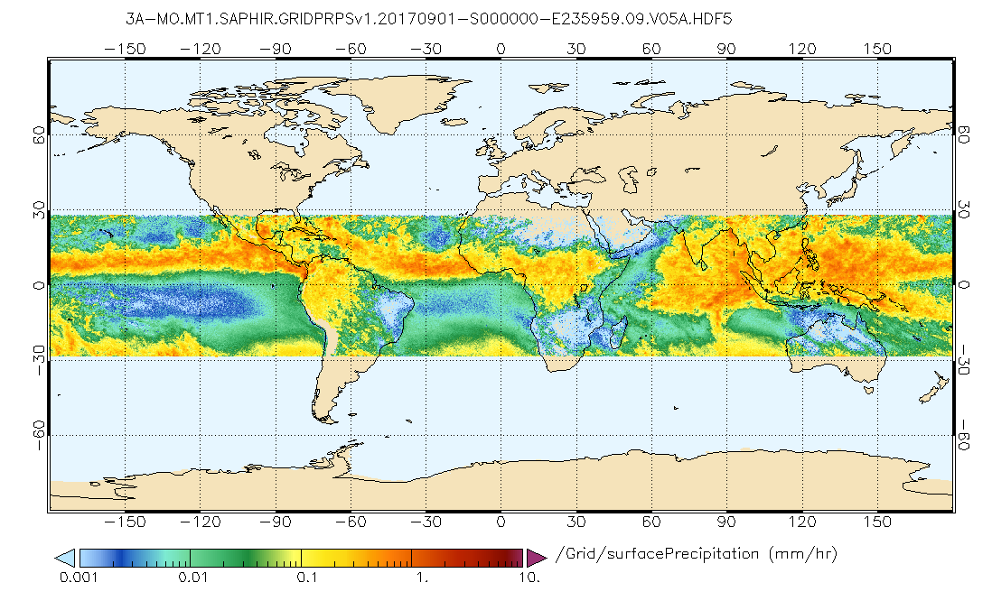
GPM SAPHIR on MT1 (PRPS) Climate-based Radiometer Precipitation Profiling L3 1 month 0.25 x 0.25 degree V06 (GPM_3PRPSMT1SAPHIR_CLIM) at GES DISC
The "CLIM" products differ from their "regular" counterparts (without the "CLIM" in the name) by the ancillary data they use. They are Climate-Reference products, which requires... -
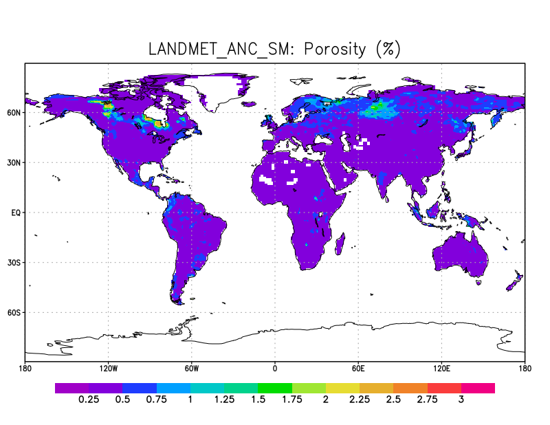
LANDMET Ancillary Soil Moisture data L3 V1 (LANDMET_ANC_SM) at GES DISC
This ancillary climatology soil porosity and wetlands coverage information were derived from the daily GEWEX fusion of satellite active and passive microwave measurements. These... -
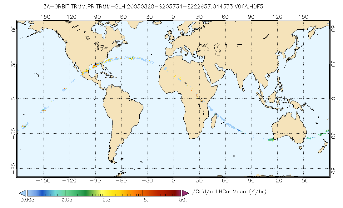
GPM PR on TRMM Gridded Orbital Spectral Latent Heating Profiles L3 1.5 hours 0.5x0.5 degree V07 (GPM_3GSLH_TRMM) at GES DISC
This is the new (GPM-formated) TRMM product. It replaces the old TRMM_3G25 Version 07 is the current version of the data set. Older versions will no longer be available and have... -
MODIS/Aqua CLD Mask Spect. Results 250m and 1km 5-Min L2 Wide Swath Subset along CloudSat V002 (MAC35S1) at GES DISC NGDA
This is the wide-swath MODIS/Aqua subset along CloudSat field of view track. The goal of the wide-swath subset is to select and return MODIS data that are within +-100 km across... -
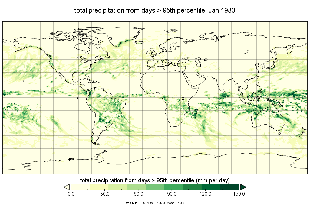
MERRA-2 statM_2d_edi_Nx: 2d, Single-Level, Monthly Extremes Detection Indices V1 (M2SMNXEDI) at GES DISC
The Modern Era Retrospective analysis for Research and Applications, Version 2 (MERRA-2) contains a wealth of information that can be used for weather and climate studies. By... -
TROPESS Chemical Reanalysis NO2 6-Hourly 3-dimensional Product V1 (TRPSCRNO26H3D) at GES DISC
The TROPESS Chemical Reanalysis NO2 6-Hourly 3-dimensional Product contains vertical concentrations of nitrogen dioxide. The data are part of the Tropospheric Chemical... -
Sentinel-5P TROPOMI Total Ozone Column 1-Orbit L2 5.5km x 3.5km V2 (S5P_L2__O3_TOT_HiR) at GES DISC
Starting from August 6th in 2019, Sentinel-5P TROPOMI along-track high spatial resolution (~5.5km at nadir) has been implemented. Starting from July 13th in 2020, five... -
VISSR/SMS-2 Infrared Imagery on 70mm Film V001 (VISSRSMS2IMIR) at GES DISC
VISSRSMS2IMIR is the Visible Infrared Spin-Scan Radiometer (VISSR) Infrared Imagery on 70mm Film data product from the second Synchronous Meteorological Satellite (SMS-2). This... -
OMI/Aura Level 1B UV Global Geolocated Earthshine Radiances 1-orbit L2 Swath 13x24 km V003 (OML1BRUG) at GES DISC
The Aura Ozone Monitoring Instrument (OMI) Level-1B (L1B) Geo-located Earth View UV Radiance, Global-Mode (OML1BRUG) Version-3 product contains geo-located Earth view spectral...

Official websites use .gov
A
.gov website belongs to an official government
organization in the United States.
Secure .gov websites use HTTPS
A
lock (
) or https:// means you’ve safely connected to
the .gov website. Share sensitive information only on official,
secure websites.