

LANDMET Ancillary Soil Moisture data L3 V1 (LANDMET_ANC_SM) at GES DISC
Access & Use Information
Public: This dataset is intended for public access and use.
Non-Federal: This dataset is covered by different Terms of Use than Data.gov.
License: No license information was provided.
Downloads & Resources
-
Google Scholar search resultsHTML
Search results for publications that cite this dataset by its DOI.
-
Get a related visualizationPNG
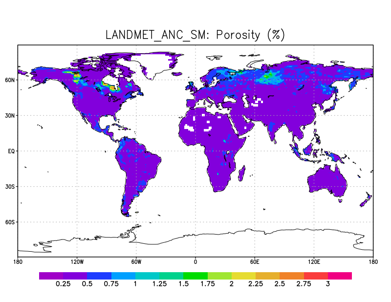
This is a sample image of porosity from ancillary product LANDMET_ANC_SM_L3_v1
-
This dataset's landing pageHTML
Access the dataset landing page from the GES DISC website.
-
Download this dataset through a directory mapHTML
Access the data via HTTPS.
-
Download this dataset through Earthdata SearchHTML
Use the Earthdata Search to find and retrieve data sets across multiple data...
-
Use OPeNDAP to access the dataset's dataHTML
Access to the data via OPeNDAP protocol.
-
View this dataset's read me documentPDF
README Document
-
Landing PageLanding Page
Dates
| Metadata Created Date | February 22, 2025 |
|---|---|
| Metadata Updated Date | February 22, 2025 |
Metadata Source
- Data.json Data.json Metadata
Harvested from nasa test json
Additional Metadata
| Resource Type | Dataset |
|---|---|
| Metadata Created Date | February 22, 2025 |
| Metadata Updated Date | February 22, 2025 |
| Publisher | NASA/GSFC/SED/ESD/GCDC/GESDISC |
| Maintainer | |
| Identifier | C1374187876-GES_DISC |
| Data First Published | 2016-11-22 |
| Language | en-US |
| Data Last Modified | 2025-02-19 |
| Category | MEaSUREs, geospatial |
| Public Access Level | public |
| Bureau Code | 026:00 |
| Metadata Context | https://project-open-data.cio.gov/v1.1/schema/catalog.jsonld |
| Schema Version | https://project-open-data.cio.gov/v1.1/schema |
| Catalog Describedby | https://project-open-data.cio.gov/v1.1/schema/catalog.json |
| Harvest Object Id | 23489f31-62b0-40b4-9dc3-a47877a8ab87 |
| Harvest Source Id | a73e0c30-4684-40ef-908e-d22e9e9e5f86 |
| Harvest Source Title | nasa test json |
| Homepage URL | https://doi.org/10.5067/MEASURES/LANDMET/ANC004 |
| Metadata Type | geospatial |
| Old Spatial | -180.0 -90.0 180.0 90.0 |
| Program Code | 026:001 |
| Source Datajson Identifier | True |
| Source Hash | b2b850c7c1a68b410d8c198c68e4847291a4ff9fe69f646d39926b1e2583062e |
| Source Schema Version | 1.1 |
| Spatial | |
| Temporal | 1998-01-01T00:00:00Z/2007-12-31T23:59:59Z |
Didn't find what you're looking for? Suggest a dataset here.