
-
MODIS/Aqua Monthly mean Day-Time Land Surface Temperature at 1x1 degree V005 (MYD11CM1D) at GES DISC NGDA
The dataset contains global monthly day-time land surface temperature averaged within 1 by 1 degree grid cells. The source for the data is MODIS/Aqua MYD11C3 Collection 005... -
OMPS-N20 NM PCA SO2 Step 1 Total Column 1-Orbit L2 Swath 17x13km NRT
The OMPS-N20 NM PCA SO2 Step1 Total Column 1-Orbit L2 Swath 17x13km collection 1 product contains the retrieved sulfur dioxide (SO2) measured by the Ozone Mapping and Profiling... -
RLC Forest Stand Carbon Map of Russia
This dataset is a 1:15 million scale map of forest stand carbon for the land area of Russia (Stone et al., 2000). The objective was to create a first approximation of the forest... -
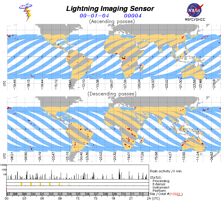
Lightning Imaging Sensor (LIS) on TRMM Science Data V4
The Lightning Imaging Sensor (LIS) Science Data was collected by the LIS instrument on the Tropical Rainfall Measuring Mission (TRMM) satellite used to detect the distribution... -
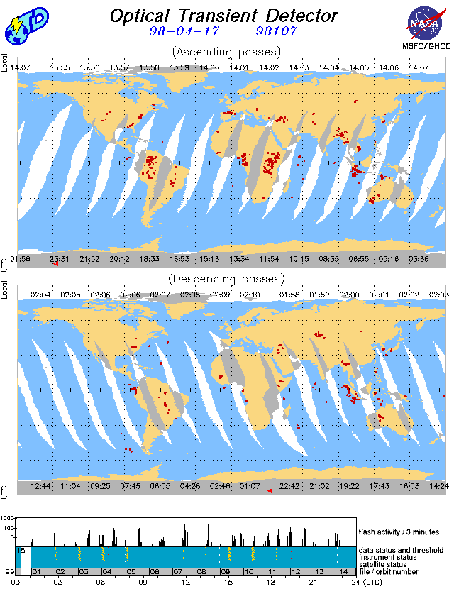
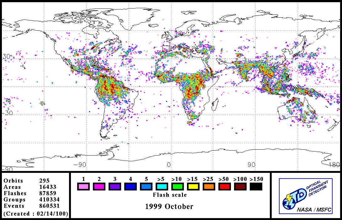
OPTICAL TRANSIENT DETECTOR (OTD) LIGHTNING V1
The Optical Transient Detector (OTD) records optical measurements of global lightning events in the daytime and nighttime. The data includes individual point (lightning) data,... -
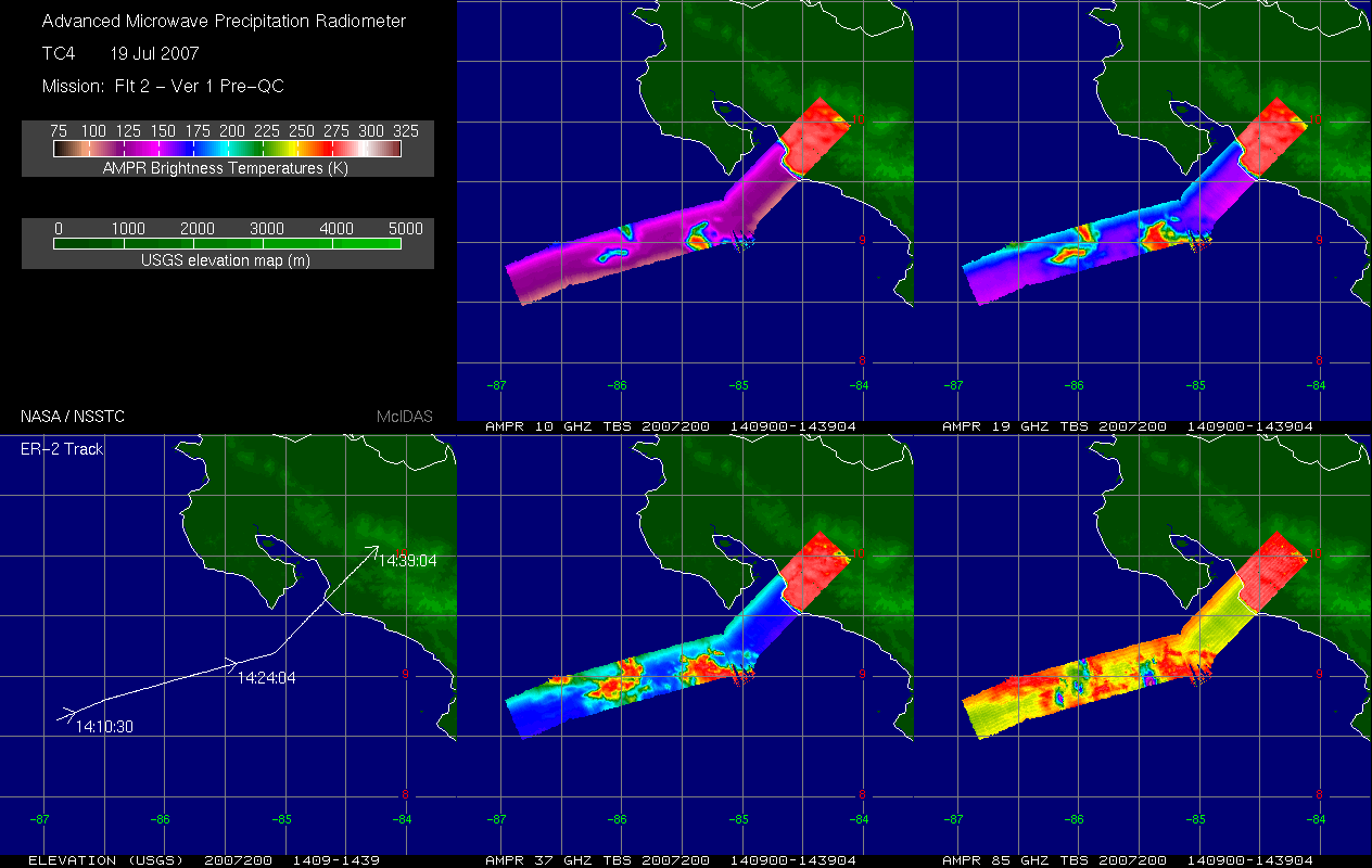
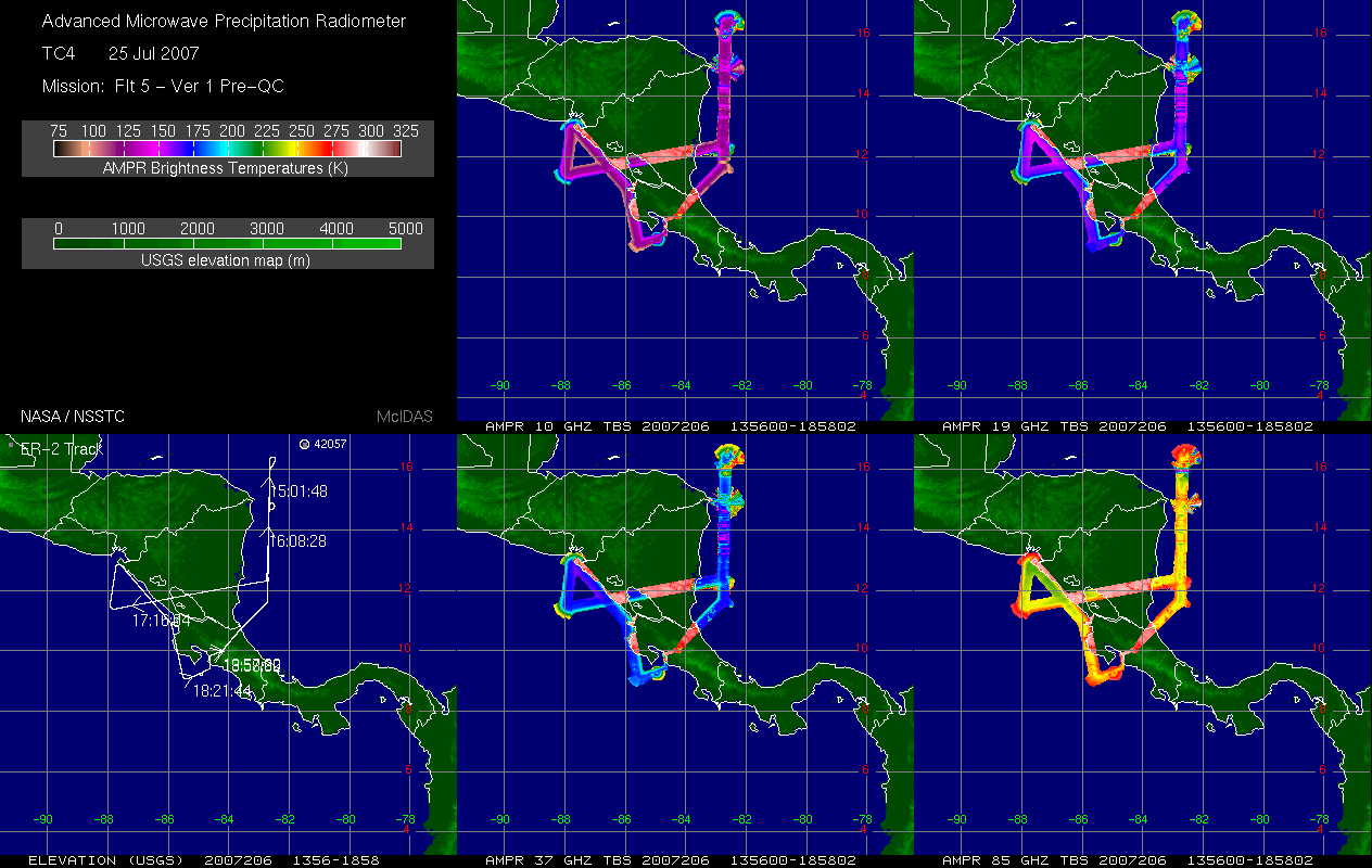
TC4 AMPR BRIGHTNESS TEMPERATURE (TB) V1
The TC4 AMPR Brightness Temperature (TB) dataset consists of brightness temperature data from July 19, 2007 through August 8, 2007. The Tropical Composition, Cloud and Climate... -
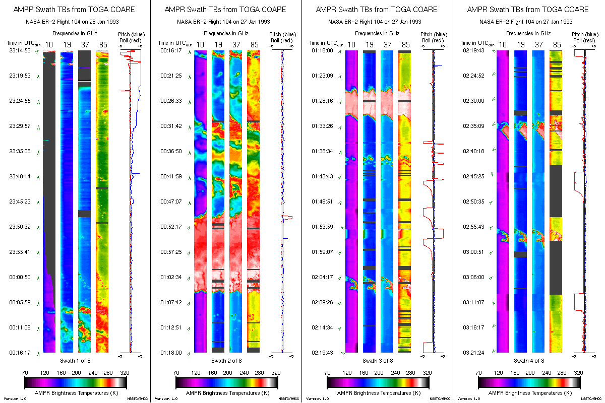
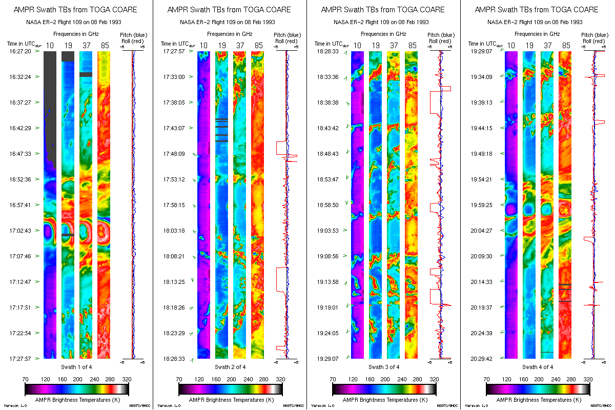
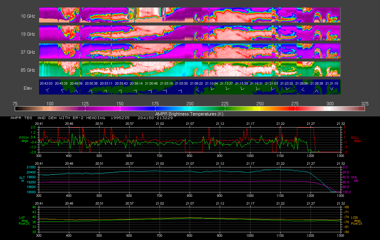
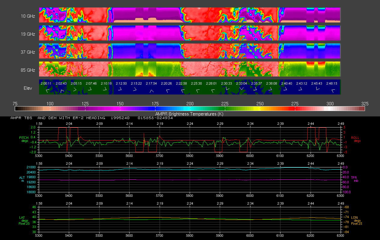
AMPR BRIGHTNESS TEMPERATURE (TB) TOGA COARE V2
The Advanced Microwave Precipitation Radiometer (AMPR) data set was part of the atmospheric measurements collected during the intensive observation period of the Tropical Ocean... -
images_RSW
Images for RSW configuration. -
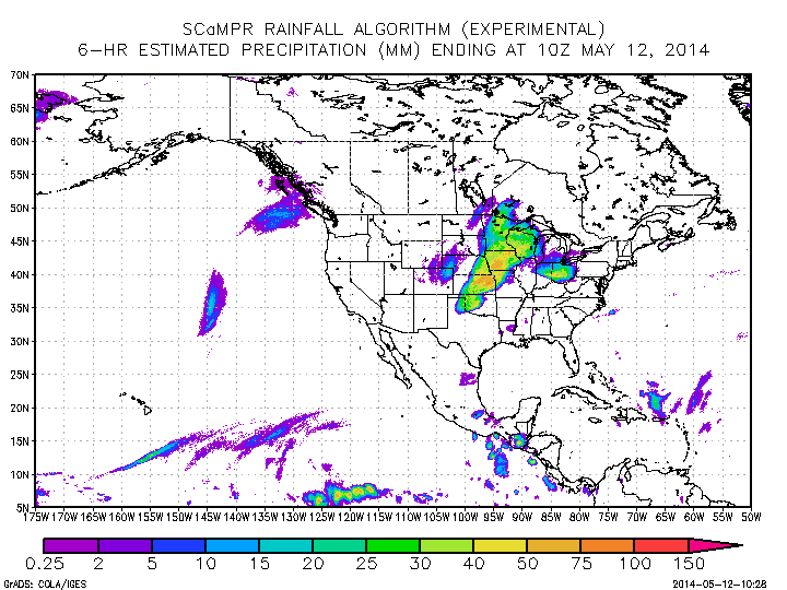
GPM Ground Validation Self-Calibrating Multivariate Precipitation Retrieval (SCaMPR) IPHEx V1
The GPM Ground Validation Self-Calibrating Multivariate Precipitation Retrieval (SCaMPR) IPHEx dataset contains rainfall rate measurements derived using the SCaMPR algorithm to... -
CAMEX-4 DC-8 INFORMATION COLLECTION AND TRANSMISSION SYSTEM V1
The CAMEX-4 DC-8 Information Collection and Transmission System dataset was collected by the Information Collection and Transmission System (ICATS), which is designed to: 1)... -
SAFARI 2000 SeaWiFS Images for Core Study Sites, 2000-2001
This data set contains Sea-viewing Wide Field-of-view Sensor (SeaWiFS) imagery for the eight core study sites of Mongu, Etosha, Kasangu, Skukuza, Mutoko, Mzola, Nampula, and... -
Global Soil Types, 1-Degree Grid (Zobler)
A global digital data base of soil properties is available at 1 degree longitude resolution. For each land cell, the data base includes major and associated soil units, surface... -
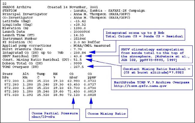
SAFARI 2000 SHADOZ Ozonesonde Data, Zambia and Regional Sites, Dry Season 2000
Ozonesonde launches were made by the Southern Hemisphere ADditional OZonesondes (SHADOZ) group as part of the SAFARI 2000 Dry Season Campaign in September 2000 (Thompson et al.,... -
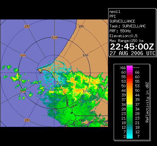
NAMMA NASA POLARIMETRIC DOPPLER WEATHER RADAR (NPOL) V1
The NAMMA NASA Polarimetric Doppler Weather Radar (NPOL) dataset used the NPOL, developed by a research team from Wallops Flight Facility, is a fully transportable and self-... -
AIRS/Aqua L1B Infrared (IR) quality assurance subset V005 (AIRIBQAP) at GES DISC
The Atmospheric Infrared Sounder (AIRS) is a grating spectrometer (R = 1200) aboard the second Earth Observing System (EOS) polar-orbiting platform, EOS Aqua. In combination... -
CAMEX-3 DC-8 NAVIGATION (DADS) DATA V1
The CAMEX-3 DC-8 Navigation Data Acquisition and Distribution System (DADS) data files contain information recorded by navigation and data collection systems onboard the NASA... -
`web_scripting_resources
Location for style sheets etc used in WordPress. Wordpress is used for the Workshop Presentations display page. Or at least it will be if I can make this work... -
AMPR BRIGHTNESS TEMPERATURE CAMEX-2 V2
The Advanced Microwave Precipitation Radiometer (AMPR) was deployed during the Convection and Moisture Experiment 2 (CAMEX-2). AMPR data were collected at a combination of...

Official websites use .gov
A
.gov website belongs to an official government
organization in the United States.
Secure .gov websites use HTTPS
A
lock (
) or https:// means you’ve safely connected to
the .gov website. Share sensitive information only on official,
secure websites.