

NAMMA NASA POLARIMETRIC DOPPLER WEATHER RADAR (NPOL) V1
Access & Use Information
Downloads & Resources
-
Google Scholar search resultsHTML
Search results for publications that cite this dataset by its DOI.
-
Download this datasetHTML
Files may be downloaded directly to your workstation from this link
-
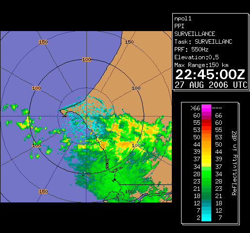
Get a related visualizationGIF
Sample browse image
-
View documentation related to this datasetHTML
The guide document contains detailed information about the dataset
-
View the primary investigator's documentation...PDF
Overview of NASA Polarimetric Doppler Weather Radar (NPOL) Data Collected in...
-
View the primary investigator's documentation...HTML
Program: netcdf2ascii.c; This program reads in netCDF Cartesian radar files...
-
View the primary investigator's documentation...HTML
Directory where netcdf.h and hdf2netcdf.h are located
-
The dataset's project home pageHTML
The home page for the project or program which sponsored the dataset
-
Get a related visualizationHTML
N/A
-
View documentation related to this datasetHTML
Instructions for citing GHRC data
-
Landing PageLanding Page
Dates
| Metadata Created Date | February 22, 2025 |
|---|---|
| Metadata Updated Date | February 22, 2025 |
Metadata Source
- Data.json Data.json Metadata
Harvested from nasa test json
Additional Metadata
| Resource Type | Dataset |
|---|---|
| Metadata Created Date | February 22, 2025 |
| Metadata Updated Date | February 22, 2025 |
| Publisher | NASA/MSFC/GHRC |
| Maintainer | |
| Identifier | C1979887556-GHRC_DAAC |
| Data First Published | 2009-04-21 |
| Language | en-US |
| Data Last Modified | 2025-02-19 |
| Category | NAMMA, geospatial |
| Public Access Level | public |
| Bureau Code | 026:00 |
| Metadata Context | https://project-open-data.cio.gov/v1.1/schema/catalog.jsonld |
| Schema Version | https://project-open-data.cio.gov/v1.1/schema |
| Catalog Describedby | https://project-open-data.cio.gov/v1.1/schema/catalog.json |
| Harvest Object Id | f81bbceb-acbe-4afb-bebc-6ea06fd6f368 |
| Harvest Source Id | a73e0c30-4684-40ef-908e-d22e9e9e5f86 |
| Harvest Source Title | nasa test json |
| Homepage URL | https://doi.org/10.5067/NAMMA/NPOL/DATA101 |
| Metadata Type | geospatial |
| Old Spatial | -19.5413 12.2132 -14.6547 17.0998 |
| Program Code | 026:001 |
| Source Datajson Identifier | True |
| Source Hash | 16b6c81efc899c7a19980227ede88bb32ac69119684199e75ab5a6f32e2a6a4b |
| Source Schema Version | 1.1 |
| Spatial | |
| Temporal | 2006-08-19T12:57:57Z/2006-09-30T09:00:53Z |
Didn't find what you're looking for? Suggest a dataset here.