

OPTICAL TRANSIENT DETECTOR (OTD) LIGHTNING V1
Access & Use Information
Downloads & Resources
-
Google Scholar search resultsHTML
Search results for publications that cite this dataset by its DOI.
-
Download this datasetHTML
Files may be downloaded directly to your workstation from this link
-
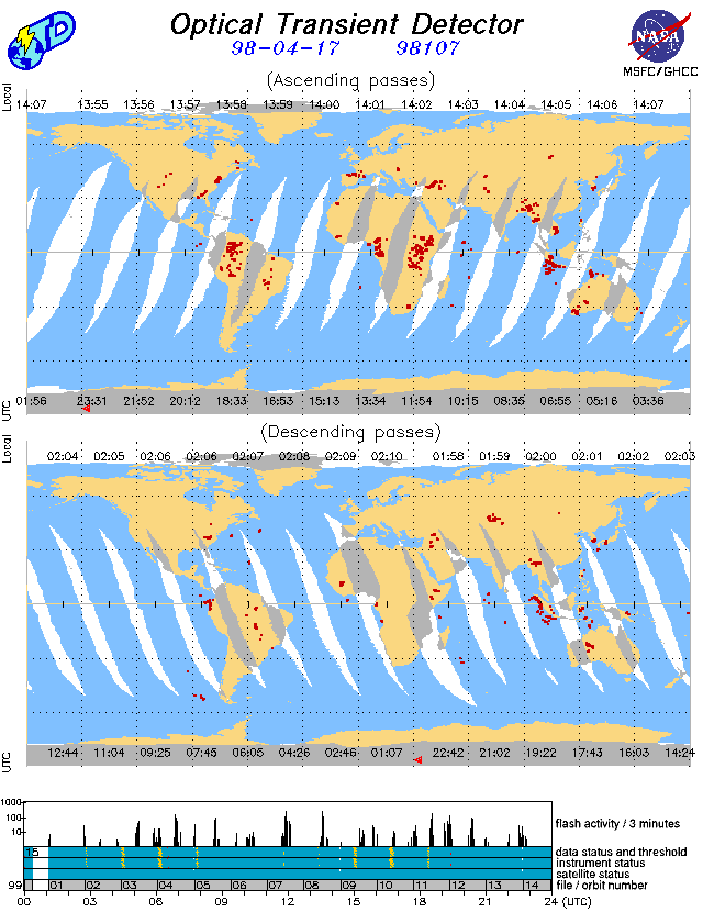
Get a related visualizationGIF
Sample browse image
-
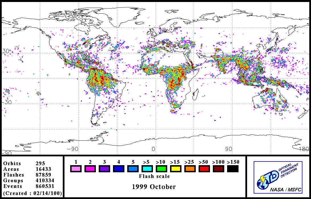
Get a related visualizationGIF
Sample browse image
-
View documentation related to this datasetPDF
The guide document contains detailed information about the dataset
-
View the primary investigator's documentation...PDF
LIS/OTD Software Update ¿¿¿ Release Notes 4 February 1999
-
Downloadable software applicationsGZ
LISOTD V1.1
-
The dataset's project home pageHTML
The home page for the project or program which sponsored the dataset
-
View a micro article on this datasetHTML
Lightning
-
View a micro article on this datasetHTML
Earth Observations: Optical Transient Detector (OTD)
-
Get a related visualizationHTML
N/A
-
View documentation related to this datasetHTML
Instructions for citing GHRC data
-
Landing PageLanding Page
Dates
| Metadata Created Date | February 22, 2025 |
|---|---|
| Metadata Updated Date | February 22, 2025 |
Metadata Source
- Data.json Data.json Metadata
Harvested from nasa test json
Additional Metadata
| Resource Type | Dataset |
|---|---|
| Metadata Created Date | February 22, 2025 |
| Metadata Updated Date | February 22, 2025 |
| Publisher | NASA/MSFC/GHRC |
| Maintainer | |
| Identifier | C1979889849-GHRC_DAAC |
| Data First Published | 1996-11-15 |
| Language | en-US |
| Data Last Modified | 2025-02-19 |
| Category | LIS, geospatial |
| Public Access Level | public |
| Bureau Code | 026:00 |
| Metadata Context | https://project-open-data.cio.gov/v1.1/schema/catalog.jsonld |
| Schema Version | https://project-open-data.cio.gov/v1.1/schema |
| Catalog Describedby | https://project-open-data.cio.gov/v1.1/schema/catalog.json |
| Harvest Object Id | dc051d12-6668-4491-97fd-ef0cdc910b83 |
| Harvest Source Id | a73e0c30-4684-40ef-908e-d22e9e9e5f86 |
| Harvest Source Title | nasa test json |
| Homepage URL | https://doi.org/10.5067/LIS/OTD/DATA101 |
| Metadata Type | geospatial |
| Old Spatial | -180.0 -70.0 180.0 70.0 |
| Program Code | 026:001 |
| Source Datajson Identifier | True |
| Source Hash | 5b59b09974c5b71e0cb08e287927ad66e04eca1fbca6f18da69c0563d8f43ab9 |
| Source Schema Version | 1.1 |
| Spatial | |
| Temporal | 1995-04-13T01:37:27Z/2000-03-23T19:17:37Z |
Didn't find what you're looking for? Suggest a dataset here.