
-
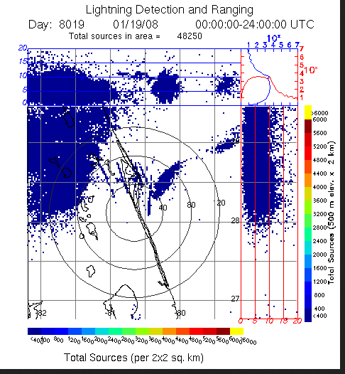
LIGHTNING DETECTION AND RANGING (LDAR) RAW DATA V1
Lightning Detection and Ranging (LDAR) Raw data consists of level 1 lightning data collected from February 25, 1997 through June 11, 2008. The LDR system is located at the... -
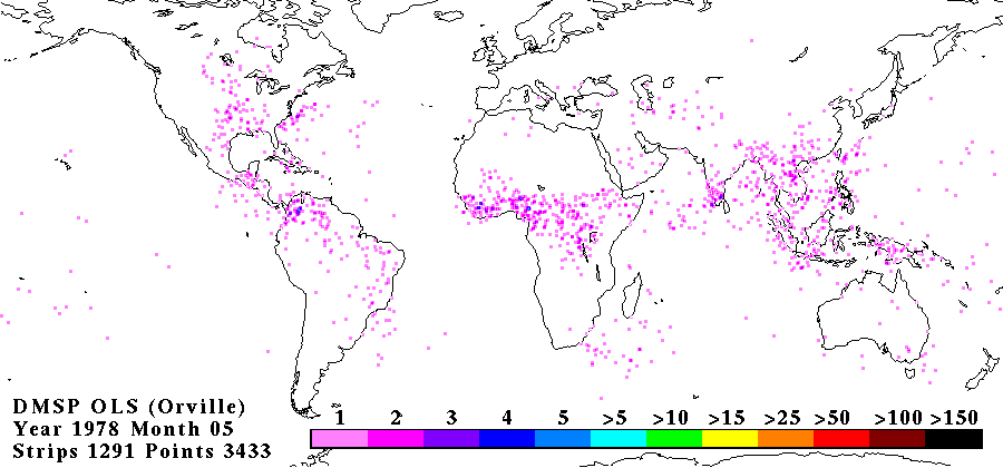
OLS ANALOG DERIVED LIGHTNING V1
The OLS Analog Derived Lightning dataset consists of global lightning signatures from the Defense Meteorological Satellite Program (DMSP) Operational Linescan System (OLS) that... -
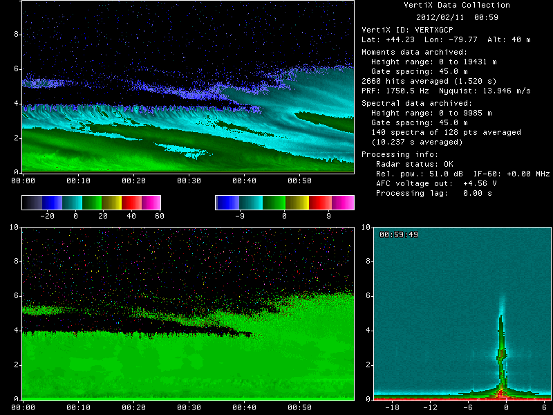
GPM GROUND VALIDATION MCGILL VERTICAL POINTING X-BAND (VERTIX) RADAR GCPEX V1
The GPM Ground Validation McGill Vertical Pointing X-Band (VertiX) Radar GCPEx dataset consists of radar reflectivity and Doppler velocity data collected by the Vertically... -
CAMEX-3 MULTISPECTRAL ATMOSPHERIC MAPPING SENSOR (MAMS) V1
The CAMEX-3 Multispectral Atmospheric Mapping Sensor (MAMS) dataset was collected by the Multispectral Atmospheric Mapping Sensor (MAMS), which is a multispectral scanner which... -
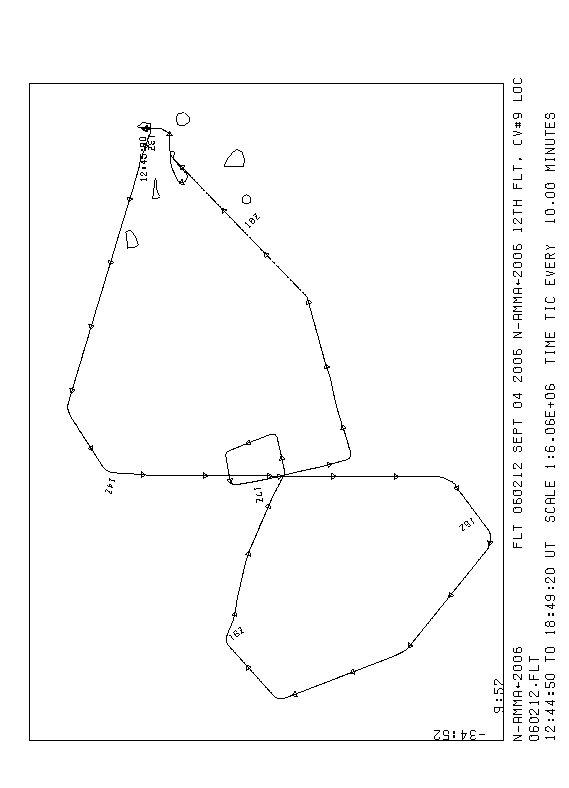
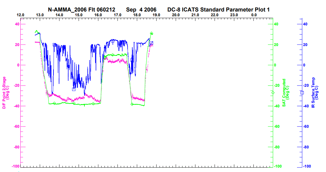
NAMMA DC-8 NAVIGATION AND HOUSEKEEPING (ICATS) V1
The NAMMA DC-8 Navigation and Housekeeping (ICATS) dataset is designed to: 1) interface and process avionics and environmental paramaters from the Navigational Management... -
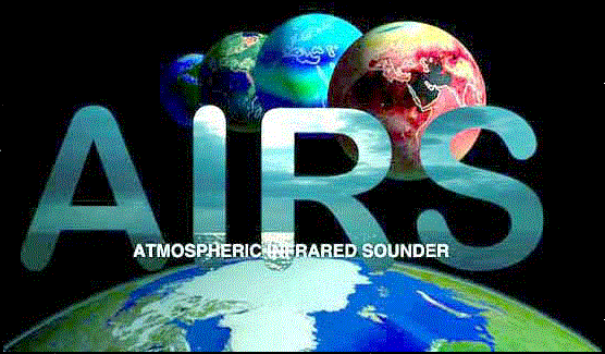
AIRS/Aqua L3 5-day Quantization in Physical Units (AIRS+AMSU) 5 degrees x 5 degrees V006 (AIRX3QP5) at GES DISC
The Atmospheric Infrared Sounder (AIRS) is a grating spectrometer (R = 1200) aboard the second Earth Observing System (EOS) polar-orbiting platform, EOS Aqua. In combination... -
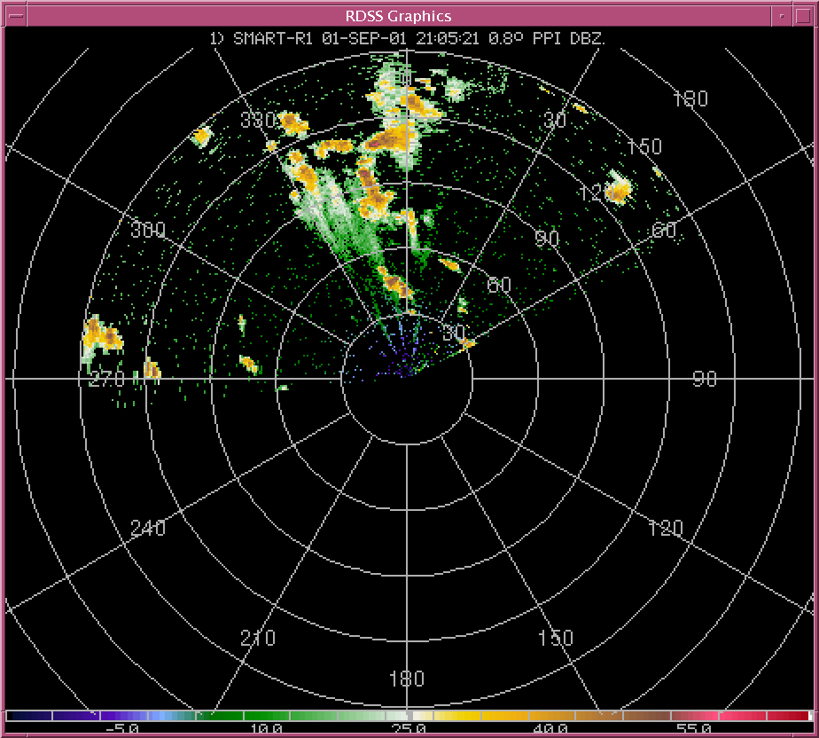
CAMEX-4 SHARED MOBILE ATMOSPHERIC RESEARCH AND TEACHING RADARS V1
The CAMEX-4 Shared Mobile Atmospheric Research and Teching Radars dataset was collected by the Shared Mobile Atmospheric Research and Teaching Radar (SMART-R), which is a... -
BOREAS/SRC AMS Suite A Surface Meteorological and Radiation Data: 1996
Contains the data collected in 1996 by the AMS suite A instrument set operated by SRC and provided to BORIS. -
Images
Images for the website main pages and all configurations. The upload and access points for the other images are: Website Template RSW images BSCW Images HIRENASD Images -
AIRS/Aqua L3 5-day Quantization in Physical Units (AIRS-only) 5 degrees x 5 degrees V006 (AIRS3QP5) at GES DISC
The Atmospheric Infrared Sounder (AIRS) is a grating spectrometer (R = 1200) aboard the second Earth Observing System (EOS) polar-orbiting platform, EOS Aqua. In combination... -
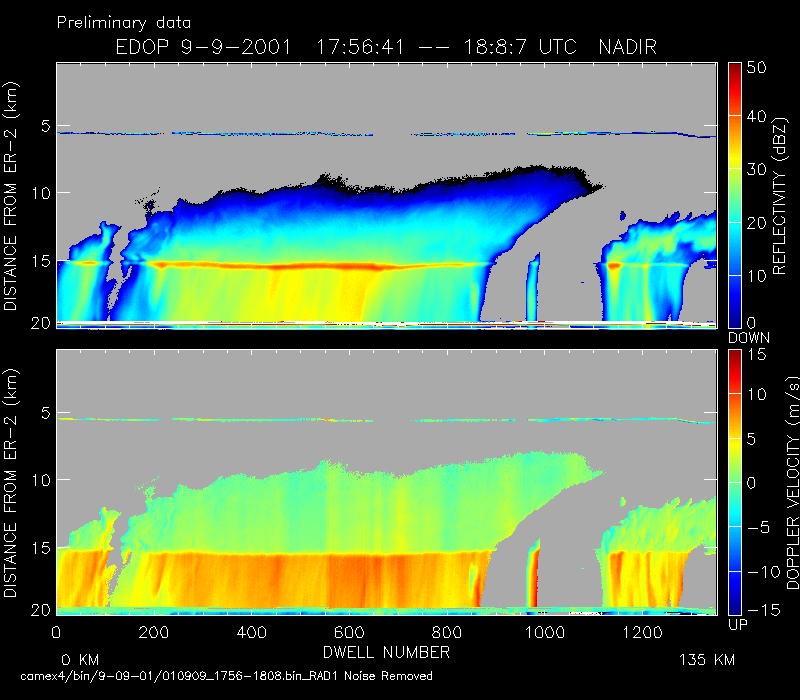
CAMEX-4 ER-2 DOPPLER RADAR V1
The CAMEX-4 ER-2 Doppler Radar dataset was collected by the ER-2 Doppler radar (EDOP), which is an X-band (9.6 GHz) Doppler radar mounted in the nose of ER-2. The instrument has... -
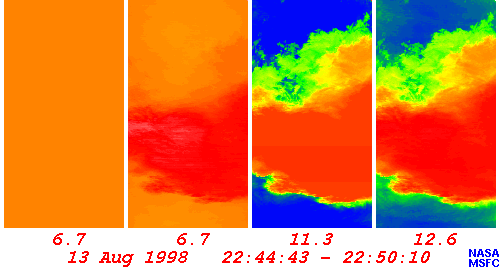
CAMEX-3 LiDAR Atmospheric Sensing Experiment (LASE) Imagery V1
The CAMEX-3 LiDAR Atmospheric Sensing Experiment (LASE) Imagery dataset is a browse-only dataset that consists of plotted reflectivity data collected by the LiDAR Atmospheric... -
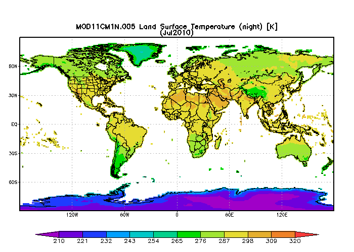
MODIS/Terra Monthly mean Night-Time Land Surface Temperature at 1x1 degree V005 (MOD11CM1N) at GES DISC NGDA
The dataset contains global monthly night-time land surface temperature averaged within 1 by 1 degree grid cells. The source for the data is MODIS/Terra MOD11C3 Collection 005... -
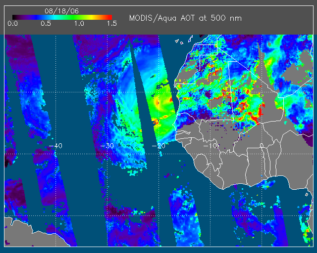
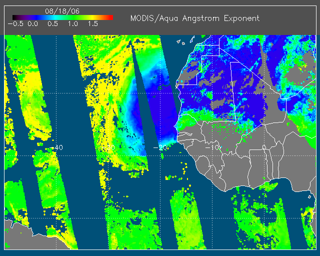
NAMMA MODIS/AQUA AND MODIS/TERRA DEEP BLUE PRODUCTS V1 NGDA
The NAMMA MODIS/AQUA and MODIS/TERRA Deep Blue Products dataset is a collection of images depicting the aerosol optical depth derived from the MODIS deep blue algorithm from... -
BOREAS Scanning Lidar Imager of Canopies by Echo Recovery (SLICER): Level-3 Data
Scanning Lidar Imager of Canopies by Echo Recovery (SLICER) data were acquired in support of BOReal Ecosystem-Atmosphere Study (BOREAS) at all of the Tower Flux (TF) sites in... -
AMPR BRIGHTNESS TEMPERATURE CAMEX-1 V2
The Advanced Microwave Precipitation Radiometer (AMPR) was deployed during the Convection and Moisture Experiments (CAMEX-1) conducted at Wallops Island, VA. AMPR data were... -
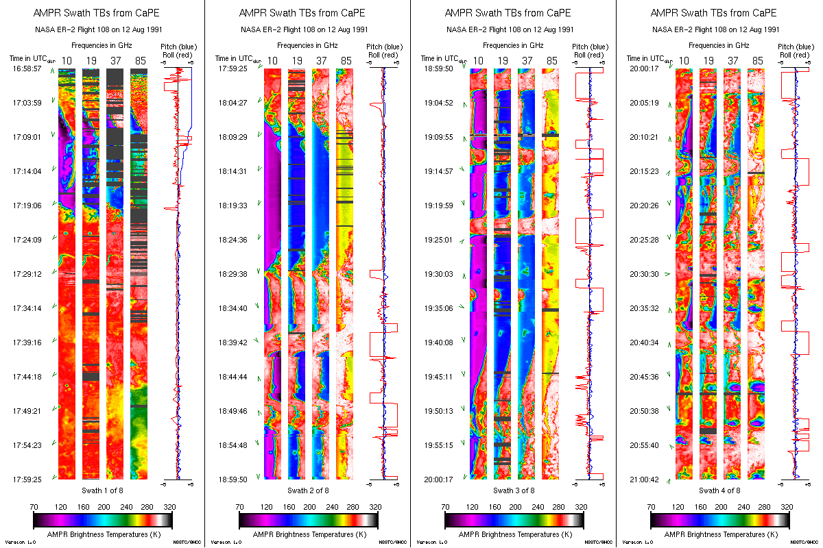
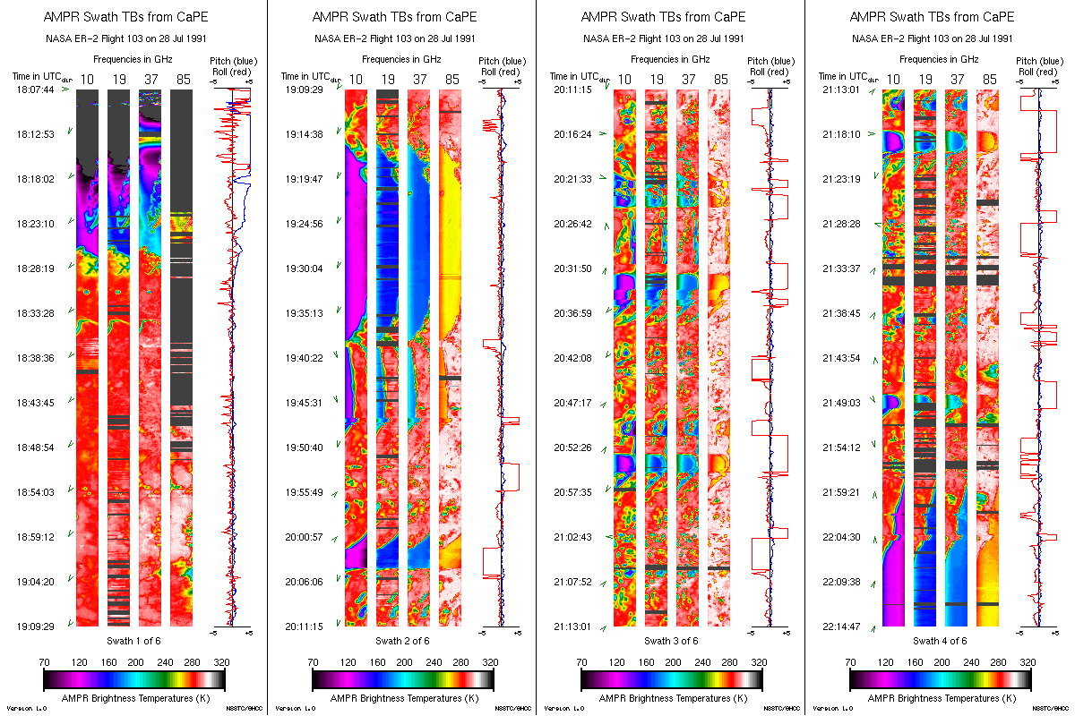
AMPR BRIGHTNESS TEMPERATURE CAPE EXPERIMENT V2
The Advanced Microwave Precipitation Radiometer (AMPR) was deployed during the Convection and Precipitation/Electrification Experiment (CaPE). AMPR data werecollected at a... -
GPM Ground Validation CXSI Radar Imagery OLYMPEX V1
The GPM Ground Validation CXSI Radar Imagery OLYMPEX dataset contains radar reflectivity and precipitation rate images obtained from Environment and Climate Change Canada... -
BOREAS HYD-06 Aircraft Gamma Ray Soil Moisture
Contains the aircraft estimates of soil moisture measured by the gamma ray instrument from HYD06. -
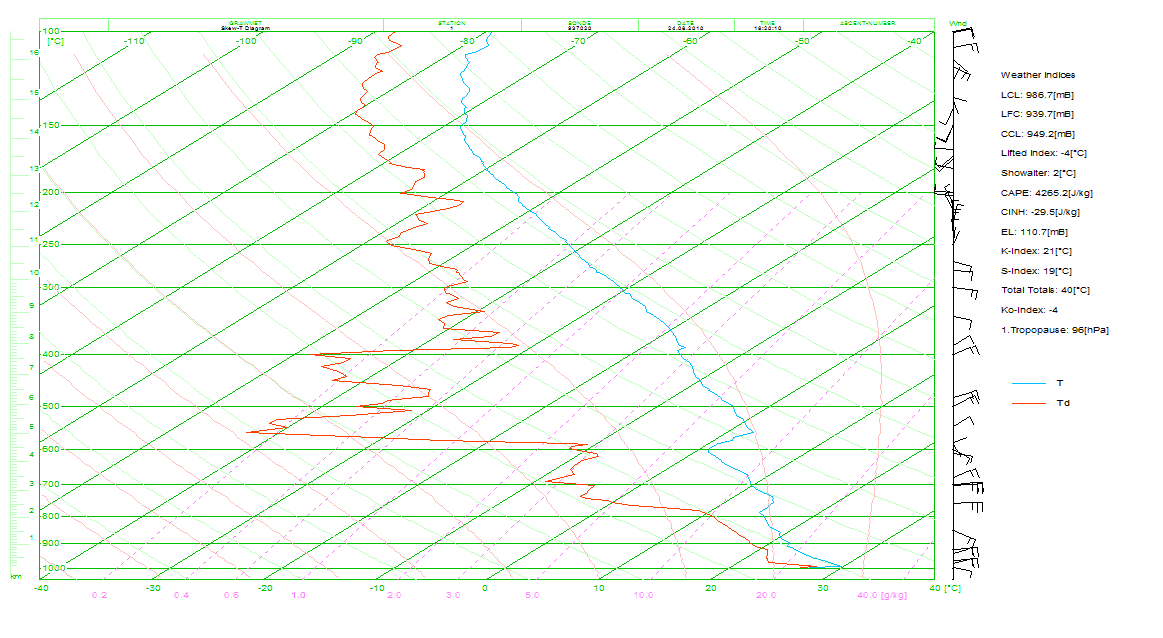
GRIP BARBADOS/CAPE VERDE RADIOSONDE V1
The GRIP Barbados/Cape Verde radiosonde data set consists of generally two soundings per day (06Z and 12Z) launched from Barbados, and one sounding per day (12Z) launched from...

Official websites use .gov
A
.gov website belongs to an official government
organization in the United States.
Secure .gov websites use HTTPS
A
lock (
) or https:// means you’ve safely connected to
the .gov website. Share sensitive information only on official,
secure websites.