

GRIP BARBADOS/CAPE VERDE RADIOSONDE V1
Access & Use Information
Public: This dataset is intended for public access and use.
Non-Federal: This dataset is covered by different Terms of Use than Data.gov.
License: No license information was provided.
Downloads & Resources
-
Google Scholar search resultsHTML
Search results for publications that cite this dataset by its DOI.
-
Download this datasetHTML
Files may be downloaded directly to your workstation from this link
-
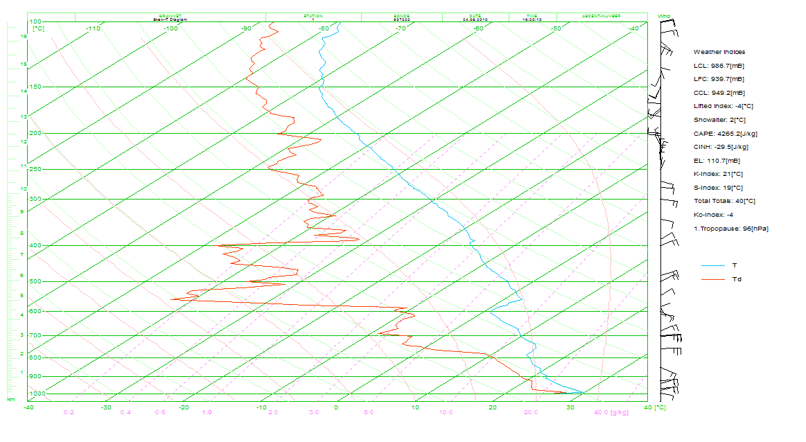
Get a related visualizationGIF
Sample browse image
-
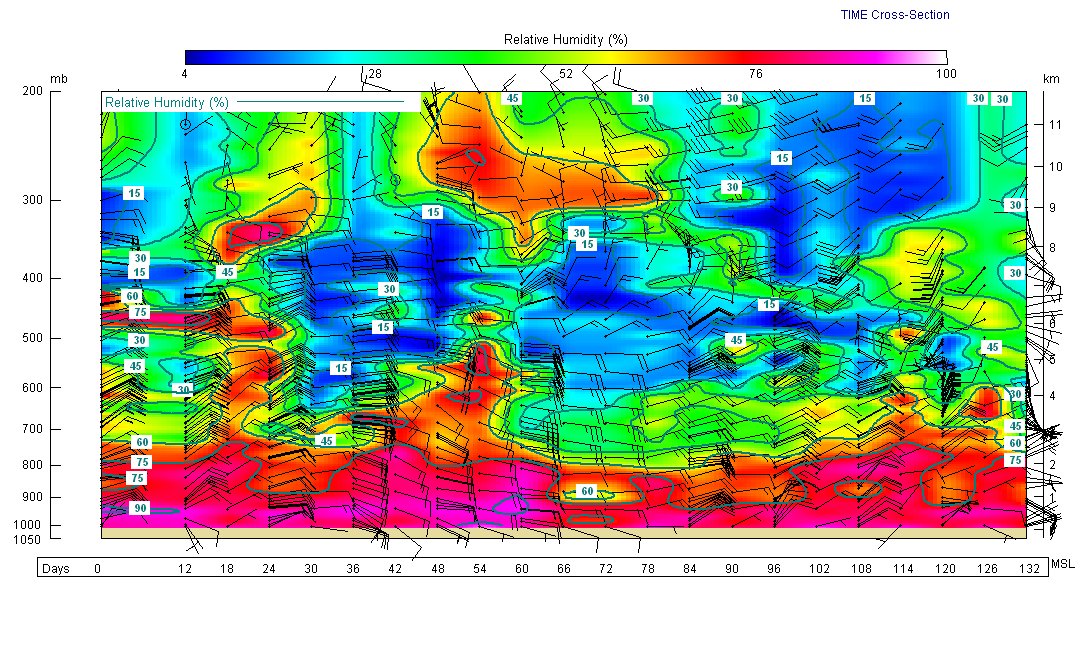
Get a related visualizationJPEG
Sample browse image
-
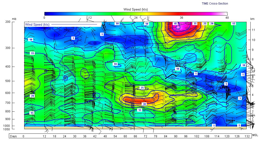
Get a related visualizationJPEG
Sample browse image
-
Get a related visualizationJPEG
Sample browse image
-
View documentation related to this datasetHTML
The guide document contains detailed information about the dataset
-
The dataset's project home pageHTML
The home page for the project or program which sponsored the dataset
-
Get a related visualizationHTML
N/A
-
View documentation related to this datasetHTML
Instructions for citing GHRC data
-
Landing PageLanding Page
Dates
| Metadata Created Date | February 22, 2025 |
|---|---|
| Metadata Updated Date | February 22, 2025 |
Metadata Source
- Data.json Data.json Metadata
Harvested from nasa test json
Additional Metadata
| Resource Type | Dataset |
|---|---|
| Metadata Created Date | February 22, 2025 |
| Metadata Updated Date | February 22, 2025 |
| Publisher | NASA/MSFC/GHRC |
| Maintainer | |
| Identifier | C1979860117-GHRC_DAAC |
| Data First Published | 2011-04-07 |
| Language | en-US |
| Data Last Modified | 2025-02-19 |
| Category | GRIP (HURRICANE), geospatial |
| Public Access Level | public |
| Bureau Code | 026:00 |
| Metadata Context | https://project-open-data.cio.gov/v1.1/schema/catalog.jsonld |
| Schema Version | https://project-open-data.cio.gov/v1.1/schema |
| Catalog Describedby | https://project-open-data.cio.gov/v1.1/schema/catalog.json |
| Harvest Object Id | faedfd7c-148f-41c7-92c8-52ba7e1eface |
| Harvest Source Id | a73e0c30-4684-40ef-908e-d22e9e9e5f86 |
| Harvest Source Title | nasa test json |
| Homepage URL | https://doi.org/10.5067/GRIP/RADIOSONDE/DATA101 |
| Metadata Type | geospatial |
| Old Spatial | -59.6251 13.1 -24.8671 16.8644 |
| Program Code | 026:001 |
| Source Datajson Identifier | True |
| Source Hash | 868a7793ec99b20b2bb86e39afb1d87d50027b8a3ff3304e25d64d2608b816cf |
| Source Schema Version | 1.1 |
| Spatial | |
| Temporal | 2010-08-14T19:00:00Z/2010-09-24T06:00:00Z |
Didn't find what you're looking for? Suggest a dataset here.