

2,680 datasets found
-
NASA S-Band Dual Polarimetric Doppler Radar (NPOL) IMPACTS V1
NASA Test —
The NASA S-Band Dual Polarimetric (NPOL) Doppler Radar IMPACTS dataset consists of rain rate, reflectivity, Doppler velocity, and other radar measurements obtained... -
NLDAS Secondary Forcing Data L4 Hourly 0.125 x 0.125 degree V2.0 (NLDAS_FORB0125_H) at GES DISC
NASA Test —
This data set contains the secondary forcing hourly data "File B" for Phase 2 of the North American Land Data Assimilation System (NLDAS-2). The data are in 1/8th... -
Sounder SIPS: Suomi NPP ATMS Level 3 RAMSES2 Standard Gridded Monthly V3 at GES DISC
NASA Test —
This level 3 monthly product is generated from the RAMSES (Retrieval Algorithm for Microwave Sounders in Earth Science) II algorithm.The RAMSES II algorithm is a... -
FLDAS Noah Land Surface Model L4 Global Monthly Anomaly 0.1 x 0.1 degree (MERRA-2 and CHIRPS) V001 (FLDAS_NOAH01_C_GL_MA) at GES DISC
NASA Test —
The monthly anomaly data set contains a series of land surface parameters simulated from the Noah 3.6.1 model in the Famine Early Warning Systems Network (FEWS NET)... -
FIREX-AQ NOAA-MET Twin Otter Data
NASA Test —
FIREXAQ_N46_Data are the wind profile and fire temperature data collected onboard the NOAA-MET Twin Otter during FIREX-AQ. This product includes data collected by the... -
UARS Cryogenic Limb Array Etalon Spectrometer (CLAES) Level 3AT V009 (UARCL3AT) at GES DISC
NASA Test —
The Cryogenic Limb Array Etalon Spectrometer (CLAES) Level 3AT data product consists of daily, 65.536 second interval time-ordered vertical profiles of temperature and... -
Trends of Thermal, Wetness, and Vegetative Change in the Circumpolar Arctic
NASA Test —
This dataset provides estimates of trends in temperature, moisture, and vegetation changes over the circumpolar Arctic. Time series trends were measured by the Theil-... -
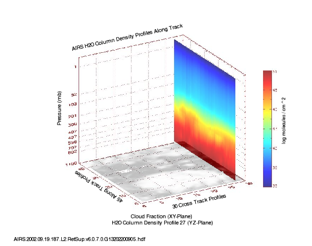
AIRS/Aqua L2 Support Retrieval (AIRS+AMSU) V006 (AIRX2SUP) at GES DISC
NASA Test —
The Atmospheric Infrared Sounder (AIRS) is a grating spectrometer (R = 1200) aboard the second Earth Observing System (EOS) polar-orbiting platform, EOS Aqua. In... -
CAMEX-4 ER-2 NAVIGATION DATA V1
NASA Test —
The CAMEX-4 ER-2 Navigation data files contain information recorded by on board navigation and data collection systems. In addition to typical navigation data (e.g.... -
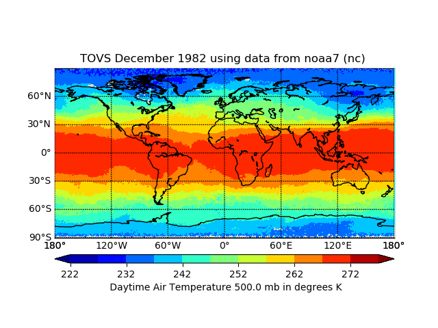
TOVS GLA MONTHLY GRIDS from NOAA-7 02 (TOVSAMNC) at GES DISC
NASA Test —
This dataset (TOVSAMNC) contains the TIROS Operational Vertical Sounder (TOVS) level 3 geophysical parameters derived using data from NOAA-7 and the physical retrieval... -
BOREAS AFM-05 Level-2 Upper Air Network Standard Pressure Level Data
NASA Test —
Basic upper-air parameters interpolated at 0.5 kiloPascal increments of atmospheric pressure from the network of upper-air stations during the 1993, 1994, and 1996... -
GPM ATMS on NOAA-20 (GPROF) Radiometer Precipitation Profiling L2A 1.5 hours 17 km V07 (GPM_2AGPROFNOAA20ATMS) at GES DISC
NASA Test —
Version 07 is the current version of the data set. The 2AGPROF (also known as, GPM GPROF (Level 2)) algorithm retrieves consistent precipitation and related science... -
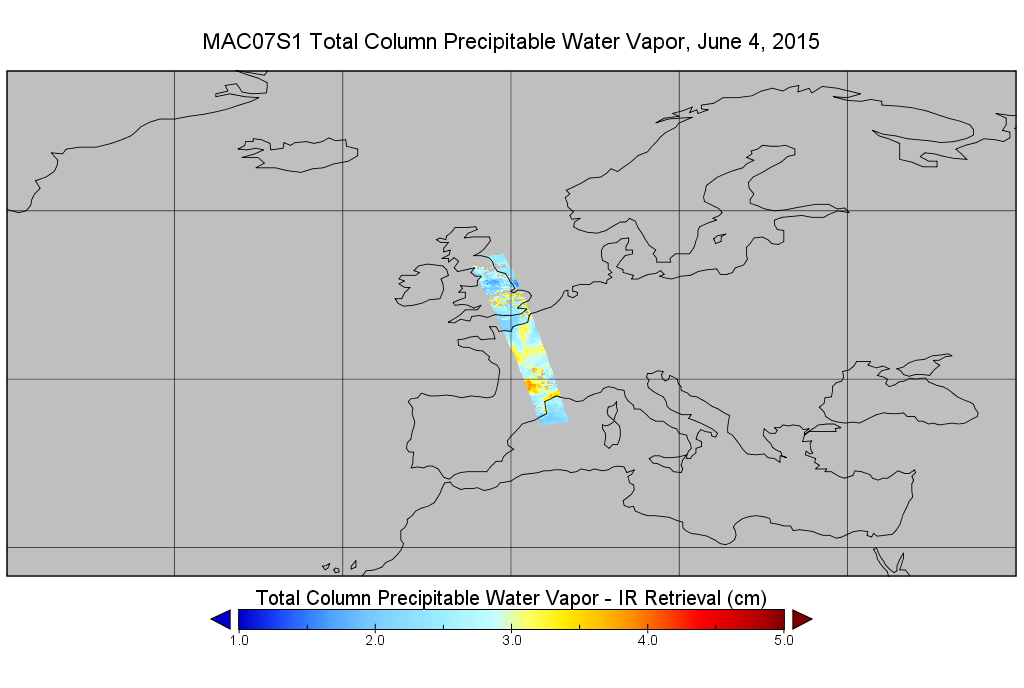
MODIS/Aqua Temp and Water Vapor Profiles 5km 5-Min L2 Wide Swath Subset along CloudSat V002 (MAC07S1) at GES DISC NGDA
NASA Test —
This is the wide-swath MODIS/Aqua subset along CloudSat field of view track. The goal of the wide-swath subset is to select and return MODIS data that are within +-100... -
OMPS-NPP L2 NP Ozone (O3) Vertical Profile swath orbital V2.9 (OMPS_NPP_NPBUVO3_L2) at GES DISC
NASA Test —
The OMPS-NPP L2 NP Ozone (O3) Total Column swath orbital product provides ozone profile retrievals from the Ozone Mapping and Profiling Suite (OMPS) Nadir-Profiler... -
GPM SSMI on F08 (GPROF) Climate-based Radiometer Precipitation Profiling L3 1 day 0.25 degree x 0.25 degree V07 (GPM_3GPROFF08SSMI_DAY_CLIM) at GES DISC
NASA Test —
Version 7 is the current version of the data set. Older versions will no longer be available and have been superseded by the current version. The "CLIM" products... -
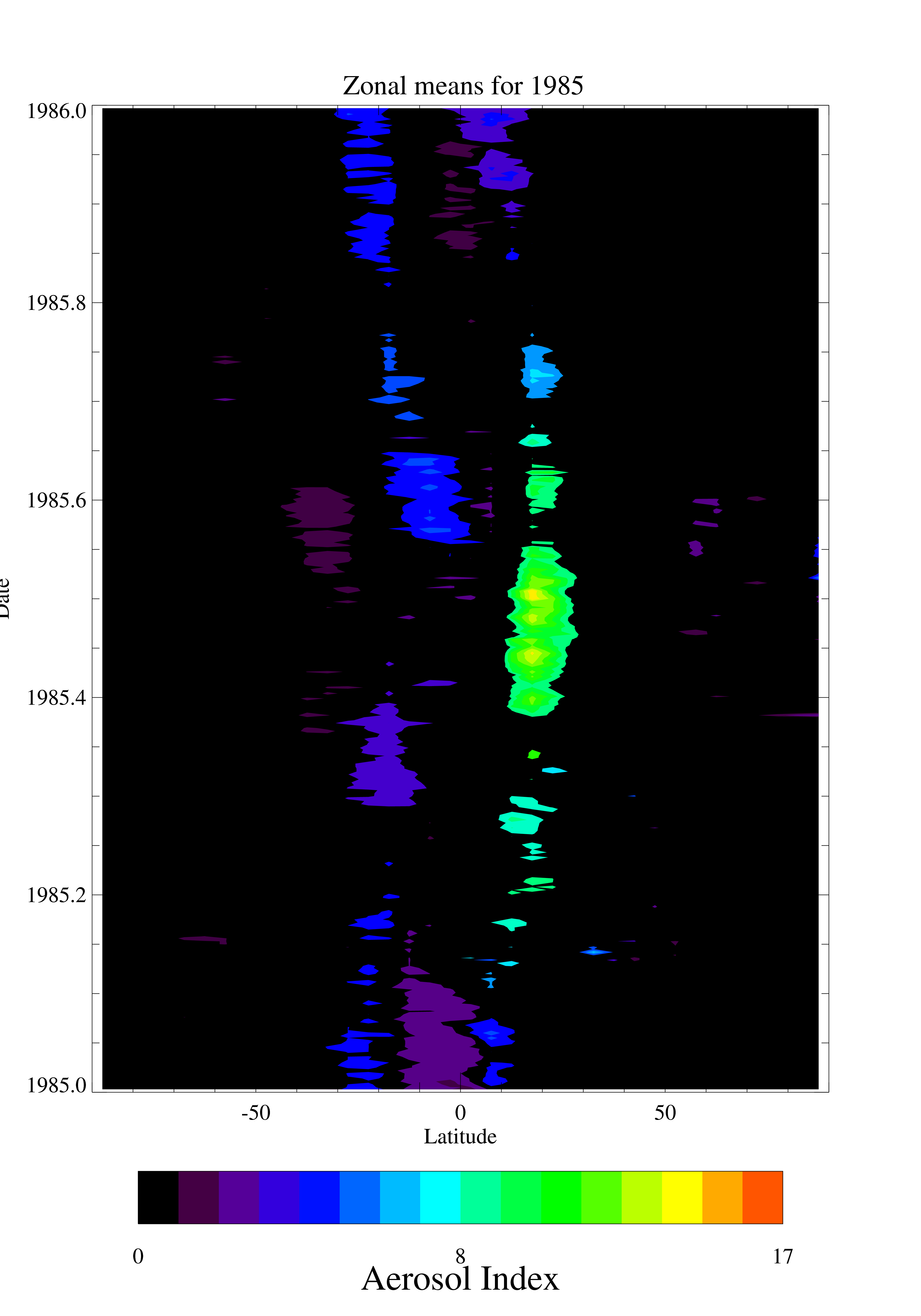
TOMS Nimbus-7 UV Aerosol Index Daily and Monthly Zonal Means V008 (TOMSN7L3zaer) at GES DISC
NASA Test —
This Nimbus-7 Total Ozone Mapping Spectrometer (TOMS) version 8 daily zonal means data product contains UV aerosol index values. The data are averaged in 5 degree... -
OMI/Aura NO2 Tropospheric, Stratospheric & Total Columns MINDS Daily L3 Global Gridded 0.25 degree x 0.25 degree V1.1 (OMI_MINDS_NO2d) at GES DISC
NASA Test —
As part of the NASA's Making Earth System Data Records for Use in Research Environments (MEaSUREs) program, this project entitled “Multi-Decadal Nitrogen Dioxide and... -
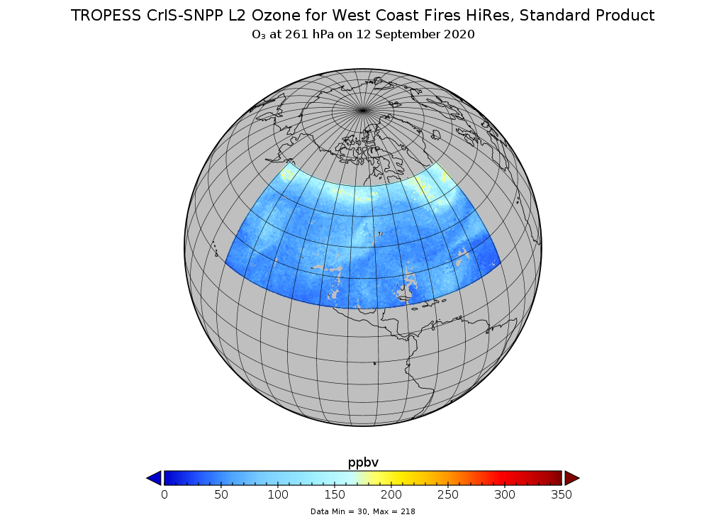
TROPESS CrIS-SNPP L2 Ozone for West Coast Fires HiRes, Standard Product V1 (TRPSDL2O3CRSWCFHI) at GES DISC
NASA Test —
The TROPESS CrIS-SNPP L2 Ozone for West Coast Fires HiRes, Standard Product contains the vertical distribution of the retrieved atmospheric state of ozone (O3), formal...
2,680 datasets found