

AIRS/Aqua L2 Support Retrieval (AIRS+AMSU) V006 (AIRX2SUP) at GES DISC
Access & Use Information
Downloads & Resources
-
Google Scholar search resultsHTML
Search results for publications that cite this dataset by its DOI.
-
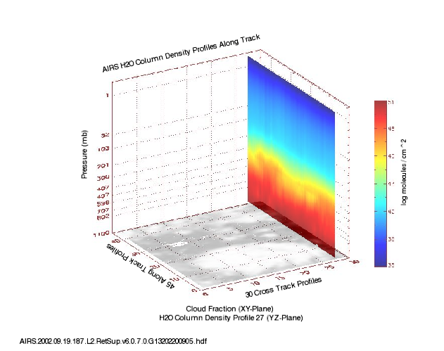
Get a related visualizationPNG
Sample plot of AIRS Level 2 Support Retrieval (AIRS+AMSU) H2O Column Density...
-
This dataset's landing pageHTML
Access the dataset landing page from the GES DISC website.
-
Download this dataset through a directory mapHTML
Access the data via HTTPS.
-
Use OPeNDAP to access the dataset's dataHTML
Access the data via the OPeNDAP protocol.
-
Download this dataset through Earthdata SearchHTML
Use the Earthdata Search to find and retrieve data sets across multiple data...
-
The dataset's project home pageHTML
AIRS home page at NASA/JPL. General information on the AIRS instrument,...
-
View information related to this datasetHTML
AIRS Documentation Page
-
View this dataset's read me documentPDF
README Document
-
View this dataset's algorithm theoretical...PDF
AIRS ATBD
-
Landing PageLanding Page
References
Dates
| Metadata Created Date | February 22, 2025 |
|---|---|
| Metadata Updated Date | February 22, 2025 |
Metadata Source
- Data.json Data.json Metadata
Harvested from nasa test json
Additional Metadata
| Resource Type | Dataset |
|---|---|
| Metadata Created Date | February 22, 2025 |
| Metadata Updated Date | February 22, 2025 |
| Publisher | NASA/GSFC/SED/ESD/GCDC/GESDISC |
| Maintainer | |
| Identifier | C1243477317-GES_DISC |
| Data First Published | 2002-08-30 |
| Language | en-US |
| Data Last Modified | 2025-02-19 |
| Category | Aqua, geospatial |
| Public Access Level | public |
| Bureau Code | 026:00 |
| Metadata Context | https://project-open-data.cio.gov/v1.1/schema/catalog.jsonld |
| Schema Version | https://project-open-data.cio.gov/v1.1/schema |
| Catalog Describedby | https://project-open-data.cio.gov/v1.1/schema/catalog.json |
| Harvest Object Id | 1444ad1d-1cd8-4827-8d3d-83d45bb5ea49 |
| Harvest Source Id | a73e0c30-4684-40ef-908e-d22e9e9e5f86 |
| Harvest Source Title | nasa test json |
| Homepage URL | https://doi.org/10.5067/Aqua/AIRS/DATA207 |
| Metadata Type | geospatial |
| Old Spatial | -180.0 -90.0 180.0 90.0 |
| Program Code | 026:001 |
| Related Documents | https://doi.org/10.5194/acp-14-399-2014, https://doi.org/10.1117/1.JRS.8.084994, https://doi.org/10.1002/2014JD022551, https://doi.org/10.1002/2014JD02166, https://doi.org/10.1002/2016JD024806, https://doi.org/10.1002/2015JD024008, https://doi.org/10.1029/2005/JD007020, https://doi.org/10.1109/TGRS.2002.808236 |
| Source Datajson Identifier | True |
| Source Hash | 1163d494cff8617294e39fb03afdd4956bb0594ef7f18b47c2a0efdaa35af90c |
| Source Schema Version | 1.1 |
| Spatial | |
| Temporal | 2002-08-30T00:00:00Z/2016-09-24T23:59:59.999Z |
Didn't find what you're looking for? Suggest a dataset here.