
-
ARCTAS DC-8 Aircraft In-situ Aerosol Trace Gas Data
ARCTAS_AerosolTraceGas_AircraftInSitu_DC8_Data is the in-situ aerosol trace gas data collected by the DC-8 aircraft during the Arctic Research of the Composition of the... -
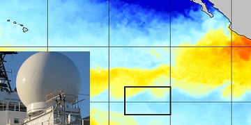
SPURS-2 research vessel along track SEA-POL rain radar imaging data for E. Tropical Pacific R/V Revelle-2 cruise
The SPURS (Salinity Processes in the Upper Ocean Regional Study) project is NASA-funded oceanographic process study and associated field program that aim to elucidate key... -
MODIS/Terra+Aqua BRDF/Albedo White Sky Albedo Band1 Daily L3 Global 30ArcSec CMG V061 NGDA
The MCD43D52 Version 6.1 Bidirectional Reflectance Distribution Function and Albedo (BRDF/Albedo) White-Sky Albedo dataset is produced daily using 16 days of Terra and Aqua... -
SOLVE I ER-2 Aircraft In-situ Trace Gas Data
SOLVE1_TraceGas_AircraftInSItu_ER2_Data is the in-situ trace gas data for the ER-2 aircraft collected during the SAGE III Ozone Loss and Validation Experiment (SOLVE). Data were... -
ECOSTRESS Evapotranspiration dis-ALEXI Daily L3 CONUS 70 m V001
The ECOsystem Spaceborne Thermal Radiometer Experiment on Space Station (ECOSTRESS) mission measures the temperature of plants to better understand how much water plants need... -
MODIS/Aqua Vegetation Indices 16-Day L3 Global 500m SIN Grid V061 NGDA
The MYD13A1 Version 6.1 product provides Vegetation Index (VI) values at a per pixel basis at 500 meter (m) spatial resolution. There are two primary vegetation layers. The... -
JERS-1 Synthetic Aperture Radar, 100-m Mosaics, South America: 1995-1996, R1
This data set provides ~100-m resolution image mosaics of South America acquired during the low flood season between September and December 1995 and during the high flood season... -
VIIRS/NPP BRDF/Albedo Albedo Daily L3 Global 0.05Deg CMG V001
The NASA/NOAA Suomi National Polar-orbiting Partnership (Suomi NPP) Visible Infrared Imaging Radiometer Suite (VIIRS) Bidirectional Reflectance Distribution Function (BRDF) and... -
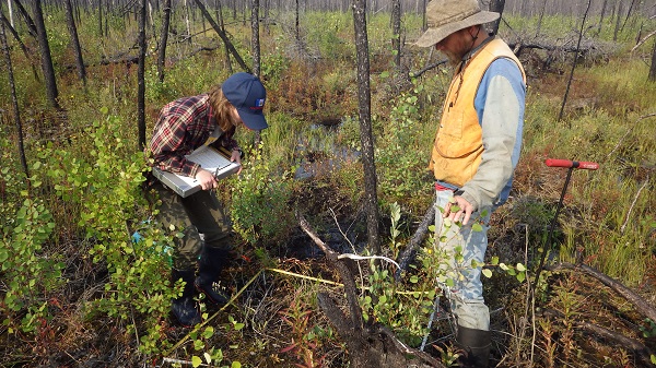
ABoVE: Post-Fire and Unburned Vegetation Community and Field Data, NWT, Canada, 2017
This dataset provides vegetation community characteristics, soil moisture, and biophysical data collected in 2017 from 11 study sites in the ABoVE Study area. The 11 study areas... -
NOAA Soundings IMPACTS V1
The NOAA Soundings IMPACTS dataset was collected from January 1, 2020 through February 29, 2020 during the Investigation of Microphysics and Precipitation for Atlantic Coast-... -
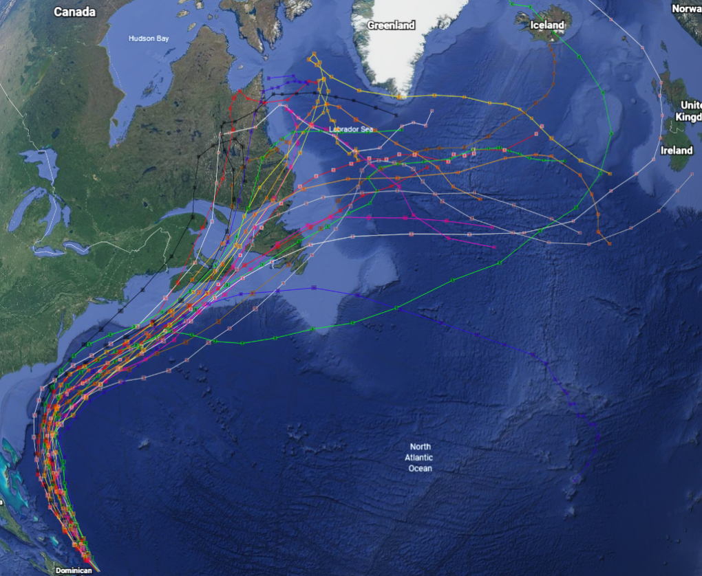
GRIP Hurricane and Tropical Storm Forecasts V1
The GRIP Hurricane and Tropical Storm Forecasts dataset consists of tropical cyclone model forecast tracks archived during the NASA Genesis and Rapid Intensification Processes... -
DSCOVR EPIC Level 2 Sulfur dioxide (SO2) Product with EPIC Version 3 Input Version 2
DSCOVR_EPIC_L2_SO2_v03 is the Deep Space Climate Observatory (DSCOVR) Enhanced Polychromatic Imaging Camera (EPIC) Level 2 Sulfur Dioxide (SO2) product with EPIC version 03... -
MLS/Aura Level 3 Monthly Binned Chlorine Monoxide (ClO) Mixing Ratio on Assorted Grids V004 (ML3MBCLO) at GES DISC
ML3MBCLO is the EOS Aura Microwave Limb Sounder (MLS) monthly binned on various vertical grids product for chlorine monoxide (ClO) derived from radiances measured primarily by... -
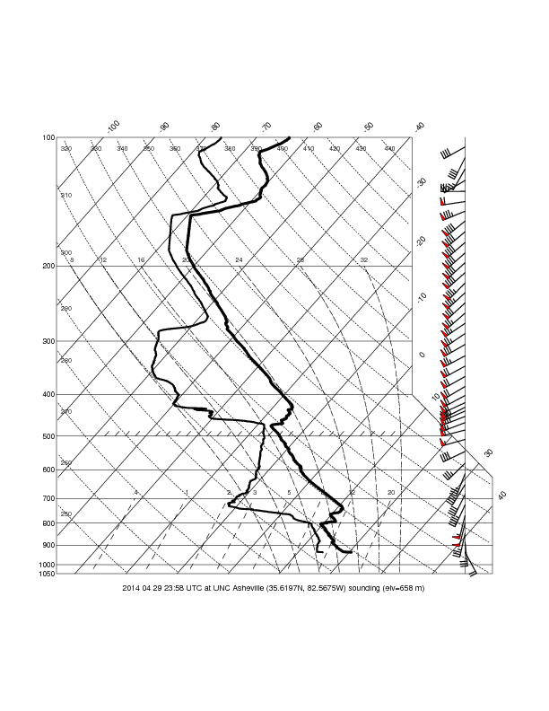
GPM Ground Validation UNCA Upper Air Radiosonde IPHEx V1
The GPM Ground Validation UNCA Upper Air Radiosonde IPHEx dataset was collected from April 29, 2014 through June 12, 2014 during the GPM Ground Validation Integrated... -
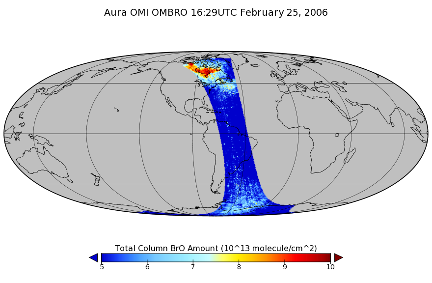
OMI/Aura Bromine Monoxide (BrO) Total Column 1-orbit L2 Swath 13x24 km V003 (OMBRO) at GES DISC
The Aura Ozone Monitoring Instrument (OMI) collection-3 Bromine Monoxide Product OMBRO from the Aura-OMI, is now available from the NASA Goddard Earth Sciences Data and... -
GHRSST L3C global sub-skin Sea Surface Temperature from the Advanced Very High Resolution Radiometer (AVHRR) on Metop satellites (currently Metop-B) (GDS V2) produced by OSI SAF
A global Group for High Resolution Sea Surface Temperature (GHRSST) Level 3 Collated (L3C) dataset derived from the Advanced Very High Resolution Radiometer (AVHRR) on the... -
Integrated fatigue damage diagnosis and prognosis under uncertainties
An integrated fatigue damage diagnosis and prognosis framework is proposed in this paper. The proposed methodology integrates a Lamb wave-based damage detection technique and a... -
NARSTO SHEMP Particulate Matter Composition Data, Canada, 2000-2002
NARSTO_SHEMP_CANADA_PM_COMPOSTION_DATA was obtained between February 14, 2000 and August 1, 2002 during the Study of the Health Effects of the Mix of Urban Air Pollutants... -
Aquarius Official Release Level 3 Rain-flagged Sea Surface Salinity Smoothed Standard Mapped Image Monthly Data V5.0
Aquarius Level 3 sea surface salinity (SSS) standard mapped image data contains gridded 1 degree spatial resolution SSS averaged over daily, 7 day, monthly, and seasonal time...

Official websites use .gov
A
.gov website belongs to an official government
organization in the United States.
Secure .gov websites use HTTPS
A
lock (
) or https:// means you’ve safely connected to
the .gov website. Share sensitive information only on official,
secure websites.