
-
Turbulent Air Motion Measurement System (TAMMS) IMPACTS V1
The Turbulent Air Motion Measurement System (TAMMS) IMPACTS dataset consists of wind speed, wind direction, and cross wind speed measurements from the TAMMS instrument onboard... -
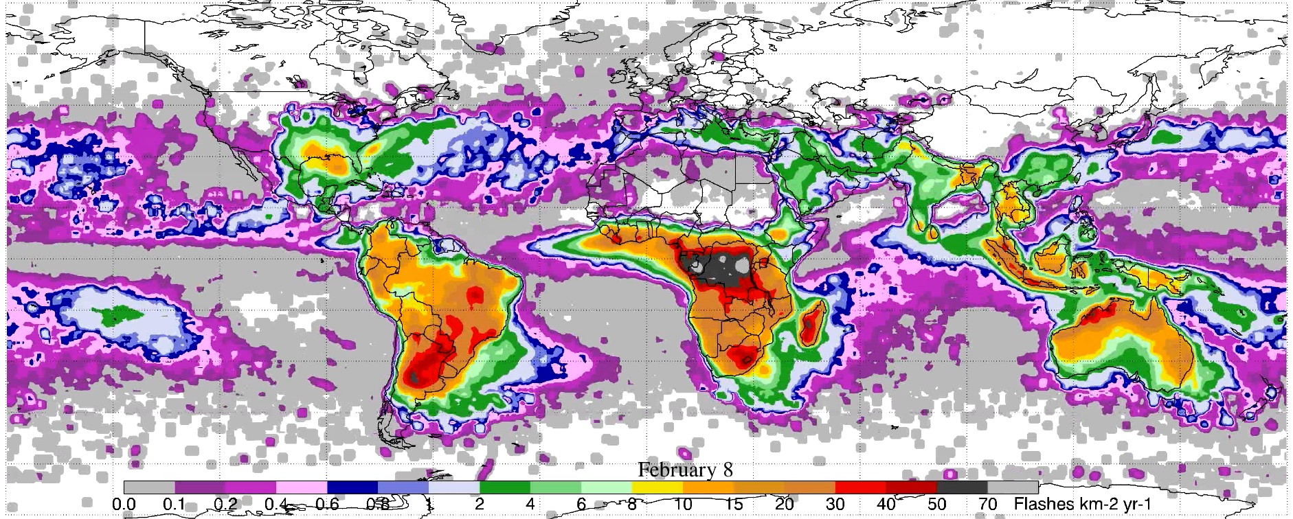
LIS 0.1 DEGREE VERY HIGH RESOLUTION GRIDDED LIGHTNING FULL CLIMATOLOGY (VHRFC) V1
The LIS 0.1 Degree Very High Resolution Gridded Lightning Full Climatology (VHRFC) dataset consists of gridded full climatologies of total lightning flash rates seen by the... -
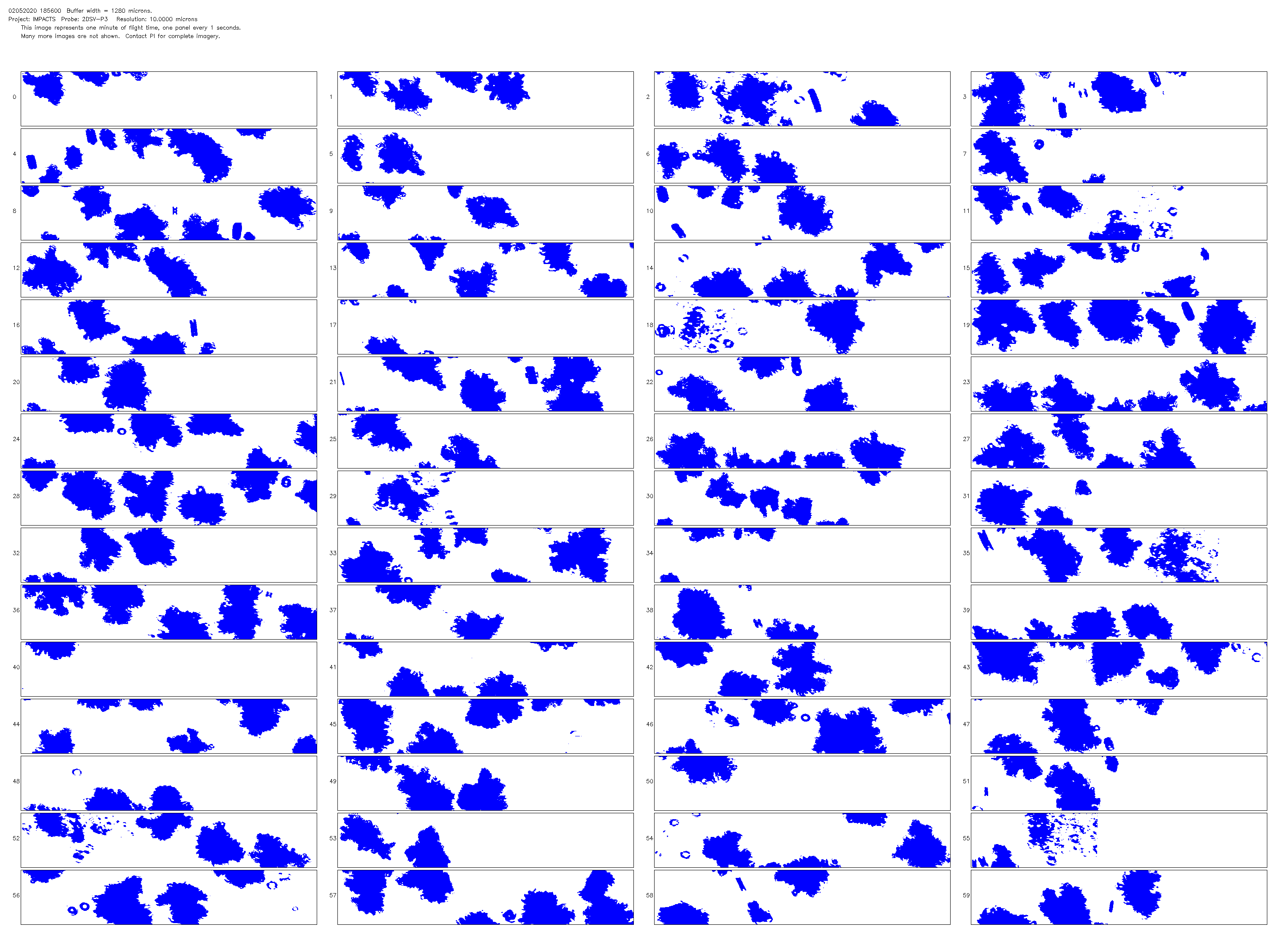
NCAR Particle Probes IMPACTS V1
The NCAR Particle Probes IMPACTS dataset consists of data collected from six instruments on the NASA P-3 aircraft, the SPEC Hawkeye Cloud Particle Imager (CPI), the Hawkeye Fast... -
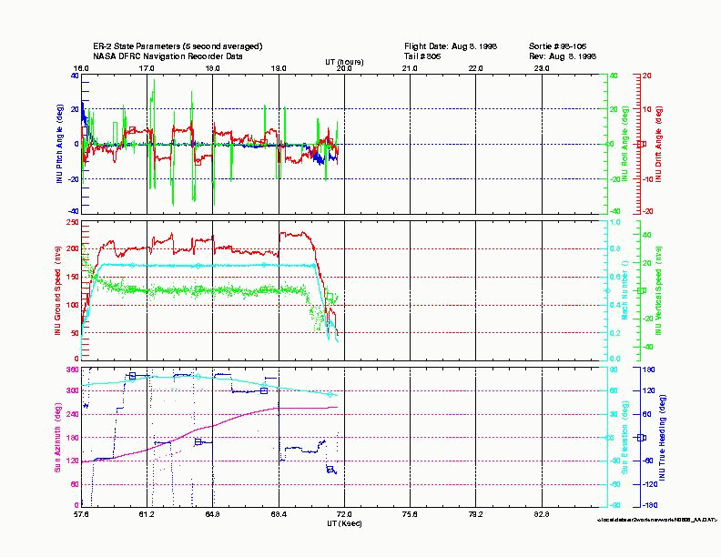
CAMEX-3 ER-2 NAVIGATION V1
The CAMEX-3 ER-2 Navigation data files contain information recorded by on board navigation and data collection systems. In addition to typical navigation data (e.g. date, time,... -
GPM Ground Validation Met One Rain Gauge Pairs OLYMPEX V1
The GPM Ground Validation Met One Rain Gauge Pairs OLYMPEX dataset contains precipitation amount and precipitation rate data collected during the Global Precipitation... -
GPM Ground Validation Reference Rainfall Data Product IFloodS V1
The GPM Ground Validation Reference Rainfall Data Product IFloodS dataset contains hourly rainfall accumulation estimates over central and northeastern Iowa for the period of 1... -
GPM Ground Validation TRMM 2A25 NRT Precipitation Radar IPHEx V7
The GPM Ground Validation TRMM 2A25 NRT Precipitation Radar IPHEx data are estimates of instantaneous three-dimensional distribution of rain from the Tropical Rainfall Measuring... -
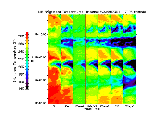
CAMEX-3 ER-2 Millimeter-wave Imaging Radiometer (MIR) V1
The CAMEX-3 ER-2 Millimeter-wave Imaging Radiometer (MIR) dataset is a browse-only dataset containing plots of brightness temperature measurements collected by the Millimeter-... -
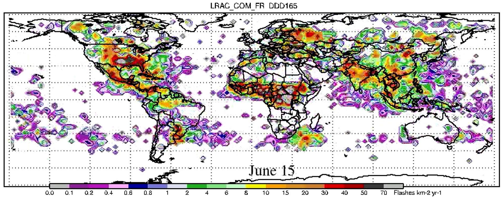
LIS/OTD 2.5 Degree Low Resolution Annual Climatology (LRAC) V2.3.2015
The LIS/OTD 2.5 Degree Low Resolution Annual Climatology (LRAC) contains a variety of gridded climatologies of total lightning flash rates obtained from two lightning detection... -
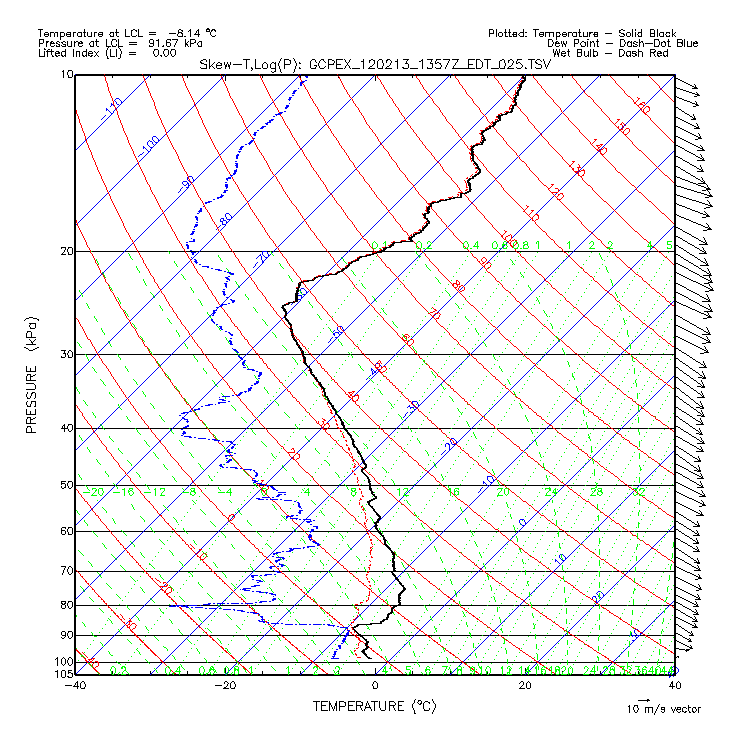
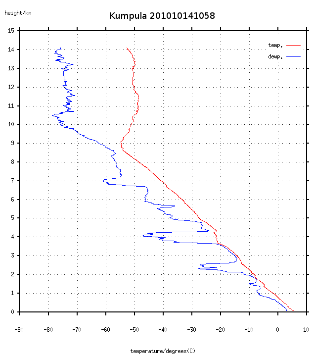
GPM GROUND VALIDATION ENVIRONMENT CANADA (EC) RADIOSONDE GCPEX V1
The GPM Ground Validation Environment Canada (EC) Radiosonde GCPEx dataset provides measurements of pressure, temperature, humidity, and winds collected by Vaisala RS92... -
GPM Ground Validation CAX1 Radar CFradial format OLYMPEX V1
The GPM Ground Validation CAX1 Radar CFradial format OLYMPEX dataset consists of radar parameters, such as Radar reflectivity, Doppler velocity, Doppler width, Differential... -
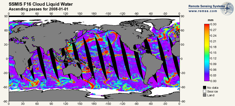
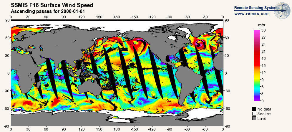
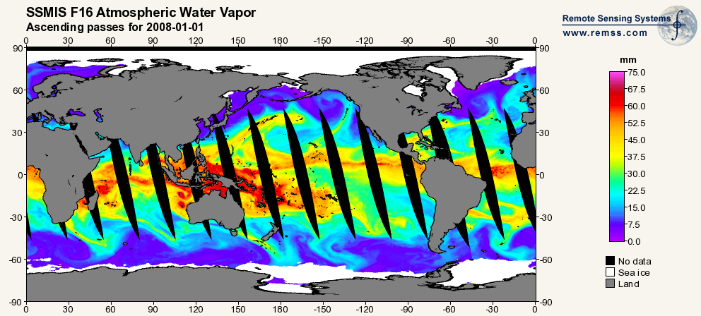
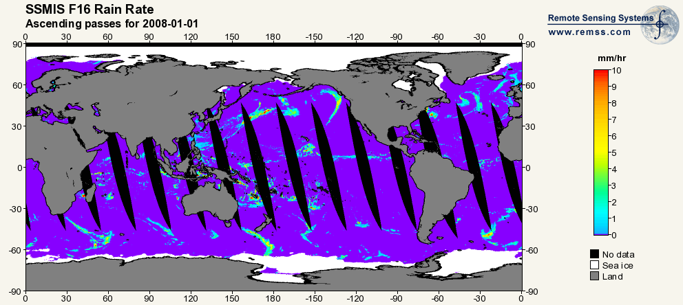
RSS SSMIS OCEAN PRODUCT GRIDS DAILY FROM DMSP F16 NETCDF V7
The RSS SSMIS Ocean Product Grids Daily from DMSP F16 netCDF dataset is part of the collection of Special Sensor Microwave/Imager (SSM/I) and Special Sensor Microwave Imager... -
LIS/OTD 0.5 Degree High Resolution Annual Climatology (HRAC) V2.3.2015
The LIS/OTD 0.5 Degree High Resolution Annual Climatology (HRAC) contains a variety of gridded climatologies of total lightning flash rates obtained from two lightning detection... -
SeaFlux Data Products V1
The SeaFlux Data Products dataset consists of estimates of ocean surface latent and sensible heat fluxes, 2m and 10m wind speed, 2m and 10m air temperature, 2m and 10m air... -
KBUF NEXRAD IMPACTS V1
The KBUF NEXRAD IMPACTS dataset consists of Next Generation Weather Radar (NEXRAD) Level II surveillance data that were collected from January 1 to March 1, 2020 during the... -
GPM Ground Validation Upper Air Radiosonde LPVEx V1
The GPM Ground Validation Radiosonde LPVEx dataset consists of sounding data collected as part of the Global Precipitation Measurement (GPM) mission Ground Validation Light... -
Millersville University Upper Air Radiosondes IMPACTS V1
The Millersville University Upper Air Radiosondes IMPACTS dataset contains atmospheric temperature, dew point temperature, wind speed, and wind direction measurements using... -
GPM GROUND VALIDATION TOTAL SKY IMAGER IPHEX V1
The GPM Ground Validation Total Sky Imager IPHEx dataset was gathered during the GPM Ground Validation Integrated Precipitation and Hydrology Experiment (IPHEx) in North... -
GPM Ground Validation Global Satellite Mapping of Precipitation (GSMaP) IFloodS V1
The GPM Ground Validation Global Satellite Mapping of Precipitation (GSMaP) IFloodS dataset consists of rainfall rate estimates from the GSMaP project. The GSMaP global rain...

Official websites use .gov
A
.gov website belongs to an official government
organization in the United States.
Secure .gov websites use HTTPS
A
lock (
) or https:// means you’ve safely connected to
the .gov website. Share sensitive information only on official,
secure websites.