
-
COWVR STP-H8 Antenna and Microwave Brightness Temperatures Version 10.0
This data set includes satellite-based observations of calibrated, geo-located antenna temperature and brightness temperatures, along with the sensor telemetry used to derive... -
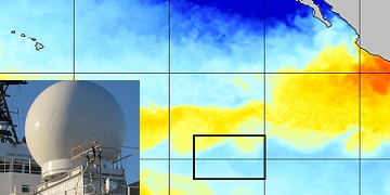
SPURS-2 research vessel along track SEA-POL rain radar imaging data for E. Tropical Pacific R/V Revelle-2 cruise
The SPURS (Salinity Processes in the Upper Ocean Regional Study) project is NASA-funded oceanographic process study and associated field program that aim to elucidate key... -
ECOSTRESS Evapotranspiration dis-ALEXI Daily L3 CONUS 70 m V001
The ECOsystem Spaceborne Thermal Radiometer Experiment on Space Station (ECOSTRESS) mission measures the temperature of plants to better understand how much water plants need... -
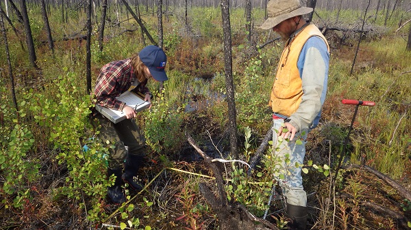
ABoVE: Post-Fire and Unburned Vegetation Community and Field Data, NWT, Canada, 2017
This dataset provides vegetation community characteristics, soil moisture, and biophysical data collected in 2017 from 11 study sites in the ABoVE Study area. The 11 study areas... -
SEASAT SCATTEROMETER BINNED 50KM SIGMA-0 DATA (Wentz)
Contains Seasat-A Scatterometer (SASS) Sigma-0 measurements for the entire Seasat mission, from July 1978 until October 1978, produced by Frank Wentz at Remote Sensing Systems.... -
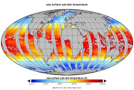
GHRSST L3C global sub-skin Sea Surface Temperature from the Advanced Very High Resolution Radiometer (AVHRR) on Metop satellites (currently Metop-B) (GDS V2) produced by OSI SAF
A global Group for High Resolution Sea Surface Temperature (GHRSST) Level 3 Collated (L3C) dataset derived from the Advanced Very High Resolution Radiometer (AVHRR) on the... -
Aquarius Official Release Level 3 Rain-flagged Sea Surface Salinity Smoothed Standard Mapped Image Monthly Data V5.0
Aquarius Level 3 sea surface salinity (SSS) standard mapped image data contains gridded 1 degree spatial resolution SSS averaged over daily, 7 day, monthly, and seasonal time... -
Tundra Plant Reflectance, CO2 Exchange, PAM Fluorometry, and Pigments, AK, 2001-2002
This dataset provides measurements at tundra plots collected near Utqiagvik and Atqasuk, AK, including visible-near infrared spectral reflectance, chamber gas exchange... -
Jason-1 GDR SSHA version E NetCDF
These Sea Surface Height Anomalies (SSHA) are derived from the Jason-1 Geophysical Data Record (GDR). Jason-1 is an altimetric mission whose instruments make direct observations... -
CAR SKUKUZA BRDF Measurements L1 V2 (CAR_SKUKUZA_BRDF) at GES DISC
CAR mission Skukuza measured bidirectional reflection functions over different natural surfaces and ecosystems in southern Africa. The measurements were conducted to... -
GHRSST Level 3U Global Subskin Sea Surface Temperature version 8.2 from the Advanced Microwave Scanning Radiometer 2 on the GCOM-W satellite by REMSS
This product contains a “Final” (Refined) Level-3U Sea Surface Temperature (SST) (currently identified by "v8.2" within the file name) for the Group for High Resolution Sea... -
West Atlantic Pre-SWOT Level-4 Hourly MITgcm LLC4320 Native Grid 2km Oceanographic Dataset Version 1.0
This dataset provides a regional multivariate oceanographic state estimate from a global ocean numerical simulation with a focus on the West Atlantic region. The global ocean... -
MODIS Terra Level 3 SST MID-IR Annual 4km Nighttime V2019.0 NGDA
Day and night spatially gridded (L3) global NASA skin sea surface temperature (SST) products from the Moderate-resolution Imaging Spectroradiometer (MODIS) onboard the Terra... -
ECCO Ocean Mixed Layer Depth - Daily Mean 0.5 Degree (Version 4 Release 4)
This dataset contains daily-averaged ocean mixed layer depth interpolated to a regular 0.5-degree grid from the ECCO Version 4 revision 4 (V4r4) ocean and sea-ice state... -
Lake Bathymetry Maps derived from Landsat and Random Forest Modeling, North Slope, AK
This dataset provides lake bathymetry maps derived from Landsat surface reflectance products for a portion of the North Slope area of Alaska. A random forest regression...

Official websites use .gov
A
.gov website belongs to an official government
organization in the United States.
Secure .gov websites use HTTPS
A
lock (
) or https:// means you’ve safely connected to
the .gov website. Share sensitive information only on official,
secure websites.