

Hyperspectral Imagery from AVIRIS-NG for Sites in ID and CA, USA, 2014 and 2015
Access & Use Information
Downloads & Resources
-
Google Scholar search resultsHTML
Search results for publications that cite this dataset by its DOI.
-
Download this datasetHTML
This link allows direct data access via Earthdata login
-
View documentation related to this datasetHTML
ORNL DAAC Data Set Documentation
-
This dataset's landing pageHTML
Data set Landing Page DOI URL
-
View documentation related to this datasetPDF
Hyperspectral Imagery from AVIRIS-NG for sites in ID and CA, US, 2014 and...
-
View documentation related to this datasetZIP
Hyperspectral Imagery from AVIRIS-NG for sites in ID and CA, US, 2014 and...
-
View documentation related to this datasetZIP
Hyperspectral Imagery from AVIRIS-NG for sites in ID and CA, US, 2014 and...
-
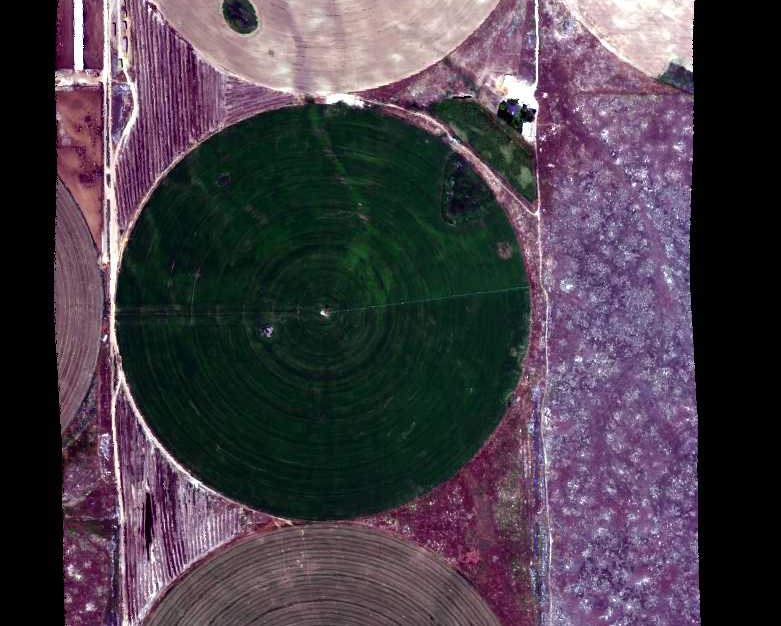
Get a related visualizationPNG
A portion of the quicklook image from flight line ang20150611t202652 over...
-
Landing PageLanding Page
Dates
| Metadata Created Date | February 23, 2025 |
|---|---|
| Metadata Updated Date | February 23, 2025 |
Metadata Source
- Data.json Data.json Metadata
Harvested from nasa test json
Additional Metadata
| Resource Type | Dataset |
|---|---|
| Metadata Created Date | February 23, 2025 |
| Metadata Updated Date | February 23, 2025 |
| Publisher | ORNL_DAAC |
| Maintainer | |
| Identifier | C2765511853-ORNL_CLOUD |
| Data First Published | 2018-05-03 |
| Language | en-US |
| Data Last Modified | 2025-02-19 |
| Category | Vegetation, geospatial |
| Public Access Level | public |
| Bureau Code | 026:00 |
| Metadata Context | https://project-open-data.cio.gov/v1.1/schema/catalog.jsonld |
| Schema Version | https://project-open-data.cio.gov/v1.1/schema |
| Catalog Describedby | https://project-open-data.cio.gov/v1.1/schema/catalog.json |
| Harvest Object Id | 8c5bb0c4-8d10-4665-a2f3-2845aa32660a |
| Harvest Source Id | a73e0c30-4684-40ef-908e-d22e9e9e5f86 |
| Harvest Source Title | nasa test json |
| Homepage URL | https://doi.org/10.3334/ORNLDAAC/1533 |
| Metadata Type | geospatial |
| Old Spatial | -118.41 36.57 -114.67 43.42 |
| Program Code | 026:001 |
| Source Datajson Identifier | True |
| Source Hash | 5d155a48f9c5275956aecd63c2329696a33430482c69583399b50343729ed91e |
| Source Schema Version | 1.1 |
| Spatial | |
| Temporal | 2014-09-15T17:38:00Z/2015-06-13T23:59:59Z |
Didn't find what you're looking for? Suggest a dataset here.