

174 datasets found
-
SPURS-1 research vessel CTD profile data for N. Atlantic cruises
NASA Test —
The SPURS (Salinity Processes in the Upper Ocean Regional Study) project is an oceanographic process study and associated field program that aim to elucidate key... -
GHRSST Level 4 MUR Global Foundation Sea Surface Temperature Analysis (v4.1) NGDA
NASA Test —
A Group for High Resolution Sea Surface Temperature (GHRSST) Level 4 sea surface temperature analysis produced as a retrospective dataset (four day latency) and near-... -
GHRSST Level 4 MW_IR_OI Global Foundation Sea Surface Temperature analysis version 5.0 from REMSS NGDA
NASA Test —
A Group for High Resolution Sea Surface Temperature (GHRSST) global Level 4 sea surface temperature analysis produced daily on a 0.09-degree grid at Remote Sensing... -
SPURS-1 research vessel Thermosalinograph series data for N. Atlantic cruises
NASA Test —
The SPURS (Salinity Processes in the Upper Ocean Regional Study) project is an oceanographic process study and associated field program that aim to elucidate key... -
GHRSST NOAA/STAR Metop-B AVHRR FRAC ACSPO v2.80 1km L2P Dataset (GDS v2)
NASA Test —
The MetOp First Generation (FG) is a European multi-satellite program jointly established by ESA and EUMETSAT, comprising three satellites, MetOp-A, -B and -C. The... -
Northwest Australian Shelf Pre-SWOT Level-4 Hourly MITgcm LLC4320 Native Grid 2km Oceanographic Dataset Version 1.0
NASA Test —
This dataset provides a regional multivariate oceanographic state estimate from a global ocean numerical simulation with a focus on the Northwest Australian Shelf... -
MODIS Terra Level 3 SST Thermal IR Annual 4km Nighttime V2019.0 NGDA
NASA Test —
Day and night spatially gridded (L3) global NASA skin sea surface temperature (SST) products from the Moderate-resolution Imaging Spectroradiometer (MODIS) onboard the... -
GHRSST NOAA/STAR GOES-16 ABI L2P America Region SST v2.70 dataset in GDS2
NASA Test —
GOES-16 (G16) is the first satellite in the US NOAA third generation of Geostationary Operational Environmental Satellites (GOES), a.k.a. GOES-R series (which will... -
GHRSST Level 3U Global Subskin Sea Surface Temperature version7.0.1a from the WindSat Polarimetric Radiometer on the Coriolis satellite
NASA Test —
The WindSat Polarimetric Radiometer, launched on January 6, 2003 aboard the Department of Defense Coriolis satellite, was designed to measure the ocean surface wind... -
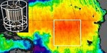
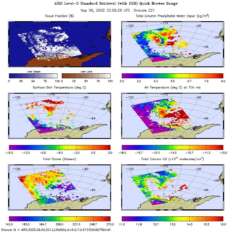
AIRS/Aqua L2 Standard Physical Retrieval (AIRS+AMSU+HSB) V006 (AIRH2RET) at GES DISC
NASA Test —
The Atmospheric Infrared Sounder (AIRS) is a grating spectrometer (R = 1200) aboard the second Earth Observing System (EOS) polar-orbiting platform, EOS Aqua. In... -
NOAA Smith and Reynolds Extended Reconstructed Sea Surface Temperature (ERSST) Level 4 Monthly Version 5 Dataset in netCDF
NASA Test —
The Smith & Reynolds Extended Reconstructed Sea Surface Temperature (ERSST) Level 4 dataset provides a historical reconstruction of monthly global ocean surface... -
GHRSST Level 2P 1 m Depth Global Sea Surface Temperature from VIIRS on Suomi NPP (GDS2) V1
NASA Test —
A global Group for High Resolution Sea Surface Temperature (GHRSST) Level 2P dataset based on retrievals from the Visible Infrared Imaging Radiometer Suite (VIIRS).... -
NOAA GHRSST Level 2P Atlantic Ocean Regional Skin Sea Surface Temperature v1.0 from the Spinning Enhanced Visible and InfraRed Imager (SEVIRI) on the Meteosat Second Generation-4 (MSG-4) satellite
NASA Test —
The GHRSST L2P MSG04 SST v1.0 dataset is produced by the US National Oceanic and Atmospheric Administration (NOAA) National Environmental Satellite, Data, and... -
GHRSST Level 3C North Atlantic Regional (NAR) subskin Sea Surface Temperature from SNPP/VIIRS and Metop-A/AVHRR (GDS V2) produced by OSI SAF
NASA Test —
A Group for High Resolution Sea Surface Temperature (GHRSST) dataset for the North Atlantic Region (NAR) derived from the Advanced Very High Resolution Radiometer... -
GHRSST Level 2P NOAA STAR SST v2.80 from VIIRS on NOAA-20 Satellite
NASA Test —
NOAA-20 (N20/JPSS-1/J1) is the second satellite in the US NOAA latest generation Joint Polar Satellite System (JPSS), launched on November 18, 2017. NOAA is... -
GHRSST Level 4 GAMSSA_28km Global Foundation Sea Surface Temperature Analysis v1.0 dataset (GDS2)
NASA Test —
A Group for High Resolution Sea Surface Temperature (GHRSST) Level 4 sea surface temperature analysis, produced daily on an operational basis at the Australian Bureau... -
GHRSST Level 2P Global Subskin Sea Surface Temperature from TRMM Microwave Imager (TMI) onboard Tropical Rainfall Measurement Mission (TRMM) satellite
NASA Test —
GDS2 Version -The Tropical Rainfall Measuring Mission (TRMM) Microwave Imager (TMI) is a well calibrated passive microwave radiometer, similar to the Special Sensor... -
Aquarius Official Release Level 3 Ancillary Reynolds Sea Surface Temperature Standard Mapped Image Monthly Data V5.0
NASA Test —
Aquarius Level 3 ancillary sea surface temperature (SST) standard mapped image data are the ancillary SST data used in the Aquarius calibration for salinity retrieval.... -
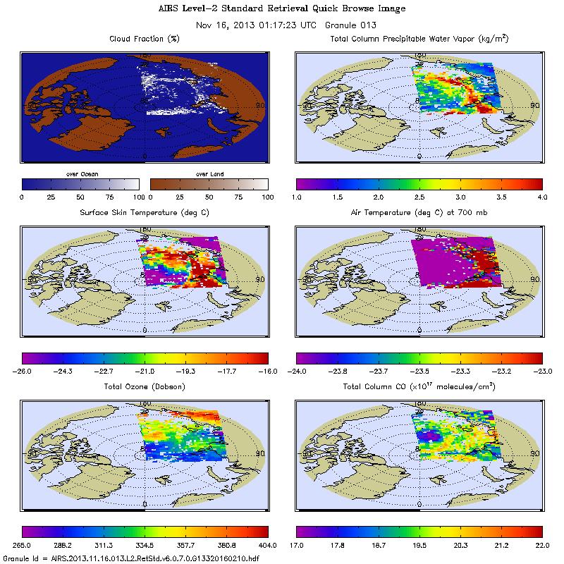
AIRS/Aqua L2 Standard Physical Retrieval (AIRS+AMSU) V006 (AIRX2RET) at GES DISC
NASA Test —
The Atmospheric Infrared Sounder (AIRS) is a grating spectrometer (R = 1200) aboard the second Earth Observing System (EOS) polar-orbiting platform, EOS Aqua. In...
174 datasets found