

27 datasets found
-
Digital Elevation Models for the Global Change Research Wetland, Maryland, USA, 2016
NASA Test —
This dataset contains four alternative digital elevation models (DEMs) at 1 m resolution and model performance statistical metrics for the Global Change Research... -
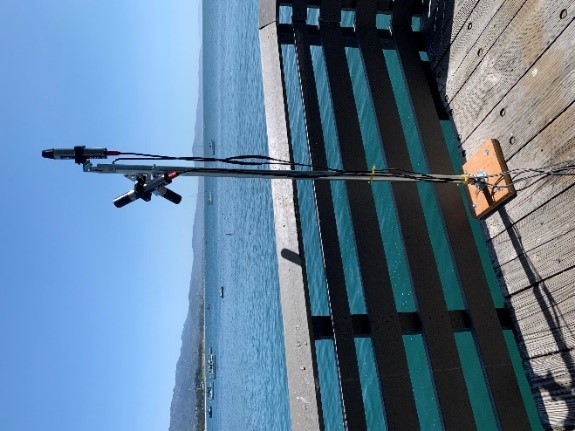
Delta-X: UAVSAR L2 Interferometric Products, MRD, Louisiana, 2021
NASA Test —
This dataset contains georeferenced UAVSAR Level 2 (L2) interferometric products for Delta-X flight lines acquired during the spring (2021-03-27 to 2021-04-18) and... -
Pre-Delta-X: Channel Bathymetry of the Atchafalaya Basin, LA, USA, 2016
NASA Test —
This dataset provides water depths and water surface elevations collected during bathymetric surveys of the main channel of the Wax Lake Delta within the Mississippi... -
ISLSCP II Sea Surface Temperature
NASA Test —
Sea surface temperature (SST) is an important indicator of the state of the earth climate system as well as a key variable in the coupling between the atmosphere and... -
CMS: Simulated Physical-Biogeochemical Data, SABGOM Model, Gulf of Mexico, 2005-2010
NASA Test —
This dataset contains monthly mean ocean surface physical and biogeochemical data for the Gulf of Mexico simulated by the South Atlantic Bight and Gulf of Mexico... -
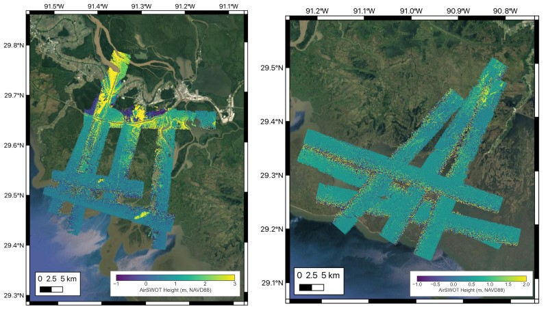
Delta-X: AirSWOT L2 Geocoded Water Surface Elevation, MRD, LA, 2021, V3
NASA Test —
This dataset contains Level 2 (L2) AirSWOT geocoded products, including estimated water surface elevation. The AirSWOT instrument is a Ka-band interferometer and for... -
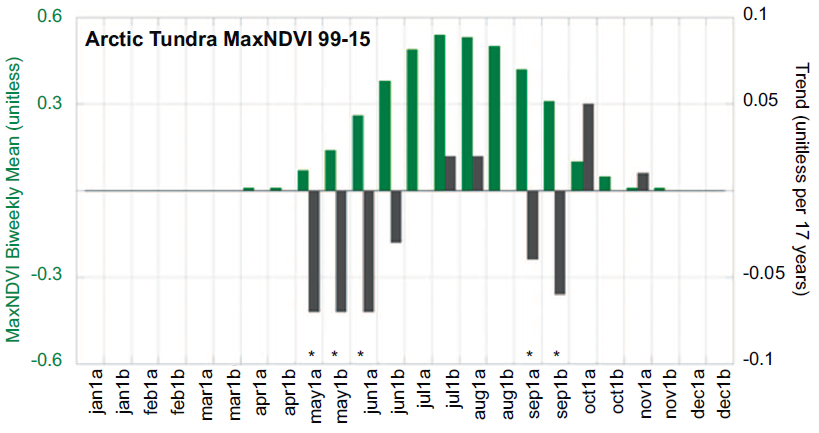
ABoVE: Climate Drivers of Pan-Arctic Tundra Vegetation Productivity, 1982-2015
NASA Test —
This dataset provides a summary of potential climate drivers of Arctic tundra vegetation productivity that have been compiled for growing seasons from 1982 to 2015.... -
Delta-X: Calibrated ANUGA Hydrodynamic Outputs for the Atchafalaya Basin, MRD, LA
NASA Test —
This dataset provides ANUGA hydrodynamic modeling results and input run-scripts for the Atchafalaya basin in the Mississippi River Delta in southern Louisiana, USA,... -
Delta-X: Modeled Land Accretion Rate Maps, Wax Lake Delta, MRD, LA, USA, 2021
NASA Test —
This dataset provides sediment transport and land accretion model results at Wax Lake Delta (WLD), Atchafalaya Basin, in coastal Louisiana, USA. Data were simulated... -
Delta-X: Matlab Model for Wax Lake Delta Land Accretion
NASA Test —
This dataset provides the Matlab sediment transport and land accretion model at Wax Lake Delta (WLD), Atchafalaya Basin, in coastal Louisiana. The data include the... -
Delta-X: ANUGA Hydrodynamic Outputs, Atchafalaya and Terrebonne, MRD, USA
NASA Test —
This dataset comprises the primary inputs and outputs from the ANUGA hydrodynamic model for spring 2021 (2021-03-20 to 2021-04-04). These dates align with the 2021... -
Delta-X: In situ Beam Attenuation and Particle Size from LISST-200X, 2021
NASA Test —
This dataset provides in situ measurements of beam attenuation coefficient at 670 nm, average suspended particle size, particle size distribution, and water... -
CMS: LiDAR Data for Mangrove Forests in the Zambezi River Delta, Mozambique, 2014
NASA Test —
This data set provides high-resolution LiDAR point cloud data collected during surveys over mangrove forests in the Zambezi River Delta in Mozambique in May 2014. The...
27 datasets found