

1,264 datasets found
-
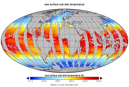
GHRSST NOAA/STAR ACSPO v2.80 0.02 degree L3S Dataset from mid-Morning LEO Satellites (GDS v2)
NASA Test —
NOAA STAR produces two lines of gridded 0.02 degree super-collated L3S LEO sub-skin Sea Surface Temperature (SST) datasets, one from the NOAA afternoon JPSS... -
MODIS Aqua Level 3 SST MID-IR Daily 4km Nighttime V2019.0 NGDA
NASA Test —
Day and night spatially gridded (L3) global NASA skin sea surface temperature (SST) products from the Moderate-resolution Imaging Spectroradiometer (MODIS) onboard the... -
Sentinel-3B OLCI Level-3B Global Binned Earth-observation Reduced-Resolution (ERR) Inherent Optical Properties (IOP) Data, version R2022.0
NASA Test —
The Ocean and Land Colour Instrument (OLCI) is the successor to ENVISAT's Medium Resolution Imaging Spectrometer (MERIS) having additional spectral channels, different... -
Mid-Atlantic coastal region and Monterey Bay measurements
NASA Test —
Measurements made near the mid-Atlantic coastal region and Monterey Bay in 2005 and 2006. -
OrbView-2 SeaWiFS Global Mapped Photosynthetically Available Radiation (PAR) Data, version R2022.0
NASA Test —
The SeaWiFS instrument was launched by Orbital Sciences Corporation on the OrbView-2 (a.k.a. SeaStar) satellite in August 1997, and collected data from September 1997... -
GHRSST L3C global sub-skin Sea Surface Temperature from the Advanced Very High Resolution Radiometer (AVHRR) on Metop satellites (currently Metop-B) (GDS V2) produced by OSI SAF
NASA Test —
A global Group for High Resolution Sea Surface Temperature (GHRSST) Level 3 Collated (L3C) dataset derived from the Advanced Very High Resolution Radiometer (AVHRR) on... -
Aquarius Official Release Level 3 Rain-flagged Sea Surface Salinity Smoothed Standard Mapped Image Monthly Data V5.0
NASA Test —
Aquarius Level 3 sea surface salinity (SSS) standard mapped image data contains gridded 1 degree spatial resolution SSS averaged over daily, 7 day, monthly, and... -
First ISCCP Regional Experiment (FIRE) Atlantic Stratocumulus Transition Experiment (ASTEX) Centre Meteorologie Spatiale Weekly Sea SurfaceTemperature Data
NASA Test —
The First ISCCP Regional Experiments have been designed to improve data products and cloud/radiation parameterizations used in general circulation models (GCMs).... -
SENTINEL-1A_DUAL_POL_GRD_MEDIUM_RES
NASA Test —
Sentinel-1A Dual-pol ground projected medium resolution images -
Global Ocean Ship-based Hydrographic Investigations Program (GO-SHIP)
NASA Test —
Measurements from the GO-SHIP (Global Ocean Ship-based Hydrographic Investigations Program) project, which is a network of sustained hydrographic sections, supporting... -
Biogeochemistry and Optics South Pacific Experiment
NASA Test —
Measurements made during the BIOSOPE: Biogeochemistry and Optics South Pacific Experiment in 2004. -
GLAS/ICESat L1B Global Elevation Data (HDF5) V034
NASA Test —
GLAH06 Level-1B Global Elevation is a product that is analogous to the geodetic data records distributed for radar altimetry missions. It contains elevations... -
Sentinel-3A OLCI Level-2 Earth-observation Reduced Resolution (ERR) Ocean Color (OC) Data, version R2022.0
NASA Test —
The Ocean and Land Colour Instrument (OLCI) is the successor to ENVISAT's Medium Resolution Imaging Spectrometer (MERIS) having additional spectral channels, different... -
Jason-1 GDR SSHA version E NetCDF
NASA Test —
These Sea Surface Height Anomalies (SSHA) are derived from the Jason-1 Geophysical Data Record (GDR). Jason-1 is an altimetric mission whose instruments make direct... -
NRT AMSR2 Unified L2B Global Swath Ocean Products V1
NASA Test —
The Advanced Microwave Scanning Radiometer 2 (AMSR2) instrument on the Global Change Observation Mission - Water 1 (GCOM-W1) provides global passive microwave... -
CAR SKUKUZA BRDF Measurements L1 V2 (CAR_SKUKUZA_BRDF) at GES DISC
NASA Test —
CAR mission Skukuza measured bidirectional reflection functions over different natural surfaces and ecosystems in southern Africa. The measurements were conducted to... -
GHRSST Level 3U Global Subskin Sea Surface Temperature version 8.2 from the Advanced Microwave Scanning Radiometer 2 on the GCOM-W satellite by REMSS
NASA Test —
This product contains a “Final” (Refined) Level-3U Sea Surface Temperature (SST) (currently identified by "v8.2" within the file name) for the Group for High... -
West Atlantic Pre-SWOT Level-4 Hourly MITgcm LLC4320 Native Grid 2km Oceanographic Dataset Version 1.0
NASA Test —
This dataset provides a regional multivariate oceanographic state estimate from a global ocean numerical simulation with a focus on the West Atlantic region. The...
1,264 datasets found