
-
ABoVE: Burn Severity, Fire Progression, Landcover and Field Data, NWT, Canada, 2014 NGDA
This data set provides peatland landcover classification maps, fire progression maps, and vegetation community biophysical data collected from areas that were burned by wildfire... -
Delta-X: UAVSAR L1 Single Look Complex (SLC) Stack Products, MRD, Louisiana, 2021
This dataset contains UAVSAR Level 1 (L1) Single Look Complex (SLC) stack products for Delta-X flight lines acquired during 2021-03-27 to 2021-04-18 (spring) and 2021-09-03 to... -
Arctic Vegetation Plots at Frost Boil Sites, North Slope, Alaska, 2000-2006
This data set describes the environment, soil, and vegetation on nonsorted circles and earth hummocks at seven study sites along a N-S-transect from the Arctic Ocean to the... -
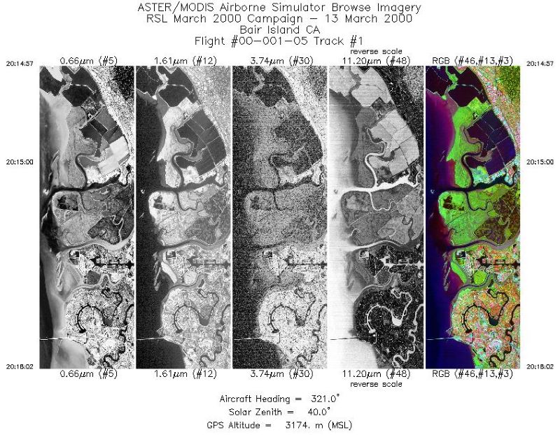
LBA-ECO LC-15 Aerodynamic Roughness Maps of Vegetation Canopies, Amazon Basin: 2000
This data set provides physical roughness maps of vegetation canopies in the Amazon Basin. The images are estimates of aerodynamic roughness length (Z0) and zero plane... -
SAFARI 2000 MAPSS MOD05_L2 Water Vapor Summary Data for Southern Africa NGDA
The MODIS (Moderate Resolution Imaging Spectroradiometer) Atmosphere Group develops remote sensing algorithms for deriving sets of atmospheric parameters from MODIS radiance... -
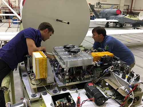
ATom: In Situ Atmospheric Water Vapor from the Diode Laser Hygrometer, Version 2
This dataset provides the concentrations of water measured by the Diode Laser Hygrometer (DLH) flown on the NASA DC-8 during the ATom 1-4 campaigns from 2016 - 2018. The DLH... -
ATom: Sulfur Dioxide by Laser Induced Fluorescence (LIF-SO2) for ATom-4 Campaign
This dataset provides concentrations of sulfur dioxide (SO2) measured by the Laser Induced Fluorescence Instrumentation for Sulfur Dioxide (SO2-LIF) on the ATom-4 campaign in... -
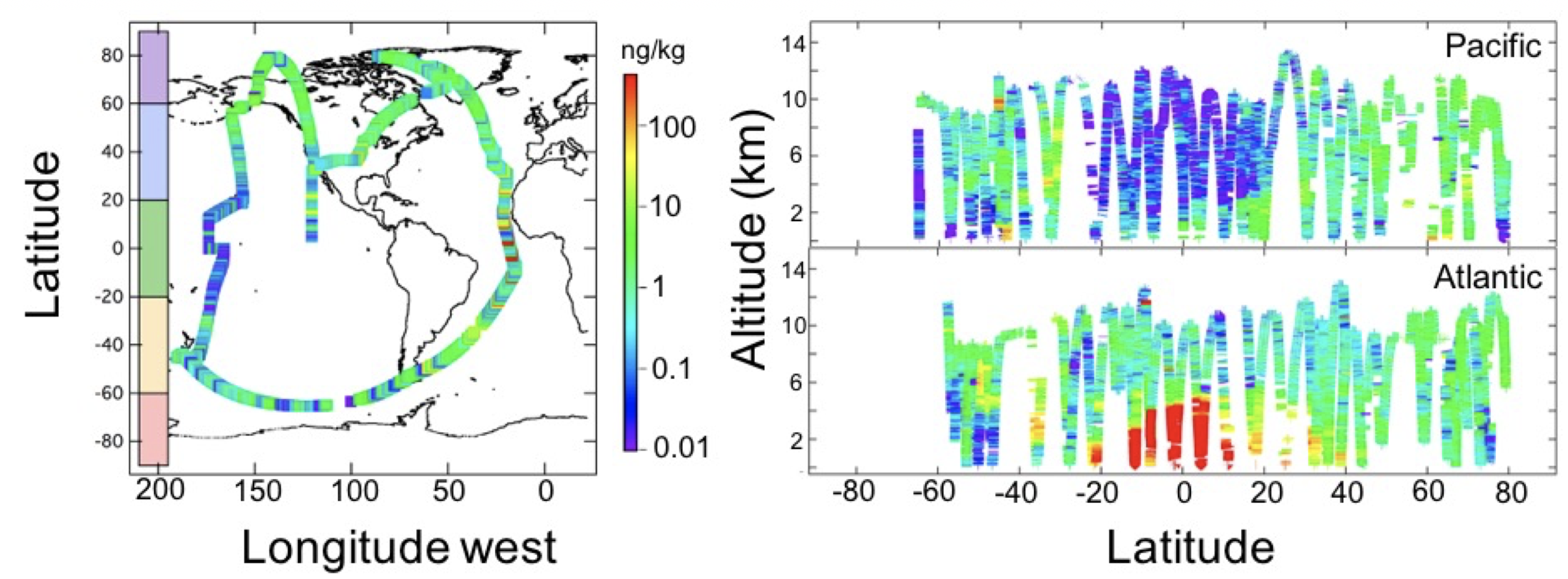
ATom: Black Carbon Mass Mixing Ratios from ATom-1 Flights
This dataset provides black carbon (BC) mass mixing ratios (in units of ng BC / kg air) measured during NASA's Atmospheric Tomography (ATom)-1 flight campaign during July and... -
Global Monthly GPP from an Improved Light Use Efficiency Model, 1982-2016
This dataset provides global monthly average gross primary productivity (GPP; g carbon/m2/d) modeled at 8 km spatial resolution for each of the 35 years from 1982-2016. GPP is... -
GEDI L4A Footprint Level Aboveground Biomass Density, Golden Weeks, Version 1
This dataset contains Global Ecosystem Dynamics Investigation (GEDI) Level 4A (L4A) predictions of the aboveground biomass density (AGBD; in Mg/ha) and estimates of the... -
BOREAS Forest Cover Layers of the NSA in Raster Format
Processed by BORIS staff from the original vector data of species, crown closure, cutting class, and site classification/subtype into raster files. -
BOREAS Follow-On DSP-10 Regridded Land Cover Maps for 1994
These images were produced by aggregating the 1-km land cover classification by Lou Steyaert at multiple resolutions (2 km, 10x5 minutes, and 0.5 degree). These data were... -
BOREAS RSS-14 GOES-7 Level-2 Shortwave and Longwave Radiation Images
This data set contains images of shortwave and longwave radiation at the surface and top of the atmosphere derived from collected GOES-7 data. The data cover the time period of... -
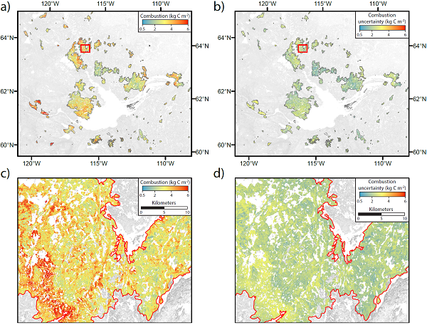
ABoVE: Wildfire Carbon Emissions and Burned Plot Characteristics, NWT, CA, 2014-2016
This dataset provides estimates of wildfire carbon emissions and uncertainties at 30-m resolution, and measurements collected at burned and unburned field plots from the 2014... -
LBA-ECO LC-01 Landsat TM Land Use/Land Cover, Northern Ecuadorian Amazon: 1986-1999
This data set contains Landsat TM imagery for the years 1986, 1989, 1996, and 1999, that have been classified into four land use/land cover (LULC) classes: Forest, Non-Forest...

Official websites use .gov
A
.gov website belongs to an official government
organization in the United States.
Secure .gov websites use HTTPS
A
lock (
) or https:// means you’ve safely connected to
the .gov website. Share sensitive information only on official,
secure websites.