
-
Flight Data For Tail 666
The following zip files contain individual flight recorded data in Matlab file format. There are 186 parameters each with a data structure that contains the following: -sensor... -
Gazetteer of Planetary Nomenclature
Planetary nomenclature, like terrestrial nomenclature, is used to uniquely identify a feature on the surface of a planet or satellite so that the feature can be easily located,... -
CERES Energy Balanced and Filled (EBAF) TOA and Surface Monthly means data in netCDF Edition 4.1
CERES_EBAF_Edition4.1 is the Clouds and the Earth's Radiant Energy System (CERES) Energy Balanced and Filled (EBAF) Top-of-Atmosphere (TOA) and surface monthly means data in... -
Gazetteer of Planetary Nomenclature
Planetary nomenclature, like terrestrial nomenclature, is used to uniquely identify a feature on the surface of a planet or satellite so that the feature can be easily located,... -
CERES BDS Terra FM1 Edition 4
CER_BDS_Terra-FM1_Edition4 is the Clouds and the Earth's Radiant Energy System (CERES) Bidirectional Scans (BDS) Terra Flight Model 1 (FM1) Edition 4 data product, which is... -
Earth Radiation Budget Experiment (ERBE) S-10 Medium Field of View (MFOV) Shape Factor (SF) Radiant Flux and Albedo
ERBE_S10_MFOV_SF_NAT_1 is the Earth Radiation Budget Experiment (ERBE) S-10 Medium Field of View (MFOV) Shape Factor (SF) Radiant Flux and Albedo data product. Data collection... -
GIBS Keyhole Markup Language (KML)
The KML documentation standard provides a solution for imagery integration into mapping tools that utilize support the KML standard, specifically Google Earth. Using the... -
CERES and GEO-Enhanced TOA, Within-Atmosphere and Surface Fluxes, Clouds and Aerosols 1-Hourly Terra-NOAA20 Edition4A NGDA
CER_SYN1deg-1Hour_Terra-NOAA20-MODIS_Edition4A is the Clouds and the Earth's Radiant Energy System (CERES) and geostationary (GEO) Top-of-Atmosphere (TOA) Within-Atmosphere and... -
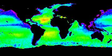
Aquarius Official Release Level 3 Rain-flagged Sea Surface Salinity Standard Mapped Image 7-Day Running Mean Data V5.0
Aquarius Level 3 sea surface salinity (SSS) rain-flagged standard mapped image data contains gridded 1 degree spatial resolution SSS averaged over daily, 7 day, monthly, and... -
Aquarius Official Release Level 3 Sea Surface Density Standard Mapped Image 7-Day Data V5.0
Aquarius Level 3 sea surface density standard mapped image data contains gridded 1 degree spatial resolution derived density averaged over daily, 7 day, monthly, and seasonal... -
ABoVE: Permafrost Measurements and Distribution Across the Y-K Delta, Alaska, 2016
This dataset provides field observations of thaw depth and dominant vegetation types, a LiDAR-derived elevation map, and permafrost distribution and probability maps for an area... -
CERES and GEO-Enhanced TOA, Within-Atmosphere and Surface Fluxes, Clouds and Aerosols Monthly Terra-NOAA20 Edition4A NGDA
CER_SYN1deg-Month_Terra-NOAA20_Edition4A is the Clouds and the Earth's Radiant Energy System (CERES) and geostationary (GEO)-Enhanced Top of Atmosphere (TOA), Within-Atmosphere,... -
Aquarius Official Release Level 3 Rain-flagged Sea Surface Salinity Standard Mapped Image Ascending 28-Day Running Mean Data V5.0
Aquarius Level 3 sea surface salinity (SSS) rain-flagged standard mapped image data contains gridded 1 degree spatial resolution SSS averaged over daily, 7 day, monthly, and... -
MISR_MODIS_AtmCorrection
This data repository (6.36gb total) supports the publication: Knobelspiesse, K., Ibrahim, A., Franz, B., Bailey, S., Levy, R., Ahmad, Z., Gales, J., Gao, M., Garay, M.,... -
Aquarius Official Release Level 3 Sea Surface Spiciness Standard Mapped Image Descending Monthly Climatology Data V5.0
Aquarius Level 3 sea surface spiciness standard mapped image data contains gridded 1 degree spatial resolution spice data averaged over daily, 7 day, monthly, and seasonal time... -
Aquarius Official Release Level 3 Ancillary Reynolds Sea Surface Temperature Standard Mapped Image Ascending Annual Data V5.0
Aquarius Level 3 ancillary sea surface temperature (SST) standard mapped image data are the ancillary SST data used in the Aquarius calibration for salinity retrieval. They are... -
CERES Monthly Gridded Single Satellite Fluxes and Clouds TRMM Edition2C
CER_FSW_TRMM-PFM-VIRS_Edition2C is the Clouds and the Earth's Radiant Energy System (CERES) Fixed Swath Width (FSW) Monthly Gridded Single Satellite Fluxes (SSF) and Clouds... -
Aquarius Official Release Level 3 Sea Surface Density Standard Mapped Image Seasonal Climatology Data V5.0
Aquarius Level 3 sea surface density standard mapped image data contains gridded 1 degree spatial resolution derived density averaged over daily, 7 day, monthly, and seasonal... -
Gazetteer of Planetary Nomenclature
Planetary nomenclature, like terrestrial nomenclature, is used to uniquely identify a feature on the surface of a planet or satellite so that the feature can be easily located,... -
DXC'10 Industrial Track Competition Data
Competition data, including nominal and faulty scenarios, for Diagnostic Problems I and II of the Second International Diagnostic Competition. Three file formats are provided,...

Official websites use .gov
A
.gov website belongs to an official government
organization in the United States.
Secure .gov websites use HTTPS
A
lock (
) or https:// means you’ve safely connected to
the .gov website. Share sensitive information only on official,
secure websites.