
-
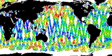
Aquarius Official Release Level 3 Wind Speed Standard Mapped Image Descending Seasonal Data V5.0
Aquarius Level 3 ocean surface wind speed standard mapped image data contains gridded 1 degree spatial resolution wind speed data averaged over daily, 7 day, monthly, and... -
Aquarius Official Release Level 3 Rain-flagged Sea Surface Salinity Standard Mapped Image Ascending Mission Cumulative Data V5.0
Aquarius Level 3 sea surface salinity (SSS) standard mapped image data contains gridded 1 degree spatial resolution SSS averaged over daily, 7 day, monthly, and seasonal time... -
GRACE NON-TIDAL ATMOSPHERE GEOPOTENTIAL COEFFICIENTS JPL RELEASE 6.0 GAA
FOR EXPERT USE ONLY. This dataset contains estimates of geopotential field derived from the Gravity Recovery and Climate Experiment (GRACE) mission measurements and a non-tidal... -
ECCO Sea Surface Height - Daily Mean llc90 Grid (Version 4 Release 4b)
This dataset provides daily-averaged dynamic sea surface height and model sea level anomaly on the native Lat-Lon-Cap 90 (LLC90) model grid from the ECCO Version 4 Release 4b... -
SWOT Level 1B High-Rate Single-look Complex Data Product, Version 2.0
High rate data processed to single-look complex SAR images for each antenna. Gridded tile (approx 64x64 km2); half swath (left or right side of full swath). Available in... -
ECCO Sea-Ice and Snow Horizontal Volume Fluxes - Daily Mean llc90 Grid (Version 4 Release 4)
This dataset provides daily-averaged sea-ice and snow horizontal volume fluxes on the native Lat-Lon-Cap 90 (LLC90) model grid from the ECCO Version 4 Release 4 (V4r4) ocean and... -
CYGNSS Level 3 Soil Moisture Version 3.2
The CYGNSS Level 3 Soil Moisture V3.2 dataset is produced by CYGNSS investigators at the University Corporation for Atmospheric Research (UCAR) and the University Colorado at... -
ECCO Sea Surface Height - Monthly Mean llc90 Grid (Version 4 Release 4)
This dataset provides monthly-averaged dynamic sea surface height and model sea level anomaly on the native Lat-Lon-Cap 90 (LLC90) model grid from the ECCO Version 4 Release 4... -
ECCO Ocean Temperature and Salinity - Monthly Mean 0.5 Degree (Version 4 Release 4)
This dataset contains monthly-averaged ocean potential temperature and salinity interpolated to a regular 0.5-degree grid from the ECCO Version 4 revision 4 (V4r4) ocean and... -
Aquarius Official Release Level 3 Sea Surface Spiciness Standard Mapped Image Ascending Monthly Climatology Data V5.0
Aquarius Level 3 sea surface spiciness standard mapped image data contains gridded 1 degree spatial resolution spice data averaged over daily, 7 day, monthly, and seasonal time... -
S-MODE L2 Shipboard Thermosalinograph, Meteorology, and Bio-optics Measurements Version 1
This dataset contains shipboard thermosalinograph (TSG), meteorology, and bio-optics measurements taken during the Sub-Mesoscale Ocean Dynamics Experiment (S-MODE) field... -
Aquarius Official Release Level 3 Rain-flagged Sea Surface Salinity Standard Mapped Image Ascending Seasonal Data V5.0
Aquarius Level 3 sea surface salinity (SSS) rain-flagged standard mapped image data contains gridded 1 degree spatial resolution SSS averaged over daily, 7 day, monthly, and... -
SWOT Level 2 River Cycle-Averaged Data Product, Version 2.0
Cycle average and aggregation of river reach pass data within predefined hydrological basins. Basin for each cycle. Available in Shapefile file format. -
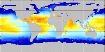
GHRSST Level 4 RAMSSA_9km Australian Regional Foundation Sea Surface Temperature Analysis v1.0 dataset (GDS2)
A Group for High Resolution Sea Surface Temperature (GHRSST) Level 4 sea surface temperature analysis, produced daily on an operational basis at the Australian Bureau of... -
SWOT Level 2 KaRIn Low Rate Sea Surface Height Data Product - WindWave, Version 2.0
The SWOT Level 2 KaRIn Low Rate Sea Surface Height Windwave Data Product from the Surface Water Ocean Topography (SWOT) mission provides global sea surface height and... -
Aquarius Official Release Level 3 Rain-flagged Sea Surface Salinity Standard Mapped Image Descending Seasonal Data V5.0
Aquarius Level 3 sea surface salinity (SSS) rain-flagged standard mapped image data contains gridded 1 degree spatial resolution SSS averaged over daily, 7 day, monthly, and... -
ECCO Ocean Bottom Pressure - Snapshot llc90 Grid (Version 4 Release 4)
This dataset provides instantaneous ocean bottom pressure and model ocean bottom pressure anomaly on the native Lat-Lon-Cap 90 (LLC90) model grid from the ECCO Version 4 Release... -
Aquarius Official Release Level 3 Sea Surface Density Standard Mapped Image Descending Annual Data V5.0
Aquarius Level 3 sea surface density standard mapped image data contains gridded 1 degree spatial resolution density data averaged over daily, 7 day, monthly, and seasonal time... -
Aquarius Official Release Level 3 Sea Surface Density Standard Mapped Image Monthly Climatology Data V5.0
Aquarius Level 3 sea surface density standard mapped image data contains gridded 1 degree spatial resolution derived density averaged over daily, 7 day, monthly, and seasonal...

Official websites use .gov
A
.gov website belongs to an official government
organization in the United States.
Secure .gov websites use HTTPS
A
lock (
) or https:// means you’ve safely connected to
the .gov website. Share sensitive information only on official,
secure websites.