
-
Aquarius Official Release Level 3 Wind Speed Standard Mapped Image Descending Monthly Climatology Data V5.0
Aquarius Level 3 ocean surface wind speed standard mapped image data contains gridded 1 degree spatial resolution wind speed data averaged over daily, 7 day, monthly, and... -
BigFoot NPP Surfaces for North and South American Sites, 2000-2004
The BigFoot project gathered Net Primary Production (NPP) data for nine EOS Land Validation Sites located from Alaska to Brazil from 2000 to 2004. Each site is representative of... -
Aquarius Official Release Level 3 Rain-flagged Sea Surface Salinity Standard Mapped Image 7-Day Data V5.0
Aquarius Level 3 sea surface salinity (SSS) rain-flagged standard mapped image data contains gridded 1 degree spatial resolution SSS averaged over daily, 7 day, monthly, and... -
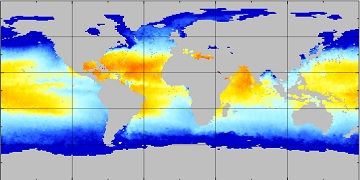
Aquarius Official Release Level 3 Sea Surface Spiciness Standard Mapped Image Ascending Annual Data V5.0
Aquarius Level 3 sea surface spiciness standard mapped image data contains gridded 1 degree spatial resolution spice data averaged over daily, 7 day, monthly, and seasonal time... -
BIGFOOT Meteorological Data for North and South American Sites, 1991-2004
The BigFoot Project has compiled daily meteorological measurements for nine EOS Land Validation Sites located from Alaska to Brazil from 1991 to 2004. Each site is... -
Aquarius Official Release Level 3 Sea Surface Density Standard Mapped Image Ascending 7-Day Data V5.0
Aquarius Level 3 sea surface density standard mapped image data contains gridded 1 degree spatial resolution density data averaged over daily, 7 day, monthly, and seasonal time... -
Flight Crew Physiological Data for Crew State Monitoring
This physiological data was collected from pilot/copilot pairs in and out of a flight simulator. It was collected to train machine-learning models to aid in the detection of... -
ABoVE: Reflectance Spectra of Tundra Plant Communities across Northern Alaska
This dataset reports full-spectrum (350-2500 nm) reflectance measurements of diverse plant communities at the plot-level and individual plant species at the leaf-level, at... -
Aquarius Official Release Level 3 Sea Surface Spiciness Standard Mapped Image Annual Data V5.0
Aquarius Level 3 sea surface spiciness standard mapped image data contains gridded 1 degree spatial resolution spice data averaged over daily, 7 day, monthly, and seasonal time... -
Flight Data For Tail 658
The following zip files contain individual flight recorded data in Matlab file format. There are 186 parameters each with a data structure that contains the following: -sensor... -
Aquarius Official Release Level 3 Sea Surface Spiciness Standard Mapped Image Ascending Seasonal Data V5.0
Aquarius Level 3 sea surface spiciness standard mapped image data contains gridded 1 degree spatial resolution spice data averaged over daily, 7 day, monthly, and seasonal time... -
SAGE III/ISS L2 Monthly Aerosol Product (NetCDF) V011
Data quality notice: The SAGE III/ISS team recommends against using data from events 2024030913SS, 2024030915SS, and 2024030917SS. These events were affected by line-of-sight... -
NARSTO Pacific 2001 Air Quality Study (PAC2001) Slocan Park (SLPK) Slocan Park Site Gaseous, Partculate Matter (PM), and Meteorological Data
NARSTO_PAC2001_SLOCAN_PARK_GAS_PM_MET_DATA is the North American Research Strategy for Tropospheric Ozone (NARSTO) Pacific 2001 Air Quality Study (PAC2001) Slocan Park (SLPK)... -
DXC'10 Framework and Oracle
The DXC Framework is a collection of programs and APIs for running and evaluating diagnostic algorithms (DAs) under identical experimental conditions. It is complementary to... -
Collaborative Testing of Turbulence Models: Incompressible Flow Cases from 1980-81 Data Library
This grouping contains the incompressible-flow cases from the 1980-81 Data Library. -
Global Food Security-support Analysis Data (GFSAD) Cropland Extent-Product 2015 Validation 30 m V001
The NASA Making Earth System Data Records for Use in Research Environments (MEaSUREs) (https://earthdata.nasa.gov/community/community-data-system-programs/measures-projects)... -
CER_BDS_Terra-FM2_Edition4
CER_BDS_Terra-FM2_Edition4 is the Clouds and the Earth's Radiant Energy System (CERES) Bidirectional Scans (BDS) Terra Flight Model 2 (FM2) Edition 4 data product, which is... -
Earth Radiation Budget Experiment (ERBE) S-10N (Nonscanner-only) Wide Field of View (WFOV) Numerical Filter (NF) Earth Flux and Albedo
ERBE_S10N_WFV_NF_NAT_1 is the Earth Radiation Budget Experiment (ERBE) S-10N (Non-scanner-only) Wide Field of View (WFOV) Numerical Filter (NF) Earth Flux and Albedo data...

Official websites use .gov
A
.gov website belongs to an official government
organization in the United States.
Secure .gov websites use HTTPS
A
lock (
) or https:// means you’ve safely connected to
the .gov website. Share sensitive information only on official,
secure websites.