
-
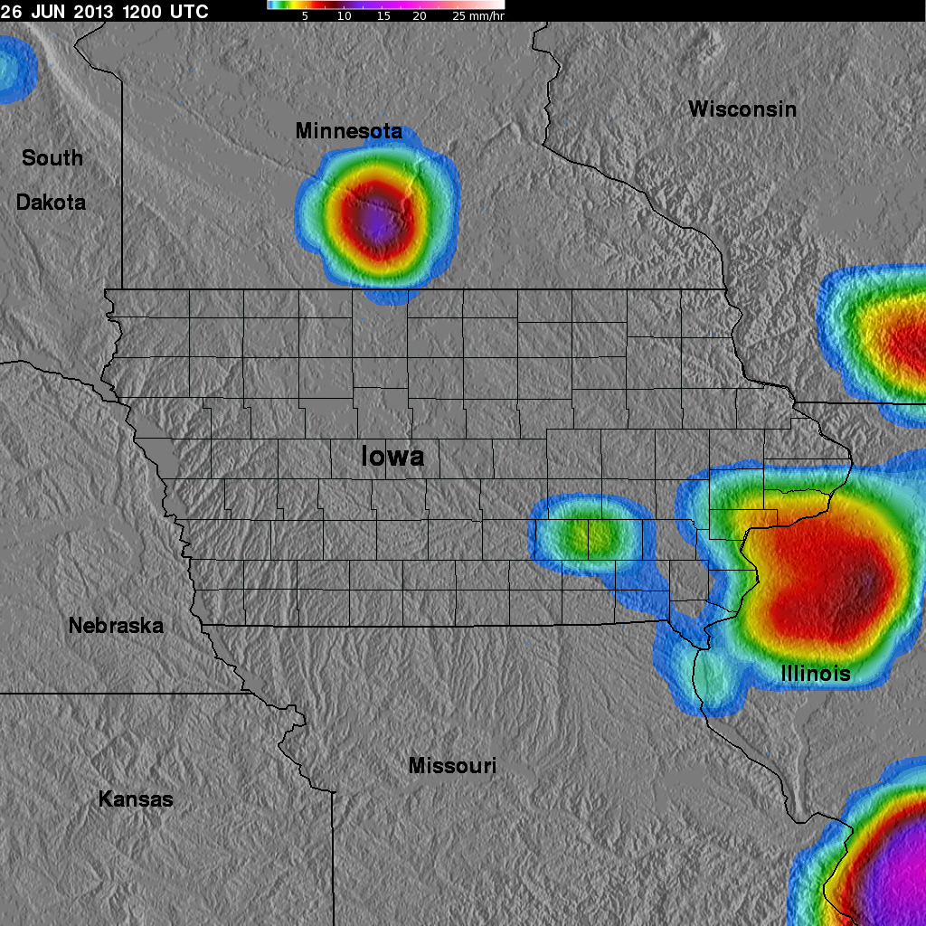
GPM Ground Validation TRMM Multi-satellite Precipitation Analysis (TMPA) IFloodS V7
The GPM Ground Validation TRMM Multi-satellite Precipitation Analysis (TMPA) IFloodS dataset is a subset of the TMPA 3B42RT gridded precipitation real-time product selected for... -
HURRICANE AND SEVERE STORM SENTINEL (HS3) GLOBAL HAWK ADVANCED VERTICAL ATMOSPHERIC PROFILING SYSTEM (AVAPS) DROPSONDE SYSTEM V2
The Hurricane and Severe Storm Sentinel (HS3) Global Hawk Advanced Vertical Atmospheric Profiling System (AVAPS) Dropsonde System dataset was collected by the Advanced Vertical... -
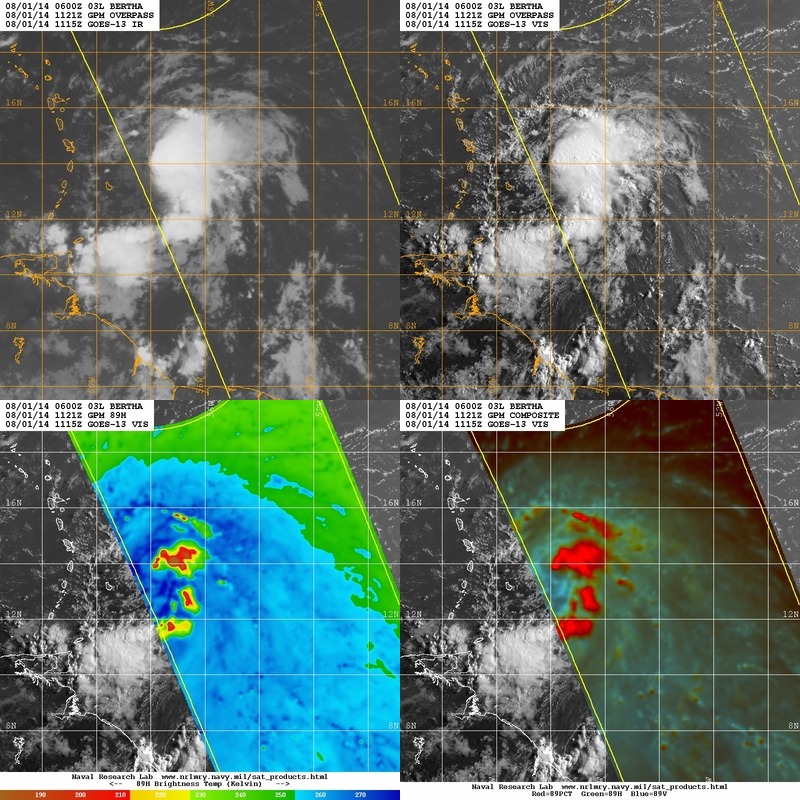
Hurricane and Severe Storm Sentinel (HS3) Naval Research Laboratory (NRL) Tropics Satellite Data V1
The Hurricane and Severe Storm Sentinel (HS3) Naval Research Laboratory (NRL) Tropics Satellite Data contains browse only data files, including brightness temperature, rain... -
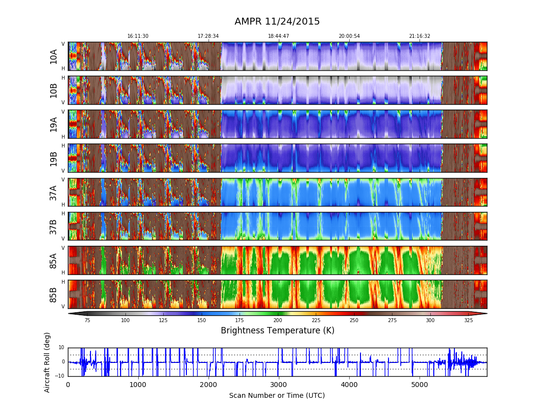
GPM Ground Validation Advanced Microwave Precipitation Radiometer (AMPR) OLYMPEX V1
The GPM Ground Validation Advanced Microwave Precipitation Radiometer (AMPR) OLYMPEX dataset was collected by the AMPR instrument flown on the high altitude ER-2 research... -
GPM GROUND VALIDATION KICT NEXRAD MC3E V1
The GPM Ground Validaiton KICT NEXRAD MC3E dataset was collected from April 22, 2011 to June 6, 2011 for the Midlatitude Continental Convective Clouds Experiment (MC3E) which... -
GPM Ground Validation Met One Rain Gauge Pairs Wallops Flight Facility (WFF) V1
The GPM Ground Validation Met One Rain Gauge Pairs Wallops Flight Facility (WFF) dataset contains rain rate data from 4 rain gauge networks located in Virginia and Maryland near... -
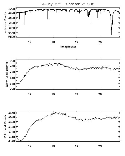
CAMEX-3 DC-8 Airborne Multichannel Microwave Radiometer (AMMR) V1
The CAMEX-3 DC-8 Airborne Multichannel Microwave Radiometer (AMMR) dataset is a browse-only dataset that consists of plotted digital count measurements collected by the Airborne... -
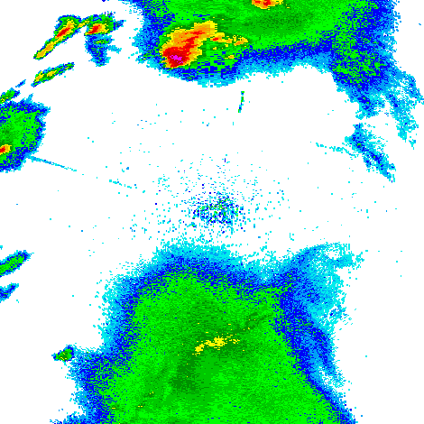
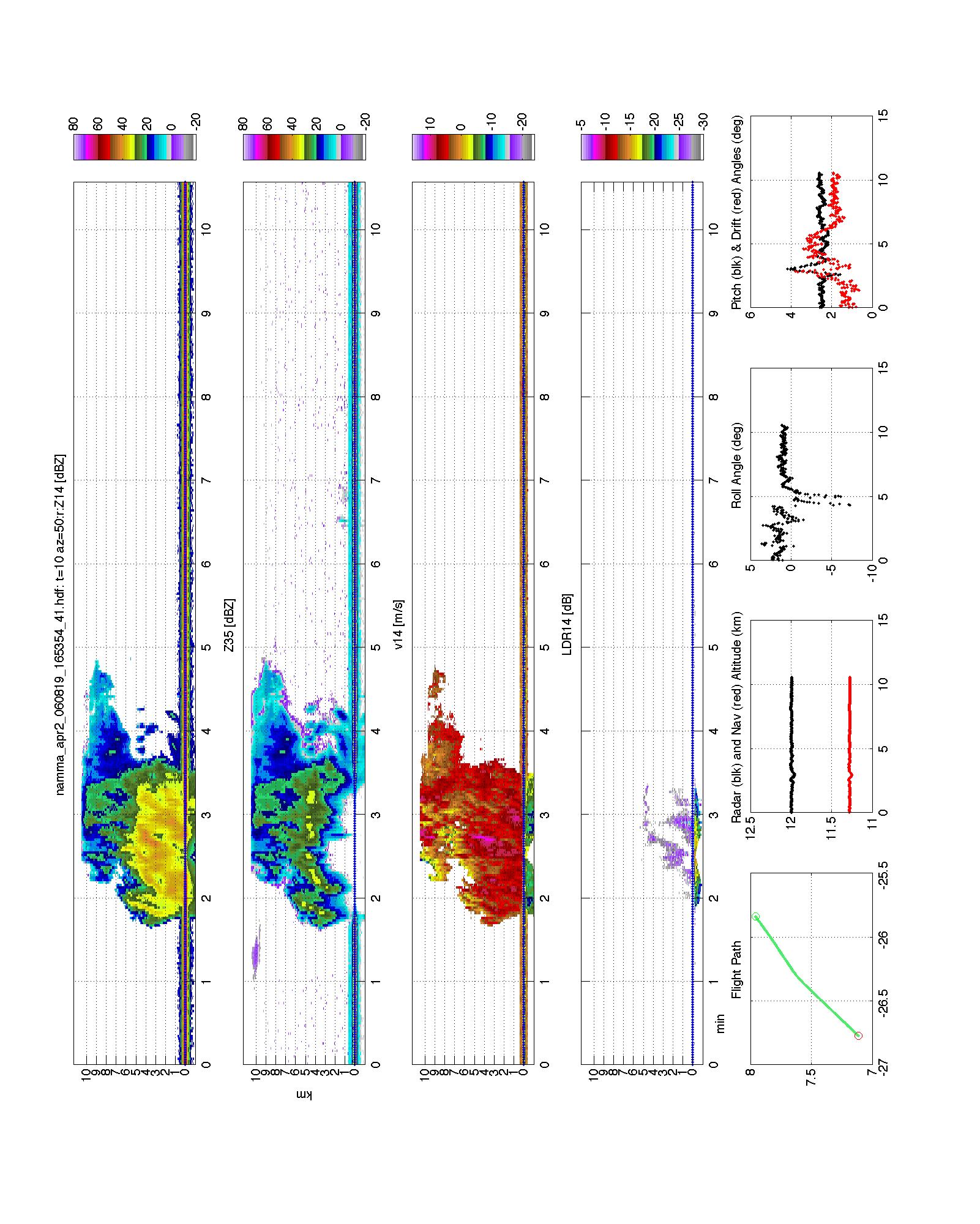
NAMMA SECOND GENERATION AIRBORNE PRECIPITATION RADAR (APR-2) V1
The NAMMA Second Generation Airborne Precipitation Radar (APR-2) dataset was collected by using the Second Generation Airborne Precipitation Radar (APR-2), which is a dual-... -
GPM Ground Validation Surface Meteorological Station C3VP V1
The GPM Ground Validation Environment Canada (EC) Surface Meteorological Station C3VP dataset consists of meteorological data collected at the Environment Canada (EC) climate... -
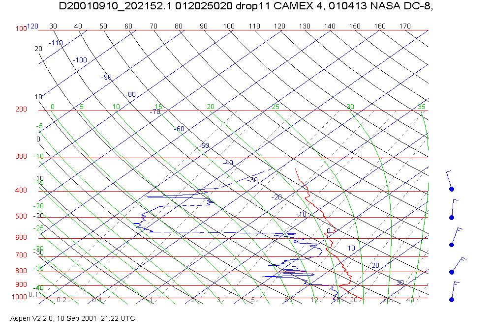
CAMEX-4 DC-8 DROPSONDE SYSTEM V1
The CAMEX-4 DC-8 Dropsonde System dataset was collected by the DC-8 Dropsonde System (D8D) uses dropwindsonde and Global Positioning System (GPS) receivers to measure the... -
GRIP LANGLEY AEROSOL RESEARCH GROUP EXPERIMENT (LARGE) V1
The GRIP Langley Aerosol Research Group Experiment (LARGE) dataset was collected by the Langley Aerosol Research Group Experiment (LARGE), which measures ultrafine aerosol... -
Water Isotope System for Precipitation and Entrainment Research (WISPER) IMPACTS V1
The Water Isotope System for Precipitation and Entrainment Research (WISPER) IMPACTS dataset consists of condensed water contents, water vapor measurements, and isotope ratios... -
Advanced Microwave Precipitation Radiometer (AMPR) IMPACTS V1
The Advanced Microwave Precipitation Radiometer (AMPR) IMPACTS dataset consists of brightness temperature measurements collected by the Advanced Microwave Precipitation... -
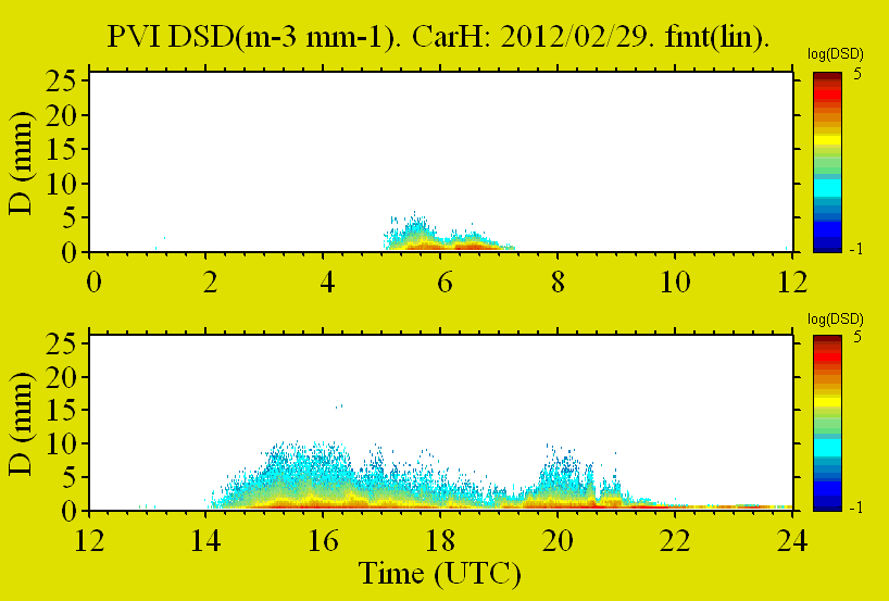
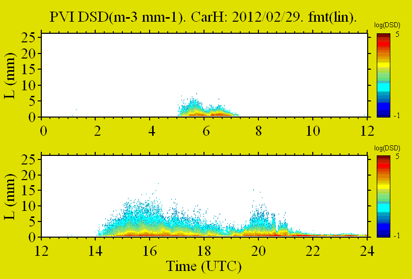
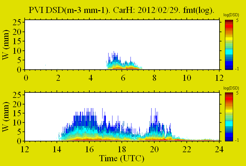
GPM GROUND VALIDATION PRECIPITATION VIDEO IMAGER (PVI) GCPEX V1
The GPM Ground Validation Precipitation Video Imager (PVI) GCPEx dataset collected precipitation particle images and drop size distribution data from November 2011 through March... -
GOES-R Geostationary Lightning Mapper (GLM) Gridded Data Products V1
The GOES-R Geostationary Lightning Mapper (GLM) Gridded Data Products consist of full disk extent gridded lightning flash data collected by the Geostationary Lightning Mapper... -
GOES-R PLT Washington D.C. Lightning Mapping Array (LMA) V1
The GOES-R PLT Washington D.C. Lightning Mapping Array (LMA) dataset consists of total lightning data measured from the Washington D.C. LMA (DCLMA) network during the GOES-R... -
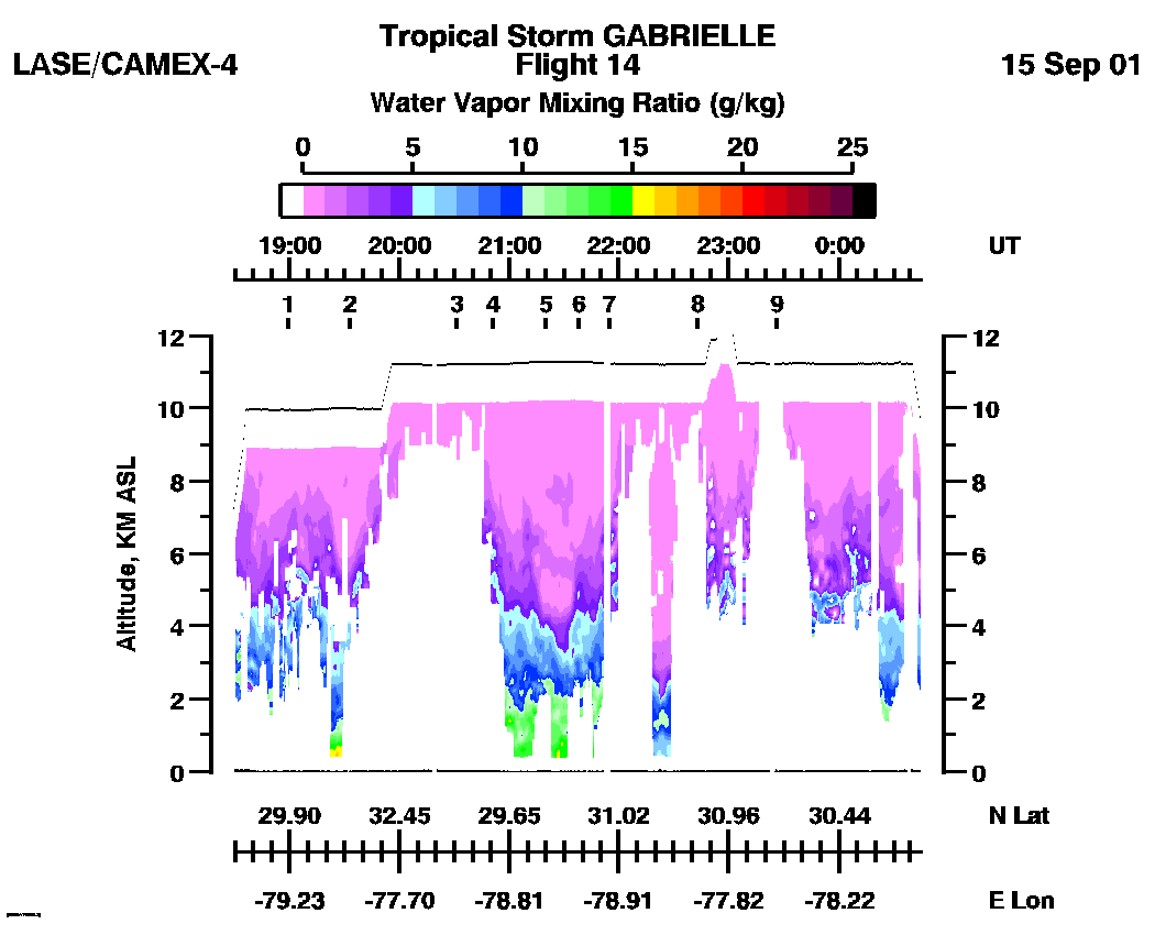
CAMEX-4 LIDAR ATMOSPHERIC SENSING EXPERIMENT (LASE) V1
The CAMEX-4 LIDAR Atmospheric Sensing Experiment (LASE) dataset was collected by the LASE instrument, which is an airborne DIAL (Differential Absorption Lidar) system used to... -
North Alabama Lightning Mapping Array (LMA) Raw Data V1
The North Alabama Lightning Mapping Array (LMA) Raw Data are used to validate the Lightning Imaging Sensor (LIS) on the International Space Station (ISS), the Geostationary...

Official websites use .gov
A
.gov website belongs to an official government
organization in the United States.
Secure .gov websites use HTTPS
A
lock (
) or https:// means you’ve safely connected to
the .gov website. Share sensitive information only on official,
secure websites.