
-
Gridded Population of the World, Version 4 (GPWv4): Land and Water Area, Revision 11
The Gridded Population of the World, Version 4 (GPWv4): Land and Water Area, Revision 11 consists of two rasters that measure surface areas of land and water in square... -
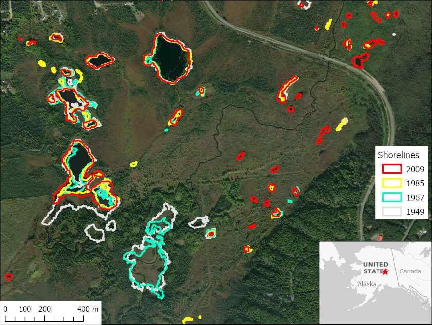
ABoVE: Historical Lake Shorelines and Areas near Fairbanks, Alaska from 1949-2009
This dataset includes maps of historical lake shorelines with derived lake areas in the southern portion of the Goldstream Valley and the surrounding landscape north of... -
ECCO Ocean and Sea-Ice Surface Freshwater Fluxes - Daily Mean 0.5 Degree (Version 4 Release 4)
This dataset contains daily-averaged ocean and sea-ice surface freshwater fluxes interpolated to a regular 0.5-degree grid from the ECCO Version 4 revision 4 (V4r4) ocean and... -
SPURS-1 research vessel Underway-CTD trajectory profile data for N. Atlantic Endeavor and Knorr cruises
The SPURS (Salinity Processes in the Upper Ocean Regional Study) project is an oceanographic process study and associated field program that aim to elucidate key mechanisms... -
West Africa Coastal Vulnerability Mapping: Subset of Global Mammal and Amphibian Richness Grids, 2015 Release
The West Africa Coastal Vulnerability Mapping: Subset of Global Mammal and Amphibian Richness Grids, 2015 Release was extracted from the NASA Socioeconomic Data and Applications... -
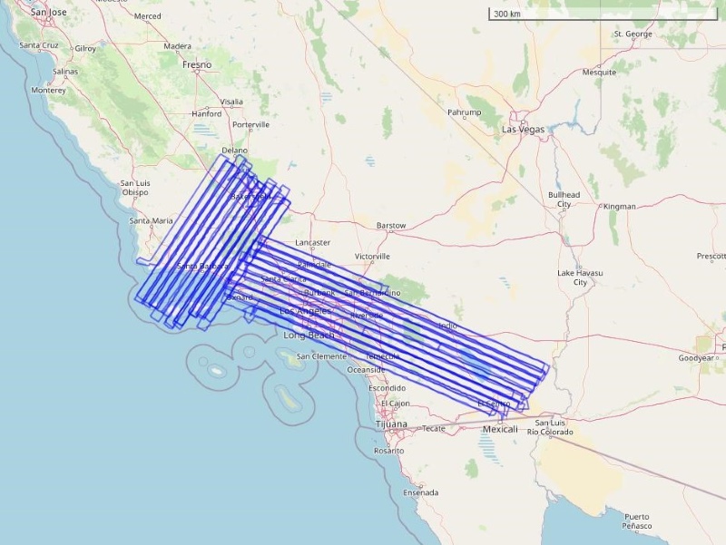
COMEX: AVIRIS-Classic Facility Instrument Associated Flights and Information, 2014
This dataset lists flight lines and provides data access links and contextual flight information for a subset of the AVIRIS-Classic Facility Instrument Collection that are... -
ECCO Atmosphere Surface Temperature, Humidity, Wind, and Pressure - Monthly Mean 0.5 Degree (Version 4 Release 4)
This dataset contains monthly-averaged atmosphere surface temperature, humidity, wind, and pressure interpolated to a regular 0.5-degree grid from the ECCO Version 4 revision 4... -
GHRSST Level 2P Western Atlantic Regional Skin Sea Surface Temperature from the Geostationary Operational Environmental Satellites (GOES) Imager on the GOES-13 satellite (GDS version 2)
The Geostationary Operational Environmental Satellites (GOES) operated by the United States National Oceanic and Atmospheric Administration (NOAA) support weather forecasting,... -
CMS: LiDAR Data for Forested Areas in Paragominas, Para, Brazil, 2012-2014
This data set provides raw LiDAR point cloud data and derived Digital Terrain Models (DTMs) for five forested areas in the municipality of Paragominas, Para, Brazil, for the... -
GHRSST Level 4 OSTIA Global Historical Reprocessed Foundation Sea Surface Temperature Analysis produced by the UK Meteorological Office
A Group for High Resolution Sea Surface Temperature (GHRSST) Level 4 historical reprocessed SST product containing daily gap-free maps of foundation SST and ice concentration on... -
MuSLI Multi-Source Land Surface Phenology Yearly North America 30 m V011
The Multi-Source Land Surface Phenology (LSP) Yearly North America 30 meter (m) Version 1.1 product (MSLSP) provides a Land Surface Phenology product for North America derived... -
IPCC IS92 Emissions Scenarios (A, B, C, D, E, F) Dataset Version 1.1
The Intergovernmental Panel on Climate Change (IPCC) IS92 Emissions Scenarios (A, B, C, D, E, F) Dataset Version 1.1 consists of six global and regional greenhouse gases (GHGs)... -
Aquarius CAP Level 3 Sea Surface Salinity Standard Mapped Image Monthly Data V5.0
Version 5.0 Aquarius CAP Level 3 products are the fourth release of the AQUARIUS/SAC-D mapped salinity and wind speed data based on the Combined Active Passive (CAP) algorithm.... -
SWOT Simulated Level-2 KaRIn SSH from MITgcm ECCO LLC4320 for Cal/Val Version 1
This dataset provides simulated sea surface height (SSH) in a format similar to the future SWOT Level 2 (L2) SSH data from KaRIn. The simulated data were generated by the "ECCO... -
Aquarius Official Release Level 3 Sea Surface Spiciness Standard Mapped Image Mission Cumulative Data V5.0
Aquarius Level 3 sea surface spiciness standard mapped image data contains gridded 1 degree spatial resolution spice data averaged over daily, 7 day, monthly, and seasonal time... -
GHRSST NOAA/STAR ACSPO v2.80 0.02 degree L3S Dataset from mid-Morning LEO Satellites (GDS v2)
NOAA STAR produces two lines of gridded 0.02 degree super-collated L3S LEO sub-skin Sea Surface Temperature (SST) datasets, one from the NOAA afternoon JPSS (L3S_LEO_PM)... -
MODIS Aqua Level 3 SST MID-IR Daily 4km Nighttime V2019.0 NGDA
Day and night spatially gridded (L3) global NASA skin sea surface temperature (SST) products from the Moderate-resolution Imaging Spectroradiometer (MODIS) onboard the Aqua...

Official websites use .gov
A
.gov website belongs to an official government
organization in the United States.
Secure .gov websites use HTTPS
A
lock (
) or https:// means you’ve safely connected to
the .gov website. Share sensitive information only on official,
secure websites.