
-
MLS/Aura Near-Real-Time L2 Nitric Acid (HNO3) Mixing Ratio V005 (ML2HNO3_NRT) at GES DISC
ML2HNO3_NRT is the EOS Aura Microwave Limb Sounder (MLS) Near-Real-Time (NRT) product for nitric acid (HNO3). This product contains HNO3 profiles derived from the 190 and 240... -
MetOp-B ASCAT Scatterometer Inter-Calibrated ESDR Level 2 Ocean Surface Equivalent Neutral Wind Vectors and Wind Stress Vectors Version 1.1
This dataset contains ocean surface wind vectors (equivalent neutral and true 10m) and wind stress vectors derived from satellite-based scatterometer observations (the MetOp-B... -
Aquarius Official Release Level 3 Wind Speed Standard Mapped Image Ascending Monthly Climatology Data V5.0
Aquarius Level 3 ocean surface wind speed standard mapped image data contains gridded 1 degree spatial resolution wind speed data averaged over daily, 7 day, monthly, and... -
GRACE NON-TIDAL ATMOSPHERE AND OCEAN GEOPOTENTIAL COEFFICIENTS CSR RELEASE 6.0 GAC
FOR EXPERT USE ONLY. This dataset contains estimates of geopotential field derived from the Gravity Recovery and Climate Experiment (GRACE) mission measurements and a non-tidal... -
MetOp-B ASCAT Level 2 25.0km Ocean Surface Wind Vectors in Full Orbit Swath
This dataset contains operational near-real-time Level 2 ocean surface wind vector retrievals from the Advanced Scatterometer (ASCAT) on MetOp-B at 25 km sampling resolution... -
OCO-2 Level 2 meteorological parameters interpolated from global assimilation model for each sounding V11.2 (OCO2_L2_Met) at GES DISC
Version 11.2 is the current version of the data set. Older versions will no longer be available and are superseded by Version 11.2. The Orbiting Carbon Observatory is the first... -
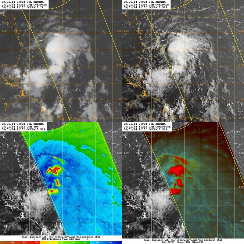
Hurricane and Severe Storm Sentinel (HS3) Naval Research Laboratory (NRL) Tropics Satellite Data V1
The Hurricane and Severe Storm Sentinel (HS3) Naval Research Laboratory (NRL) Tropics Satellite Data contains browse only data files, including brightness temperature, rain... -
ECCO Gent-McWilliams Ocean Bolus Velocity - Monthly Mean 0.5 Degree (Version 4 Release 4)
This dataset contains monthly-averaged Gent-McWilliams ocean bolus velocity interpolated to a regular 0.5-degree grid from the ECCO Version 4 revision 4 (V4r4) ocean and sea-ice... -
Waveglider data for the SPURS-1 N. Atlantic field campaign
The SPURS (Salinity Processes in the Upper Ocean Regional Study) project is an oceanographic process study and associated field program that aim to elucidate key mechanisms... -
ATom: Sulfur Dioxide by Laser Induced Fluorescence (LIF-SO2) for ATom-4 Campaign
This dataset provides concentrations of sulfur dioxide (SO2) measured by the Laser Induced Fluorescence Instrumentation for Sulfur Dioxide (SO2-LIF) on the ATom-4 campaign in... -
Aquarius Official Release Level 3 Rain-flagged Sea Surface Salinity Standard Mapped Image Descending 28-Day Running Mean Data V5.0
Aquarius Level 3 sea surface salinity (SSS) rain-flagged standard mapped image data contains gridded 1 degree spatial resolution SSS averaged over daily, 7 day, monthly, and... -
SPURS-2 shipboard X-band radar backscatter data for the E. Tropical Pacific field campaign
The SPURS (Salinity Processes in the Upper Ocean Regional Study) project is a NASA-funded oceanographic process study and associated field program that aim to elucidate key... -
OCO-2 Level 1B calibrated, geolocated science spectra, Retrospective Processing V11r (OCO2_L1B_Science) at GES DISC
Version 11r is the current version of the data set. Older versions will no longer be available and are superseded by Version 11r. The Orbiting Carbon Observatory is the first... -
OCO-3 Level 2 meteorological parameters interpolated from global assimilation model for each sounding, Forward Processing V11 (OCO3_L2_Met) at GES DISC
Version 11 is the current version of the data set. Older versions will no longer be available and are superseded by Version 11. The Orbiting Carbon Observatory -3 (OCO-3) was... -
SPURS-2 research vessel Underway Salinity Profiling System (USPS) data for the E. Tropical Pacific R/V Revelle cruises
The SPURS (Salinity Processes in the Upper Ocean Regional Study) project is a NASA-funded oceanographic process study and associated field program that aim to elucidate key... -
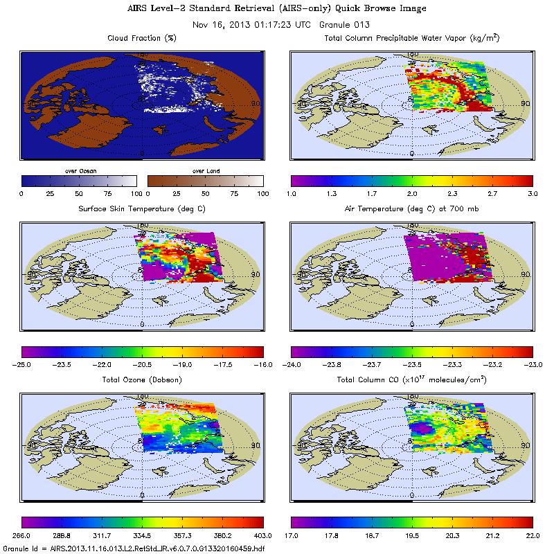
AIRS/Aqua L2 Near Real Time (NRT) Standard Physical Retrieval (AIRS-only) V006 (AIRS2RET_NRT) at GES DISC
The Atmospheric Infrared Sounder (AIRS) Level 2 Near Real Time (NRT) Standard Physical Retrieval (AIRS-only) product (AIRS2RET_NRT_006) differs from the routine product... -
MODIS Terra Level 3 SST Thermal IR 8 Day 4km Daytime V2019.0 NGDA
Day and night spatially gridded (L3) global NASA skin sea surface temperature (SST) products from the Moderate-resolution Imaging Spectroradiometer (MODIS) onboard the Terra... -
RSS SMAP Level 3 Sea Surface Salinity Standard Mapped Image 8-Day Running Mean V5.0 Validated Dataset
The version 5.0 SMAP-SSS level 3, 8-Day running mean gridded product is based on the fifth release of the validated standard mapped sea surface salinity (SSS) data from the NASA...

Official websites use .gov
A
.gov website belongs to an official government
organization in the United States.
Secure .gov websites use HTTPS
A
lock (
) or https:// means you’ve safely connected to
the .gov website. Share sensitive information only on official,
secure websites.