

TRMM Precipitation Radar Spectral Latent Heating L3 1 month 0.5 degree x 0.5 degree V7 (TRMM_3H25) at GES DISC
Access & Use Information
Downloads & Resources
-
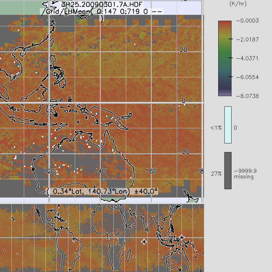
Get a related visualizationPNG
TRMM_3H25_7.png
-
This dataset's landing pageHTML
Access the dataset landing page from the GES DISC website.
-
Download this dataset through a directory mapHTML
Access the data via HTTPS
-
Get a related visualization through GIOVANNIHTML
The GES-DISC Interactive Online Visualization ANd aNalysis Interface...
-
Use OPeNDAP to access the dataset's dataHTML
Access the data via the OPeNDAP protocol.
-
Download this dataset through Earthdata SearchHTML
Use the Earthdata Search to find and retrieve data sets across multiple data...
-
The dataset's project home pageHTML
TRMM Project Home Page
-
View documentation related to this datasetPDF
File specification document.
-
View documentation related to this datasetPDF
Comparison between TRMM versions 6 and 7.
-
View this dataset's read me documentPDF
README Document
-
View documentation related to this datasetPDF
Details of the caveats to consider in this product.
-
View documentation related to this datasetPDF
Details of the caveats to consider in this product.
-
View documentation related to this datasetHTML
TRMM Data Gaps
-
Landing PageLanding Page
References
| https://doi.org/10.1175/AMSMONOGRAPHS-D-15-0013.1 |
Dates
| Metadata Created Date | February 23, 2025 |
|---|---|
| Metadata Updated Date | February 23, 2025 |
Metadata Source
- Data.json Data.json Metadata
Harvested from nasa test json
Additional Metadata
| Resource Type | Dataset |
|---|---|
| Metadata Created Date | February 23, 2025 |
| Metadata Updated Date | February 23, 2025 |
| Publisher | NASA/GSFC/SED/ESD/GCDC/GESDISC |
| Maintainer | |
| Identifier | C1282032633-GES_DISC |
| Data First Published | 2011-07-01 |
| Language | en-US |
| Data Last Modified | 2025-02-19 |
| Category | TRMM, geospatial |
| Public Access Level | public |
| Bureau Code | 026:00 |
| Metadata Context | https://project-open-data.cio.gov/v1.1/schema/catalog.jsonld |
| Schema Version | https://project-open-data.cio.gov/v1.1/schema |
| Catalog Describedby | https://project-open-data.cio.gov/v1.1/schema/catalog.json |
| Harvest Object Id | d8b69d6a-250d-43f2-8e45-a2a22416a699 |
| Harvest Source Id | a73e0c30-4684-40ef-908e-d22e9e9e5f86 |
| Harvest Source Title | nasa test json |
| Homepage URL | https://cmr.earthdata.nasa.gov:443/search/concepts/C1282032633-GES_DISC.html |
| Metadata Type | geospatial |
| Old Spatial | -180.0 -37.0 180.0 37.0 |
| Program Code | 026:001 |
| Related Documents | https://doi.org/10.1175/AMSMONOGRAPHS-D-15-0013.1 |
| Source Datajson Identifier | True |
| Source Hash | 896eee3f0184e4ee71cb86d75128cf639b7becd455b0e7a0b10eb3ec4270f4c1 |
| Source Schema Version | 1.1 |
| Spatial | |
| Temporal | 1998-01-01T00:00:00Z/2015-04-01T23:59:59.999Z |
Didn't find what you're looking for? Suggest a dataset here.