

RapidScat Level 2B Ocean Wind Vectors in 12.5km Slice Composites Version 1.1
Access & Use Information
Downloads & Resources
-
Google Scholar search resultsHTML
Search results for publications that cite this dataset by its DOI.
-
View documentation related to this datasetHTML
Access to Climate quality L2B data record.
-
View this dataset's documented anomaliesCSV
ASCII CSV orbital revolution time tables with quality assurance information.
-
View this dataset's user's guidePDF
User Guide
-
View documentation related to this datasetHTML
Website providing more detailed information about the ISS-RapidScat Mission.
-
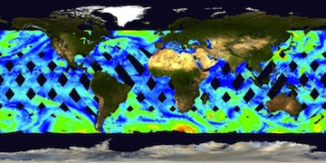
Get a related visualizationJPEG
Thumbnail
-
View documentation related to this datasetHTML
Detailed background information on the ISS-RapidScat mission published by the...
-
View documentation related to this datasetPDF
Summary of Facts on the ISS-RapidScat Mission
-
View this dataset's documented anomaliesHTML
Text file containing reverse chronological list of future scheduled outages...
-
View this dataset's read me documentHTML
README file
-
View this dataset's data citation policyHTML
Data Use and Citation Policy
-
Download this dataset through a directory mapHTML
HTTPS endpoint for data browse and download
-
Download this dataset through Earthdata SearchHTML
Browse granule search results in Earthdata Search
-
Landing PageLanding Page
Dates
| Metadata Created Date | February 23, 2025 |
|---|---|
| Metadata Updated Date | February 23, 2025 |
Metadata Source
- Data.json Data.json Metadata
Harvested from nasa test json
Additional Metadata
| Resource Type | Dataset |
|---|---|
| Metadata Created Date | February 23, 2025 |
| Metadata Updated Date | February 23, 2025 |
| Publisher | NASA/JPL/PODAAC |
| Maintainer | |
| Identifier | C2526576283-POCLOUD |
| Data First Published | 2015-04-15 |
| Language | en-US |
| Data Last Modified | 2025-02-19 |
| Category | ISS_RapidScat, geospatial |
| Public Access Level | public |
| Bureau Code | 026:00 |
| Metadata Context | https://project-open-data.cio.gov/v1.1/schema/catalog.jsonld |
| Schema Version | https://project-open-data.cio.gov/v1.1/schema |
| Catalog Describedby | https://project-open-data.cio.gov/v1.1/schema/catalog.json |
| Harvest Object Id | 38289f38-a1da-4b5d-868f-daab626909fb |
| Harvest Source Id | a73e0c30-4684-40ef-908e-d22e9e9e5f86 |
| Harvest Source Title | nasa test json |
| Homepage URL | https://doi.org/10.5067/RSX12-L2B11 |
| Metadata Type | geospatial |
| Old Spatial | -180.0 -61.0 180.0 61.0 |
| Program Code | 026:001 |
| Source Datajson Identifier | True |
| Source Hash | 5fe3df2889d51bf72009cbffb934ea5d2db9b1efce14dd874d1a45cf6dbfacfe |
| Source Schema Version | 1.1 |
| Spatial | |
| Temporal | 2014-10-03T19:28:21Z/2016-03-10T15:10:44Z |
Didn't find what you're looking for? Suggest a dataset here.