

NAMMA PRAIA CAPE VERDE RADIOSONDE V1
Access & Use Information
Downloads & Resources
-
Google Scholar search resultsHTML
Search results for publications that cite this dataset by its DOI.
-
Download this datasetHTML
Files may be downloaded directly to your workstation from this link
-
Get a related visualizationGIF
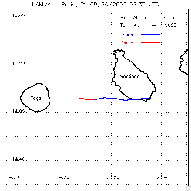
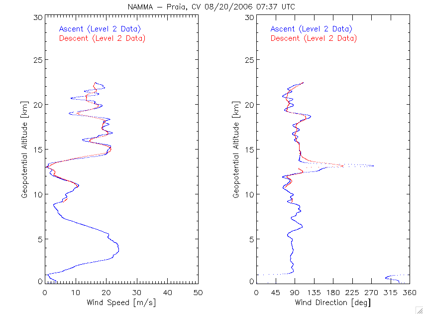
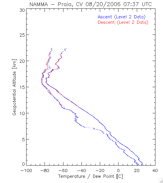
Sample browse image
-
Get a related visualizationGIF
Sample browse image
-
Get a related visualizationGIF
Sample browse image
-
Get a related visualizationGIF
Sample browse image
-
View documentation related to this datasetHTML
The guide document contains detailed information about the dataset
-
View the primary investigator's documentation...HTML
NAMMA praia radiosonde data ascent 07/28/2006
-
View the primary investigator's documentation...PDF
Praia, Cape Verde Radiosonde Data Description
-
View the primary investigator's documentation...HTML
NAMMA PRAIA RADIOSONDE FlightLog
-
View the primary investigator's documentation...PDF
NAMMA praia radiosonde data products
-
View the primary investigator's documentation...PDF
NAMMA-Praia, Cape Verde Radiosonde Description
-
View the primary investigator's documentation...HTML
NAMMA praia radiosonde data descent 07/28/2006
-
The dataset's project home pageHTML
The home page for the project or program which sponsored the dataset
-
Get a related visualizationHTML
N/A
-
View documentation related to this datasetHTML
Instructions for citing GHRC data
-
Landing PageLanding Page
Dates
| Metadata Created Date | February 22, 2025 |
|---|---|
| Metadata Updated Date | February 22, 2025 |
Metadata Source
- Data.json Data.json Metadata
Harvested from nasa test json
Additional Metadata
| Resource Type | Dataset |
|---|---|
| Metadata Created Date | February 22, 2025 |
| Metadata Updated Date | February 22, 2025 |
| Publisher | NASA/MSFC/GHRC |
| Maintainer | |
| Identifier | C1979887749-GHRC_DAAC |
| Data First Published | 2006-06-01 |
| Language | en-US |
| Data Last Modified | 2025-02-19 |
| Category | NAMMA, geospatial |
| Public Access Level | public |
| Bureau Code | 026:00 |
| Metadata Context | https://project-open-data.cio.gov/v1.1/schema/catalog.jsonld |
| Schema Version | https://project-open-data.cio.gov/v1.1/schema |
| Catalog Describedby | https://project-open-data.cio.gov/v1.1/schema/catalog.json |
| Harvest Object Id | c169c5a4-4711-4081-bb18-2b14ce576727 |
| Harvest Source Id | a73e0c30-4684-40ef-908e-d22e9e9e5f86 |
| Harvest Source Title | nasa test json |
| Homepage URL | https://doi.org/10.5067/NAMMA/RADIOSONDE/DATA201 |
| Metadata Type | geospatial |
| Old Spatial | -24.5327 14.6689 -23.4742 15.2707 |
| Program Code | 026:001 |
| Source Datajson Identifier | True |
| Source Hash | d1600a6348fa9930acaffb5a8bfcaf527dcdd58ebf2885f3b51bc4d02f059625 |
| Source Schema Version | 1.1 |
| Spatial | |
| Temporal | 2006-08-18T17:07:39Z/2006-09-14T13:24:56Z |
Didn't find what you're looking for? Suggest a dataset here.