

NACP NAFD Project: Forest Disturbance History from Landsat, 1986-2010
Access & Use Information
Public: This dataset is intended for public access and use.
Non-Federal: This dataset is covered by different Terms of Use than Data.gov.
License: No license information was provided.
Downloads & Resources
-
Google Scholar search resultsHTML
Search results for publications that cite this dataset by its DOI.
-
Download this datasetHTML
This link allows direct data access via Earthdata login
-
View documentation related to this datasetHTML
ORNL DAAC Data Set Documentation
-
This dataset's landing pageHTML
Data set Landing Page DOI URL
-
View documentation related to this datasetPNG
Data Set Documentation
-
View documentation related to this datasetPDF
Data Set Documentation
-
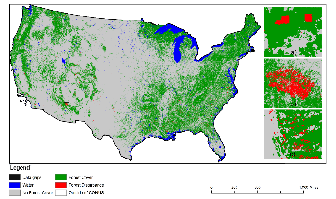
Get a related visualizationPNG
Browse Image
-
Use Web Coverage Service (WCS) to download the...HTML
Web Coverage Service for this collection.
-
Landing PageLanding Page
Dates
| Metadata Created Date | February 22, 2025 |
|---|---|
| Metadata Updated Date | February 22, 2025 |
Metadata Source
- Data.json Data.json Metadata
Harvested from nasa test json
Additional Metadata
| Resource Type | Dataset |
|---|---|
| Metadata Created Date | February 22, 2025 |
| Metadata Updated Date | February 22, 2025 |
| Publisher | ORNL_DAAC |
| Maintainer | |
| Identifier | C2539891727-ORNL_CLOUD |
| Data First Published | 2016-03-03 |
| Language | en-US |
| Data Last Modified | 2025-02-19 |
| Category | NACP, geospatial |
| Public Access Level | public |
| Bureau Code | 026:00 |
| Metadata Context | https://project-open-data.cio.gov/v1.1/schema/catalog.jsonld |
| Schema Version | https://project-open-data.cio.gov/v1.1/schema |
| Catalog Describedby | https://project-open-data.cio.gov/v1.1/schema/catalog.json |
| Harvest Object Id | 83ad1453-a9ef-4438-aaa7-5ff6c7326908 |
| Harvest Source Id | a73e0c30-4684-40ef-908e-d22e9e9e5f86 |
| Harvest Source Title | nasa test json |
| Homepage URL | https://doi.org/10.3334/ORNLDAAC/1290 |
| Metadata Type | geospatial |
| Old Spatial | -128.03 22.69 -65.2 51.68 |
| Program Code | 026:001 |
| Source Datajson Identifier | True |
| Source Hash | d3b4d145eb4d66a5b9f740bfc1f5927ade1e87ce71123c774e8863223b37fdde |
| Source Schema Version | 1.1 |
| Spatial | |
| Temporal | 1986-01-01T00:00:00Z/2010-12-31T23:59:59Z |
Didn't find what you're looking for? Suggest a dataset here.