

Maps of Vegetation Types and Physiographic Features, Kuparuk River Basin, Alaska
Access & Use Information
Downloads & Resources
-
Google Scholar search resultsHTML
Search results for publications that cite this dataset by its DOI.
-
Download this datasetHTML
This link allows direct data access via Earthdata login
-
View documentation related to this datasetHTML
ORNL DAAC Data Set Documentation
-
This dataset's landing pageHTML
Data set Landing Page DOI URL
-
View documentation related to this datasetKML
kuparuk_basin_elevation.kmz
-
View documentation related to this datasetKML
kuparuk_basin_hydrology.kmz
-
View documentation related to this datasetKML
kuparuk_basin_landscape.kmz
-
View documentation related to this datasetPDF
Kuparuk_Veg_Maps.pdf
-
View documentation related to this datasetKML
upper_kuparuk_geobotanical.kmz
-
View documentation related to this datasetKML
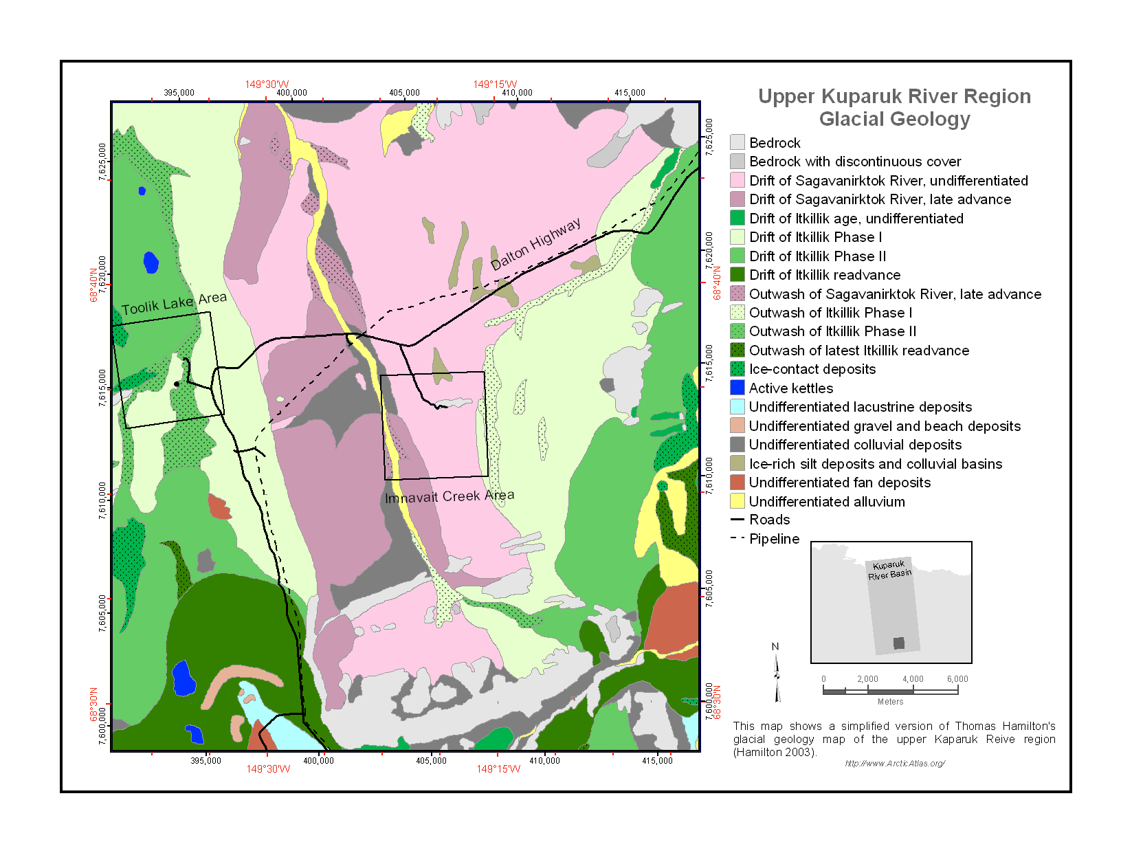
upper_kuparuk_glacialgeol.kmz
-
View documentation related to this datasetKML
upper_kuparuk_hydrology.kmz
-
Get a related visualizationPNG
Browse Image
-
The dataset's project home pageHTML
ABoVE project site
-
Use Web Coverage Service (WCS) to download the...HTML
Web Coverage Service for this collection.
-
Landing PageLanding Page
Dates
| Metadata Created Date | February 22, 2025 |
|---|---|
| Metadata Updated Date | February 22, 2025 |
Metadata Source
- Data.json Data.json Metadata
Harvested from nasa test json
Additional Metadata
| Resource Type | Dataset |
|---|---|
| Metadata Created Date | February 22, 2025 |
| Metadata Updated Date | February 22, 2025 |
| Publisher | ORNL_DAAC |
| Maintainer | |
| Identifier | C2170969950-ORNL_CLOUD |
| Data First Published | 2018-12-31 |
| Language | en-US |
| Data Last Modified | 2025-02-19 |
| Category | ABoVE, geospatial |
| Public Access Level | public |
| Bureau Code | 026:00 |
| Metadata Context | https://project-open-data.cio.gov/v1.1/schema/catalog.jsonld |
| Schema Version | https://project-open-data.cio.gov/v1.1/schema |
| Catalog Describedby | https://project-open-data.cio.gov/v1.1/schema/catalog.json |
| Harvest Object Id | 39293b82-52e2-41a0-ba25-131971a63269 |
| Harvest Source Id | a73e0c30-4684-40ef-908e-d22e9e9e5f86 |
| Harvest Source Title | nasa test json |
| Homepage URL | https://doi.org/10.3334/ORNLDAAC/1378 |
| Metadata Type | geospatial |
| Old Spatial | -151.2 68.29 -148.09 70.54 |
| Program Code | 026:001 |
| Source Datajson Identifier | True |
| Source Hash | 04b7286cd7c2bea6764755e0fca7d489b6b934d41967442d49a29df75e1a0302 |
| Source Schema Version | 1.1 |
| Spatial | |
| Temporal | 1976-08-04T00:00:00Z/2008-12-31T23:59:59Z |
Didn't find what you're looking for? Suggest a dataset here.