

Get a related visualization
URL: https://daac.ornl.gov/VEGETATION/guides/Forested_Areas_Para_Brazil_Fig1.png
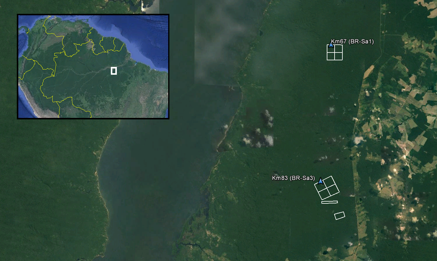
Footprints from each of the surveyed areas within Tapajos National Forest in Para, Brazil are included in TAP_A_footprints.shp. The Km67 and Km83 eddy flux towers (AmeriFlux Sites BR-Sa1 and BR-Sa3) are within the surveyed areas.
Source: LiDAR and DTM Data from Tapajos National Forest in Para, Brazil, 2008
About this Resource
| Last updated | unknown |
|---|---|
| Created | unknown |
| Name | Get a related visualization |
| Format | PNG Image File |
| License | License not specified |
| Created | 3 months ago |
| Media type | image/png |
| has views | True |
| id | c2641cb3-5087-4a2e-8013-3fe381757778 |
| metadata modified | 3 months ago |
| package id | 60d239a5-94ab-40e6-862e-c1ee75e906f5 |
| position | 6 |
| state | active |
| tracking summary | {'total': 0, 'recent': 0} |