

Last of the Wild Project, Version 3 (LWP-3): 1993 Human Footprint, 2018 Release
Access & Use Information
Public: This dataset is intended for public access and use.
Non-Federal: This dataset is covered by different Terms of Use than Data.gov.
License: No license information was provided.
Downloads & Resources
-
Google Scholar search resultsHTML
Search results for publications that cite this dataset by its DOI.
-
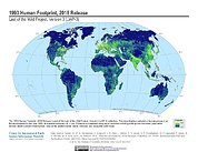
Get a related visualizationJPEG
Sample browse graphic of the data set.
-
Download this datasetHTML
Data Download Page
-
Get a related map visualizationHTML
Maps Download Page
-
View documentation related to this datasetHTML
Documentation Page
-
Use Web Map Service (WMS) to download the...HTML
Web Map Service Page
-
View documentation related to this datasetHTML
Data Set Overview Page
-
Landing PageLanding Page
References
| https://doi.org/10.7927/H46T0JQ4 |
Dates
| Metadata Created Date | February 21, 2025 |
|---|---|
| Metadata Updated Date | February 21, 2025 |
Metadata Source
- Data.json Data.json Metadata
Harvested from nasa test json
Additional Metadata
| Resource Type | Dataset |
|---|---|
| Metadata Created Date | February 21, 2025 |
| Metadata Updated Date | February 21, 2025 |
| Publisher | SEDAC |
| Maintainer | |
| Identifier | C1607144563-SEDAC |
| Data First Published | 2018-08-10 |
| Language | en-US |
| Data Last Modified | 2025-02-19 |
| Category | LWP, geospatial |
| Public Access Level | public |
| Bureau Code | 026:00 |
| Metadata Context | https://project-open-data.cio.gov/v1.1/schema/catalog.jsonld |
| Schema Version | https://project-open-data.cio.gov/v1.1/schema |
| Catalog Describedby | https://project-open-data.cio.gov/v1.1/schema/catalog.json |
| Harvest Object Id | e10acae1-9df6-44a6-ad5f-7689607c92ac |
| Harvest Source Id | a73e0c30-4684-40ef-908e-d22e9e9e5f86 |
| Harvest Source Title | nasa test json |
| Homepage URL | https://doi.org/10.7927/H4H9938Z |
| Metadata Type | geospatial |
| Old Spatial | -180.0 -65.25 180.0 90.0 |
| Program Code | 026:001 |
| Related Documents | https://doi.org/10.7927/H46T0JQ4 |
| Source Datajson Identifier | True |
| Source Hash | 10e4f6d354cf26bf4ff9d5f61c0bca977f2285d9b09004f3fae0bc2366172ae6 |
| Source Schema Version | 1.1 |
| Spatial | |
| Temporal | 1993-01-01T00:00:00Z/1993-12-31T00:00:00Z |
Didn't find what you're looking for? Suggest a dataset here.