

L2 Daily Solar-Induced Fluorescence (SIF) from MetOp-A GOME-2, 2007-2018, V2
Access & Use Information
Public: This dataset is intended for public access and use.
Non-Federal: This dataset is covered by different Terms of Use than Data.gov.
License: No license information was provided.
Downloads & Resources
-
Google Scholar search resultsHTML
Search results for publications that cite this dataset by its DOI.
-
Download this datasetHTML
This link allows direct data access via Earthdata login
-
View documentation related to this datasetHTML
ORNL DAAC Data Set Documentation
-
This dataset's landing pageHTML
Data set Landing Page DOI URL
-
Use OPeNDAP to access the dataset's dataHTML
USE SERVICE API
-
View documentation related to this datasetPDF
L2 Daily Solar-Induced Fluorescence (SIF) from MetOp-A GOME-2, 2007-2018, V2:...
-
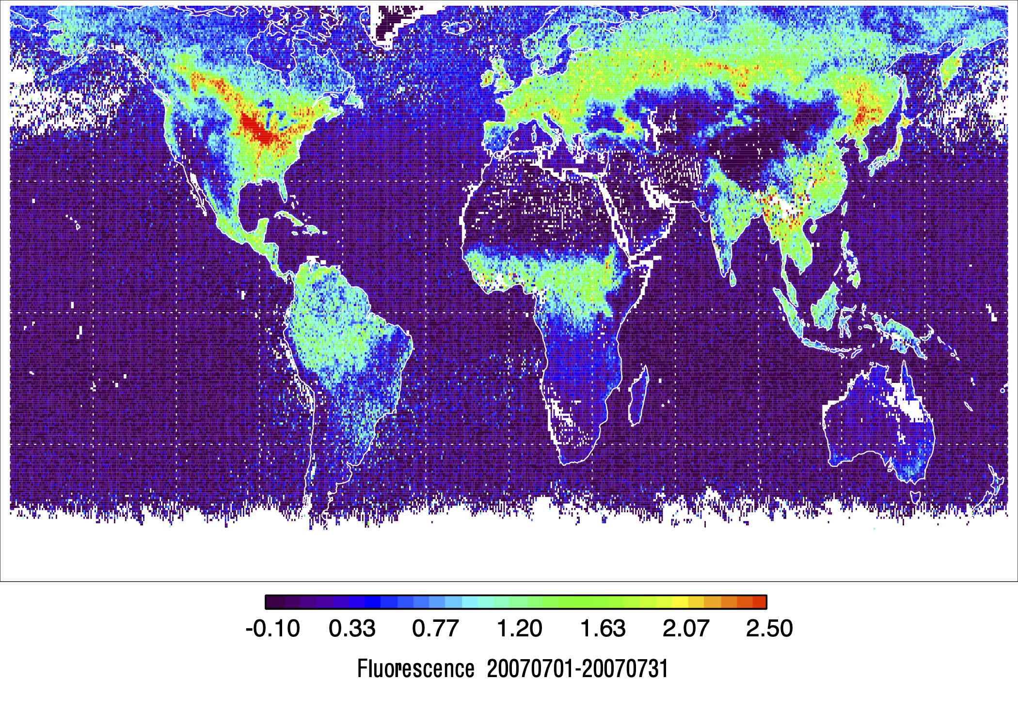
Get a related visualizationPNG
Monthly mean solar-induced fluorescence (SIF) values (mW m-2 nm-1 sr-1) at...
-
The dataset's project home pageHTML
Project site
-
Landing PageLanding Page
Dates
| Metadata Created Date | February 23, 2025 |
|---|---|
| Metadata Updated Date | February 23, 2025 |
Metadata Source
- Data.json Data.json Metadata
Harvested from nasa test json
Additional Metadata
| Resource Type | Dataset |
|---|---|
| Metadata Created Date | February 23, 2025 |
| Metadata Updated Date | February 23, 2025 |
| Publisher | ORNL_DAAC |
| Maintainer | |
| Identifier | C2847115945-ORNL_CLOUD |
| Data First Published | 2024-01-25 |
| Language | en-US |
| Data Last Modified | 2025-02-19 |
| Category | SIF-ESDR, geospatial |
| Public Access Level | public |
| Bureau Code | 026:00 |
| Metadata Context | https://project-open-data.cio.gov/v1.1/schema/catalog.jsonld |
| Schema Version | https://project-open-data.cio.gov/v1.1/schema |
| Catalog Describedby | https://project-open-data.cio.gov/v1.1/schema/catalog.json |
| Harvest Object Id | 5c7a21c8-6899-4e23-9b73-1465c3b856f5 |
| Harvest Source Id | a73e0c30-4684-40ef-908e-d22e9e9e5f86 |
| Harvest Source Title | nasa test json |
| Homepage URL | https://doi.org/10.3334/ORNLDAAC/2292 |
| Metadata Type | geospatial |
| Old Spatial | -180.0 -89.78 180.0 89.6 |
| Program Code | 026:001 |
| Source Datajson Identifier | True |
| Source Hash | 530d7953b18dfe21f724283f41a99f64ce2c3a893292193e2496e03a4720a8d8 |
| Source Schema Version | 1.1 |
| Spatial | |
| Temporal | 2007-02-01T00:29:17Z/2018-02-01T00:32:43Z |
Didn't find what you're looking for? Suggest a dataset here.