

GPM GROUND VALIDATION ADVANCED MICROWAVE PRECIPITATION RADIOMETER (AMPR) MC3E V1
Access & Use Information
Public: This dataset is intended for public access and use.
Non-Federal: This dataset is covered by different Terms of Use than Data.gov.
License: No license information was provided.
Downloads & Resources
-
Google Scholar search resultsHTML
Search results for publications that cite this dataset by its DOI.
-
Download this datasetHTML
Files may be downloaded directly to your workstation from this link
-
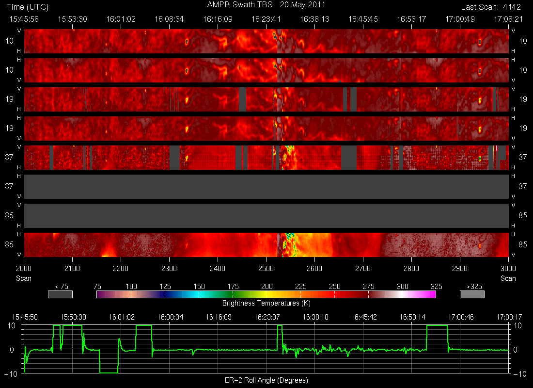
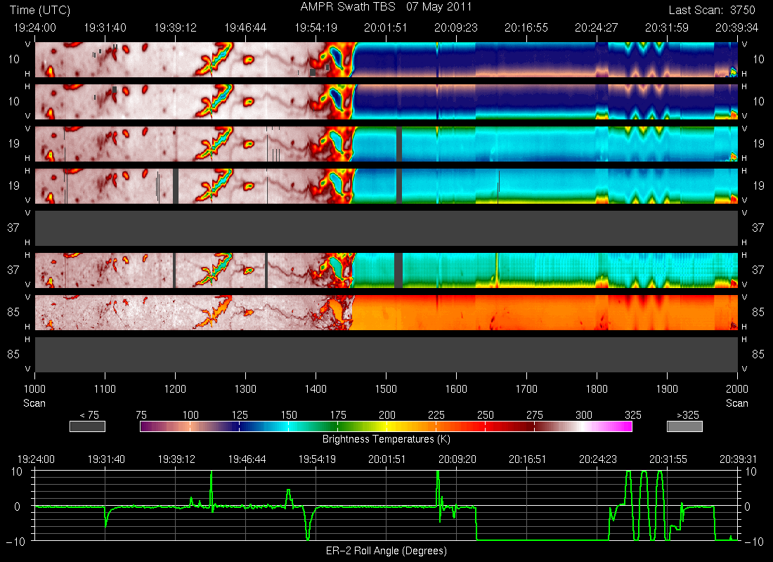
Get a related visualizationGIF
Sample browse image
-
Get a related visualizationGIF
Sample browse image
-
View information related to this datasetHTML
MC3E Field Campaign Collection DOI
-
View documentation related to this datasetPDF
The guide document contains detailed information about the dataset
-
Downloadable software applicationsHTML
Sample read program for AMPR data from MC3E
-
The dataset's project home pageHTML
The home page for the project or program which sponsored the dataset
-
Get a related visualizationHTML
N/A
-
View documentation related to this datasetHTML
Instructions for citing GHRC data
-
Landing PageLanding Page
Dates
| Metadata Created Date | February 22, 2025 |
|---|---|
| Metadata Updated Date | February 22, 2025 |
Metadata Source
- Data.json Data.json Metadata
Harvested from nasa test json
Additional Metadata
| Resource Type | Dataset |
|---|---|
| Metadata Created Date | February 22, 2025 |
| Metadata Updated Date | February 22, 2025 |
| Publisher | NASA/MSFC/GHRC |
| Maintainer | |
| Identifier | C1979126507-GHRC_DAAC |
| Data First Published | 2012-02-06 |
| Language | en-US |
| Data Last Modified | 2025-02-19 |
| Category | MC3E, geospatial |
| Public Access Level | public |
| Bureau Code | 026:00 |
| Metadata Context | https://project-open-data.cio.gov/v1.1/schema/catalog.jsonld |
| Schema Version | https://project-open-data.cio.gov/v1.1/schema |
| Catalog Describedby | https://project-open-data.cio.gov/v1.1/schema/catalog.json |
| Harvest Object Id | 18b6aa92-2d67-44d4-acc1-814d2d309688 |
| Harvest Source Id | a73e0c30-4684-40ef-908e-d22e9e9e5f86 |
| Harvest Source Title | nasa test json |
| Homepage URL | https://doi.org/10.5067/GPMGV/MC3E/AMPR/DATA101 |
| Metadata Type | geospatial |
| Old Spatial | -105.64 27.8598 -91.3954 42.4929 |
| Program Code | 026:001 |
| Source Datajson Identifier | True |
| Source Hash | 88b14f69df0b8542f97365cea097e7b783ddb07cb7711b347197753bd7f79a02 |
| Source Schema Version | 1.1 |
| Spatial | |
| Temporal | 2011-04-25T07:14:09Z/2011-06-01T23:33:14Z |
Didn't find what you're looking for? Suggest a dataset here.