

Global One-Eighth Degree Urban Land Extent Projection and Base Year Grids by SSP Scenarios, 2000-2100
Access & Use Information
Public: This dataset is intended for public access and use.
Non-Federal: This dataset is covered by different Terms of Use than Data.gov.
License: No license information was provided.
Downloads & Resources
-
Google Scholar search resultsHTML
Search results for publications that cite this dataset by its DOI.
-
Download this datasetHTML
Data Download Page
-
View documentation related to this datasetHTML
Documentation Page
-
View documentation related to this datasetHTML
Data Set Overview Page
-
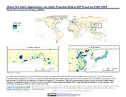
Get a related visualizationJPEG
Sample Browse for the data set.
-
Landing PageLanding Page
Dates
| Metadata Created Date | February 21, 2025 |
|---|---|
| Metadata Updated Date | February 21, 2025 |
Metadata Source
- Data.json Data.json Metadata
Harvested from nasa test json
Additional Metadata
| Resource Type | Dataset |
|---|---|
| Metadata Created Date | February 21, 2025 |
| Metadata Updated Date | February 21, 2025 |
| Publisher | SEDAC |
| Maintainer | |
| Identifier | C2205031324-SEDAC |
| Data First Published | 2021-04-05 |
| Language | en-US |
| Data Last Modified | 2025-02-19 |
| Category | SSP, geospatial |
| Public Access Level | public |
| Bureau Code | 026:00 |
| Metadata Context | https://project-open-data.cio.gov/v1.1/schema/catalog.jsonld |
| Schema Version | https://project-open-data.cio.gov/v1.1/schema |
| Catalog Describedby | https://project-open-data.cio.gov/v1.1/schema/catalog.json |
| Harvest Object Id | ce9e8269-26e9-4e52-8b90-6197638d3178 |
| Harvest Source Id | a73e0c30-4684-40ef-908e-d22e9e9e5f86 |
| Harvest Source Title | nasa test json |
| Homepage URL | https://doi.org/10.7927/nj0x-8y67 |
| Metadata Type | geospatial |
| Old Spatial | -180.0 -90.0 180.0 90.0 |
| Program Code | 026:001 |
| Source Datajson Identifier | True |
| Source Hash | e039ee1f473dc37ceeaa44736fab81c4596d9953f79c686a134c0a6c2bdd666f |
| Source Schema Version | 1.1 |
| Spatial | |
| Temporal | 2000-01-01T00:00:00Z/2100-12-31T00:00:00Z |
Didn't find what you're looking for? Suggest a dataset here.