

CarbonTracker-Lagrange South America OCO-2 Vertical Profile of Footprints V1 (CMS_CTL_SA_OCO2_FOOTPRINTS)
Access & Use Information
Public: This dataset is intended for public access and use.
Non-Federal: This dataset is covered by different Terms of Use than Data.gov.
License: No license information was provided.
Downloads & Resources
-
Google Scholar search resultsHTML
Search results for publications that cite this dataset by its DOI.
-
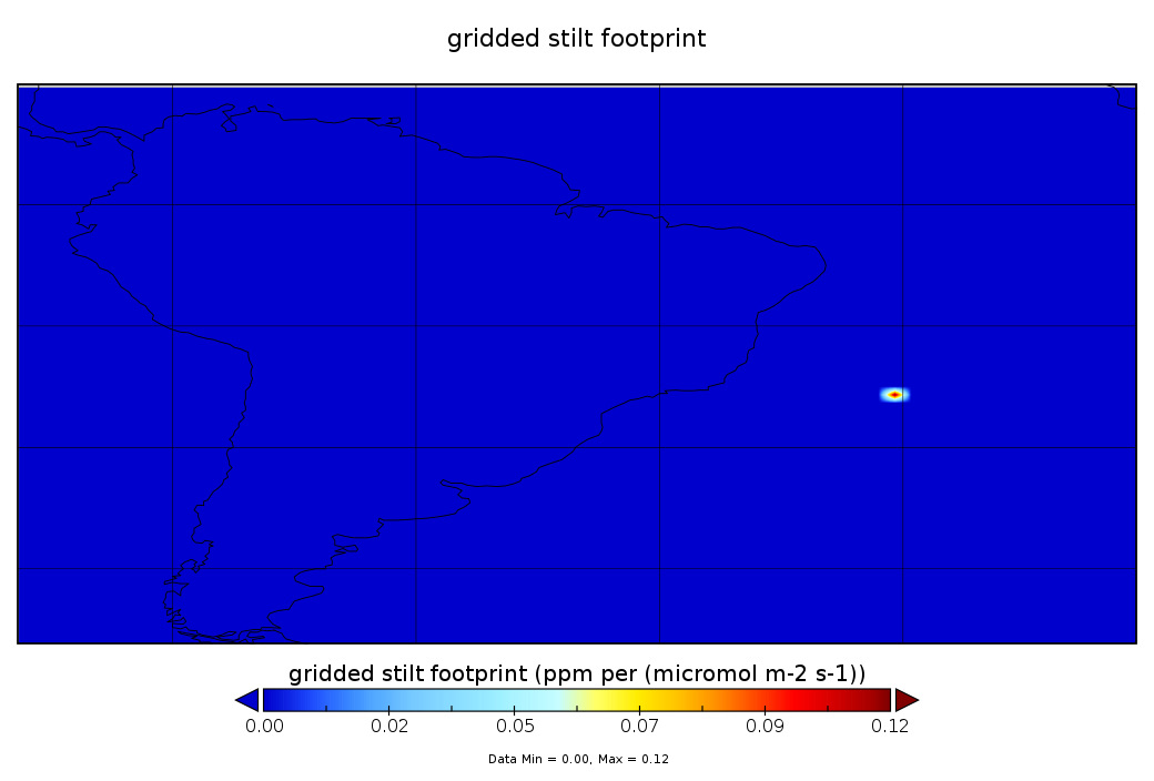
Get a related visualizationPNG
CMS_CTL_SA_OCO2_FOOTPRINTS_1.png
-
This dataset's landing pageHTML
Access the dataset landing page from the GES DISC website.
-
Download this dataset through a directory mapHTML
Access the data via HTTPS.
-
View this dataset's read me documentPDF
README Document
-
Use OPeNDAP to access the dataset's dataHTML
Access the data via the OPeNDAP protocol.
-
The dataset's project home pageHTML
The NASA Carbon Monitoring System (CMS) page.
-
Download this dataset through Earthdata SearchHTML
Use the Earthdata Search to find and retrieve data sets across multiple data...
-
Landing PageLanding Page
Dates
| Metadata Created Date | February 22, 2025 |
|---|---|
| Metadata Updated Date | February 22, 2025 |
Metadata Source
- Data.json Data.json Metadata
Harvested from nasa test json
Additional Metadata
| Resource Type | Dataset |
|---|---|
| Metadata Created Date | February 22, 2025 |
| Metadata Updated Date | February 22, 2025 |
| Publisher | NASA/GSFC/SED/ESD/GCDC/GESDISC |
| Maintainer | |
| Identifier | C2467880659-GES_DISC |
| Data First Published | 2015-08-22 |
| Language | en-US |
| Data Last Modified | 2025-02-19 |
| Category | CMS, geospatial |
| Public Access Level | public |
| Bureau Code | 026:00 |
| Metadata Context | https://project-open-data.cio.gov/v1.1/schema/catalog.jsonld |
| Schema Version | https://project-open-data.cio.gov/v1.1/schema |
| Catalog Describedby | https://project-open-data.cio.gov/v1.1/schema/catalog.json |
| Harvest Object Id | 3e532428-2c49-4a79-a862-583697a23585 |
| Harvest Source Id | a73e0c30-4684-40ef-908e-d22e9e9e5f86 |
| Harvest Source Title | nasa test json |
| Homepage URL | https://doi.org/10.5067/SUUR6I3N1PME |
| Metadata Type | geospatial |
| Old Spatial | -84.5 -54.5 -15.5 14.5 |
| Program Code | 026:001 |
| Source Datajson Identifier | True |
| Source Hash | 17ccc7ef65d0667ed276ee0c17d9d9e8dea63687f1371159deaaf56ea171a363 |
| Source Schema Version | 1.1 |
| Spatial | |
| Temporal | 2015-08-22T16:00:00Z/2016-05-31T18:00:00Z |
Didn't find what you're looking for? Suggest a dataset here.