

Get a related visualization
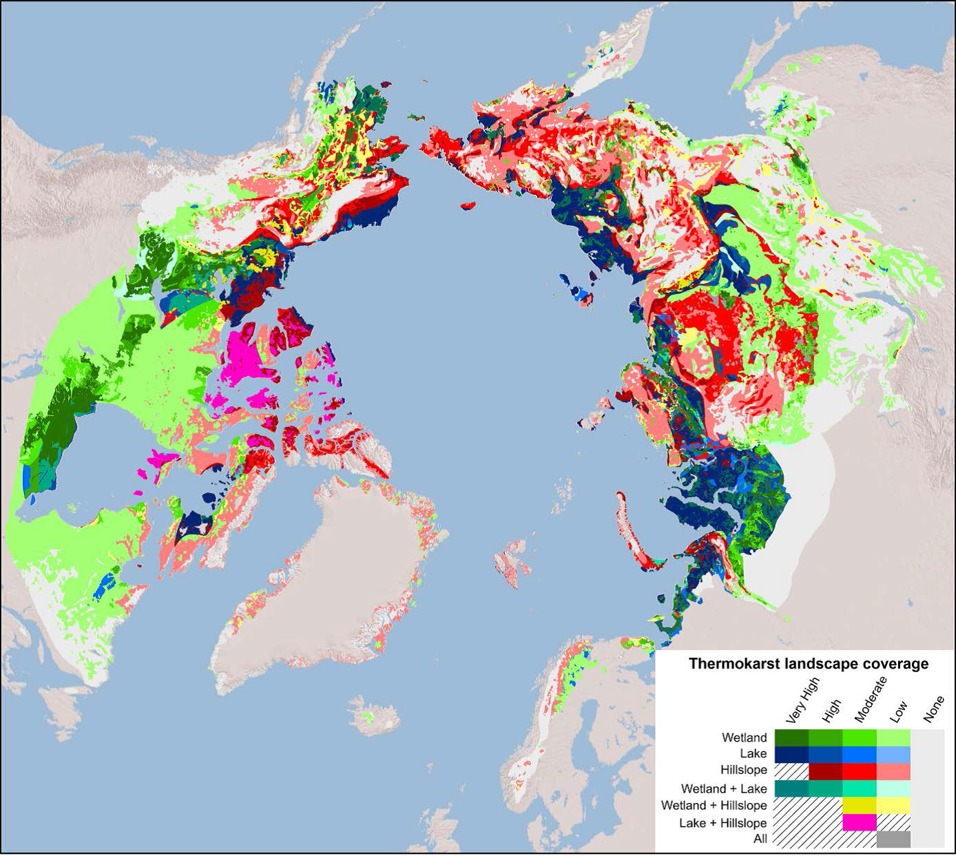
URL: https://daac.ornl.gov/SOILS/guides/Thermokarst_Circumpolar_Map_Fig1.png
Browse Image
Source: Arctic Circumpolar Distribution and Soil Carbon of Thermokarst Landscapes, 2015
About this Resource
| Last updated | unknown |
|---|---|
| Created | unknown |
| Name | Get a related visualization |
| Format | PNG Image File |
| License | License not specified |
| Created | 3 months ago |
| Media type | image/png |
| has views | True |
| id | ca884b77-2d0a-4423-893b-b14b5a638401 |
| metadata modified | 3 months ago |
| package id | 649d919a-c5b9-410d-b3b0-2721090daa2b |
| position | 6 |
| state | active |
| tracking summary | {'total': 0, 'recent': 0} |