

AIRS/Aqua L1C Near Real Time (NRT) Infrared (IR) resampled and corrected radiances V6.7 (AIRICRAD_NRT) at GES DISC
Access & Use Information
Downloads & Resources
-
Google Scholar search resultsHTML
Search results for publications that cite this dataset by its DOI.
-
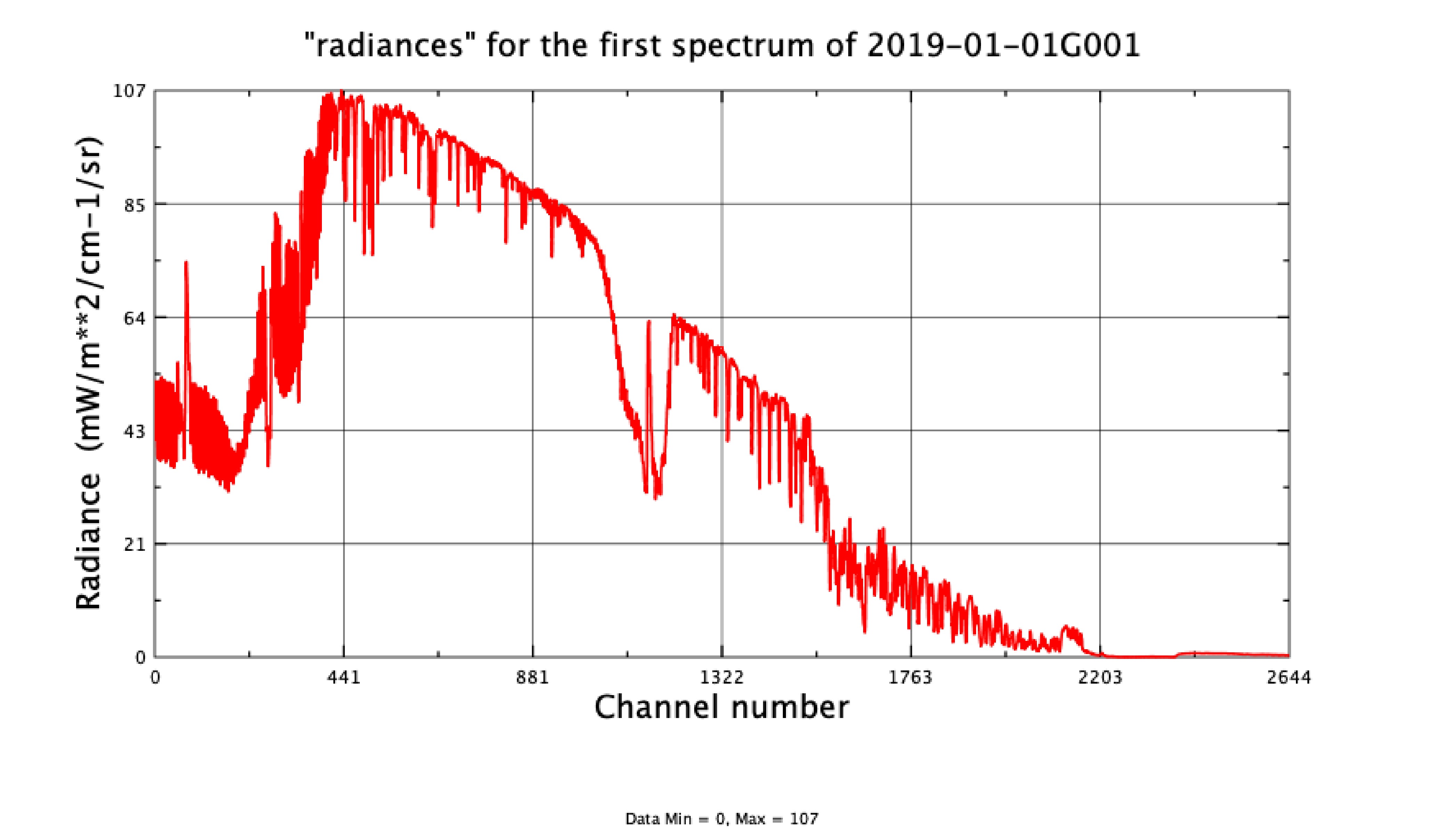
Get a related visualizationJPEG
Sample image of an AIRICRAD channel converted to brighness temperature
-
This dataset's landing pageHTML
Access the dataset landing page from the GES DISC website.
-
Download this dataset through a directory mapHTML
Access the data via HTTPS. Earthdata user registration is required. Register...
-
Use OPeNDAP to access the dataset's dataHTML
Access the data via the OPeNDAP protocol.
-
Download this dataset through Earthdata SearchHTML
You must register using the EOSDIS User Registration System in order to...
-
The dataset's project home pageHTML
AIRS home page at NASA/JPL. General information on the AIRS instrument suite,...
-
View information related to this datasetHTML
AIRS Documentation Page
-
View this dataset's read me documentPDF
README Document
-
View this dataset's algorithm theoretical...PDF
Algorithm Theoretical Basis Document
-
Landing PageLanding Page
References
| https://doi.org/10.1117/12.2529400 |
| https://doi.org/10.1117/12.2061967 |
| https://doi.org/10.1029/2005JD006146 |
Dates
| Metadata Created Date | February 22, 2025 |
|---|---|
| Metadata Updated Date | February 22, 2025 |
Metadata Source
- Data.json Data.json Metadata
Harvested from nasa test json
Additional Metadata
| Resource Type | Dataset |
|---|---|
| Metadata Created Date | February 22, 2025 |
| Metadata Updated Date | February 22, 2025 |
| Publisher | NASA/GSFC/SED/ESD/GCDC/GESDISC |
| Maintainer | |
| Identifier | C1712047294-GES_DISC |
| Data First Published | 2020-01-02 |
| Language | en-US |
| Data Last Modified | 2025-02-19 |
| Category | Aqua, LANCE, geospatial |
| Public Access Level | public |
| Bureau Code | 026:00 |
| Metadata Context | https://project-open-data.cio.gov/v1.1/schema/catalog.jsonld |
| Schema Version | https://project-open-data.cio.gov/v1.1/schema |
| Catalog Describedby | https://project-open-data.cio.gov/v1.1/schema/catalog.json |
| Harvest Object Id | 78411492-c184-4392-a3fb-674935992b2d |
| Harvest Source Id | a73e0c30-4684-40ef-908e-d22e9e9e5f86 |
| Harvest Source Title | nasa test json |
| Homepage URL | https://doi.org/10.5067/LJSDHD3RLTII |
| Metadata Type | geospatial |
| Old Spatial | -180.0 -90.0 180.0 90.0 |
| Program Code | 026:001 |
| Related Documents | https://doi.org/10.1117/12.2529400, https://doi.org/10.1117/12.2061967, https://doi.org/10.1029/2005JD006146 |
| Source Datajson Identifier | True |
| Source Hash | 6e8759bd17af9776a5822d118b7e6cbb3d6a20fd382cf02aa60088552680f5f6 |
| Source Schema Version | 1.1 |
| Spatial | |
| Temporal | 2002-09-06T00:00:00Z/2022-01-17T00:00:00Z |
Didn't find what you're looking for? Suggest a dataset here.