

Adaptive Sampling of Rain and Ocean Salinity from Autonomous Seagliders (Guam 2019-2020)
Access & Use Information
Public: This dataset is intended for public access and use.
Non-Federal: This dataset is covered by different Terms of Use than Data.gov.
License: No license information was provided.
Downloads & Resources
-
Google Scholar search resultsHTML
Search results for publications that cite this dataset by its DOI.
-
Download this dataset through a directory mapHTML
HTTPS endpoint for data browse and download
-
Download this dataset through Earthdata SearchHTML
Browse granule search results in Earthdata Search
-
View this dataset's user's guidePDF
User Guide
-
View documentation related to this datasetPDF
Project Report
-
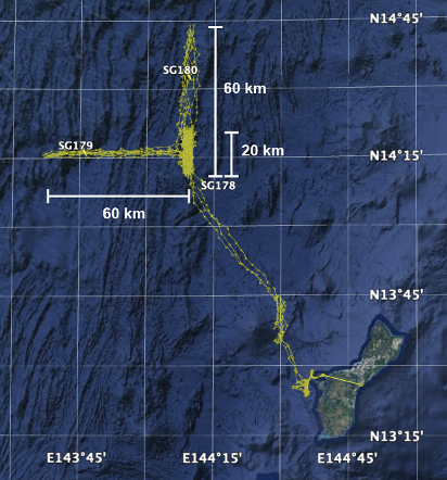
Get a related visualizationPNG
Thumbnail
-
View this dataset's data recipesHTML
Generic Data Readers
-
View this dataset's data citation policyHTML
Data Use and Citation Policy
-
View this dataset's read me documentHTML
README
-
Landing PageLanding Page
Dates
| Metadata Created Date | February 22, 2025 |
|---|---|
| Metadata Updated Date | February 22, 2025 |
Metadata Source
- Data.json Data.json Metadata
Harvested from nasa test json
Additional Metadata
| Resource Type | Dataset |
|---|---|
| Metadata Created Date | February 22, 2025 |
| Metadata Updated Date | February 22, 2025 |
| Publisher | NASA/JPL/PODAAC |
| Maintainer | |
| Identifier | C2151536874-POCLOUD |
| Data First Published | 2019-10-03 |
| Language | en-US |
| Data Last Modified | 2025-02-19 |
| Category | geospatial |
| Public Access Level | public |
| Bureau Code | 026:00 |
| Metadata Context | https://project-open-data.cio.gov/v1.1/schema/catalog.jsonld |
| Schema Version | https://project-open-data.cio.gov/v1.1/schema |
| Catalog Describedby | https://project-open-data.cio.gov/v1.1/schema/catalog.json |
| Harvest Object Id | 9f132a71-f8d7-4459-b6ce-0b75d1140e4c |
| Harvest Source Id | a73e0c30-4684-40ef-908e-d22e9e9e5f86 |
| Harvest Source Title | nasa test json |
| Homepage URL | https://doi.org/10.5067/ASROS-GLGU1 |
| Metadata Type | geospatial |
| Old Spatial | 143.63035 13.39476 144.613 14.71229 |
| Program Code | 026:001 |
| Source Datajson Identifier | True |
| Source Hash | 3b4e98694c1fee1e0560655690659dbd7910350a577a17d8829d5cff7340feae |
| Source Schema Version | 1.1 |
| Spatial | |
| Temporal | 2019-10-03T00:00:00Z/2020-01-15T02:00:00Z |
Didn't find what you're looking for? Suggest a dataset here.