

Get a related visualization
URL: https://daac.ornl.gov/ABOVE/guides/Wildfires_Date_of_Burning_Fig1.png
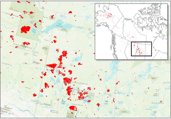
Date of Burning (DoB) estimated for areas within each fire scar (inset) across Alaska and Canada. Red areas show fire scar locations across central Canada (detail) in 2015.
Source: ABoVE: Wildfire Date of Burning within Fire Scars across Alaska and Canada, 2001-2019
About this Resource
| Last updated | unknown |
|---|---|
| Created | unknown |
| Name | Get a related visualization |
| Format | PNG Image File |
| License | License not specified |
| Created | 3 months ago |
| Media type | image/png |
| has views | True |
| id | 3195ce6a-020c-4867-8111-b506eeaaf2f0 |
| metadata modified | 3 months ago |
| package id | 080abcfe-de5f-4b68-8db1-b2e02eeb6ff0 |
| position | 5 |
| state | active |
| tracking summary | {'total': 0, 'recent': 0} |