

Get a related visualization
URL: https://daac.ornl.gov/ABOVE/guides/End_of_Season_Snow_Depth_Fig1.png
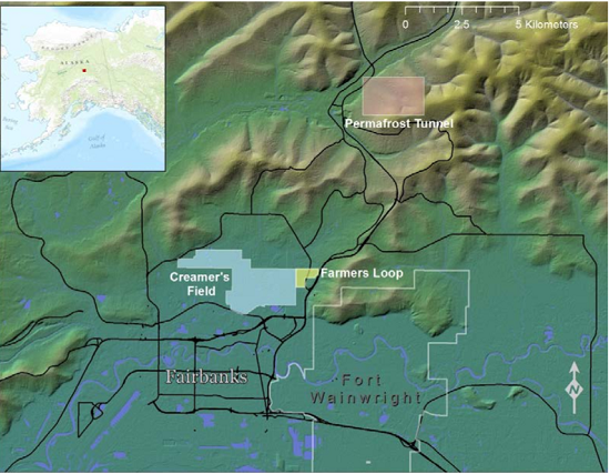
Locations of the Creamer's Field, Farmer's Loop, and Permafrost Tunnel transect sites (photo from Bjella et al., 2015).
Source: ABoVE: End of Season Snow Depth at CRREL sites near Fairbanks, Alaska, 2014-2019
About this Resource
| Last updated | unknown |
|---|---|
| Created | unknown |
| Name | Get a related visualization |
| Format | PNG Image File |
| License | License not specified |
| Created | 3 months ago |
| Media type | image/png |
| has views | True |
| id | 7c7f7401-cdc5-48e4-af9d-73e679c24dd3 |
| metadata modified | 3 months ago |
| package id | 2dbf330b-003e-42c6-b637-363e8ac7d68f |
| position | 7 |
| state | active |
| tracking summary | {'total': 0, 'recent': 0} |