

ABoVE: Ecosystem Map, Great Slave Lake Area, Northwest Territories, Canada, 1997-2011
Access & Use Information
Downloads & Resources
-
Google Scholar search resultsHTML
Search results for publications that cite this dataset by its DOI.
-
Download this datasetHTML
This link allows direct data access via Earthdata login
-
View documentation related to this datasetHTML
ORNL DAAC Data Set Documentation
-
This dataset's landing pageHTML
Data set Landing Page DOI URL
-
View documentation related to this datasetPDF
ABoVE: Ecosystem Map, Great Slave Lake Area, Northwest Territories, Canada,...
-
View documentation related to this datasetCSV
ABoVE: Ecosystem Map, Great Slave Lake Area, Northwest Territories, Canada,...
-
View documentation related to this datasetCSV
ABoVE: Ecosystem Map, Great Slave Lake Area, Northwest Territories, Canada,...
-
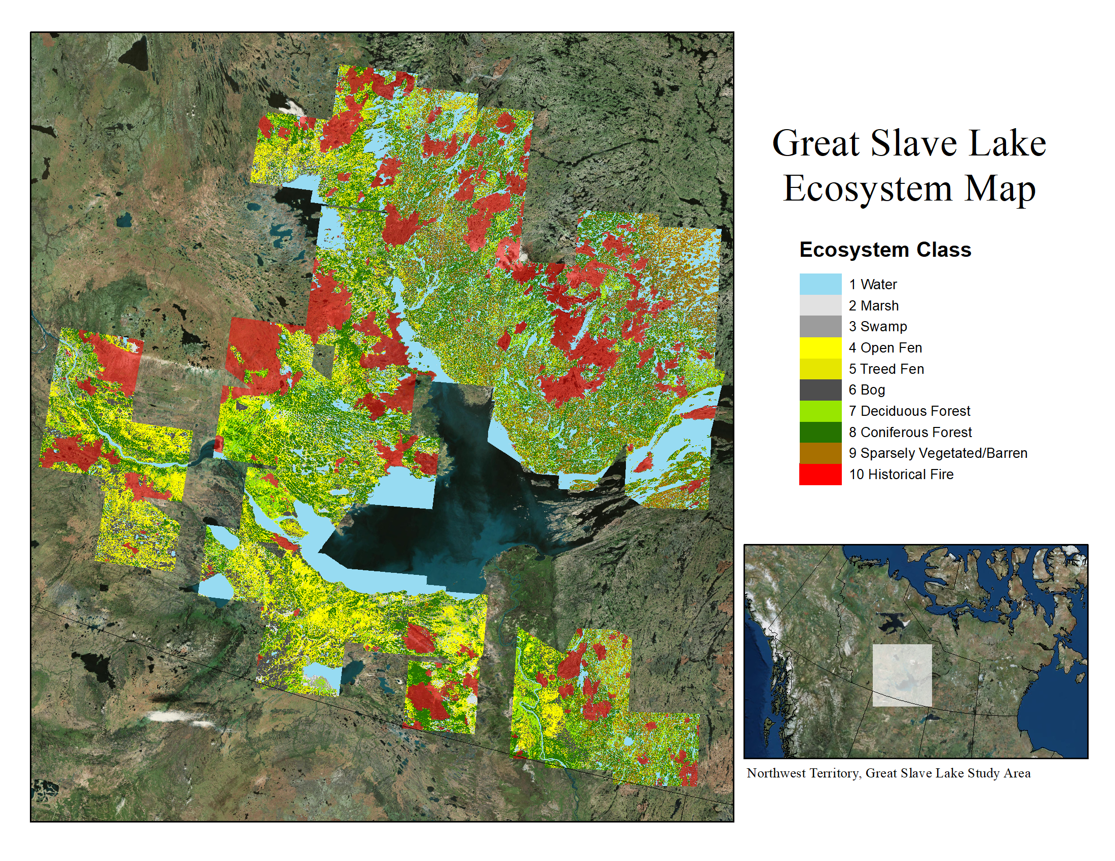
Get a related visualizationPNG
Ecosystem map for the Great Slave Lake area, NWT, Canada for the period...
-
The dataset's project home pageHTML
ABoVE project site
-
Landing PageLanding Page
Dates
| Metadata Created Date | February 23, 2025 |
|---|---|
| Metadata Updated Date | February 23, 2025 |
Metadata Source
- Data.json Data.json Metadata
Harvested from nasa test json
Additional Metadata
| Resource Type | Dataset |
|---|---|
| Metadata Created Date | February 23, 2025 |
| Metadata Updated Date | February 23, 2025 |
| Publisher | ORNL_DAAC |
| Maintainer | |
| Identifier | C2143402730-ORNL_CLOUD |
| Data First Published | 2019-11-18 |
| Language | en-US |
| Data Last Modified | 2025-02-18 |
| Category | ABoVE, geospatial |
| Public Access Level | public |
| Bureau Code | 026:00 |
| Metadata Context | https://project-open-data.cio.gov/v1.1/schema/catalog.jsonld |
| Schema Version | https://project-open-data.cio.gov/v1.1/schema |
| Catalog Describedby | https://project-open-data.cio.gov/v1.1/schema/catalog.json |
| Harvest Object Id | 02aa0934-e75e-4eaf-aa88-4dd86ebb41a6 |
| Harvest Source Id | a73e0c30-4684-40ef-908e-d22e9e9e5f86 |
| Harvest Source Title | nasa test json |
| Homepage URL | https://doi.org/10.3334/ORNLDAAC/1695 |
| Metadata Type | geospatial |
| Old Spatial | -123.04 58.51 -109.46 65.15 |
| Program Code | 026:001 |
| Source Datajson Identifier | True |
| Source Hash | dcf5c97ba17f1d19a0b51eee9192ab1b8cc3811025d659ceff2c76c2ff3ce167 |
| Source Schema Version | 1.1 |
| Spatial | |
| Temporal | 1997-09-25T00:00:00Z/2011-09-14T23:59:59Z |
Didn't find what you're looking for? Suggest a dataset here.