

Get a related visualization
URL: https://daac.ornl.gov/ABOVE/guides/ABoVE_Planning_Field_Sites_fig1.png
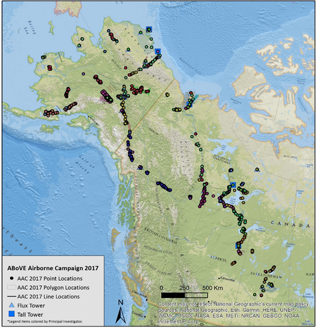
Locations of the field sites (points, lines, and polygons) used in planning the 2017 ABoVE Airborne Campaign.
Source: ABoVE: Directory of Field Sites Associated with 2017 ABoVE Airborne Campaign
About this Resource
| Last updated | unknown |
|---|---|
| Created | unknown |
| Name | Get a related visualization |
| Format | PNG Image File |
| License | License not specified |
| Created | 3 months ago |
| Media type | image/png |
| has views | True |
| id | a1b63fd9-e5da-4dda-8acc-5bb43c1475cd |
| metadata modified | 3 months ago |
| package id | f6f04cf6-c357-4506-b2ba-642a689ed25a |
| position | 6 |
| state | active |
| tracking summary | {'total': 0, 'recent': 0} |