

Get a related visualization
URL: https://daac.ornl.gov/ABOVE/guides/ABoVE_AirSWOT_Radar_Data_Fig1.png
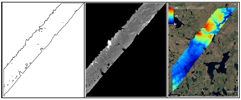
Example of AirSWOT radar products in ABoVE Projection at 3.6 m2 resolution, for a flight over the ABoVE C grid Ch065v034. Left: Shape for backscatter image. Middle: Magnitude image. Right: Elevation product image.
Source: ABoVE: AirSWOT Ka-band Radar over Surface Waters of Alaska and Canada, 2017
About this Resource
| Last updated | unknown |
|---|---|
| Created | unknown |
| Name | Get a related visualization |
| Format | PNG Image File |
| License | License not specified |
| Created | 3 months ago |
| Media type | image/png |
| has views | True |
| id | 5005735e-64f6-4245-9023-cf140fc05e07 |
| metadata modified | 3 months ago |
| package id | 0286f77f-8494-480f-9414-15bd82dcaeae |
| position | 6 |
| state | active |
| tracking summary | {'total': 0, 'recent': 0} |