

111 datasets found
-
Digital Elevation Models for the Global Change Research Wetland, Maryland, USA, 2016
NASA Test —
This dataset contains four alternative digital elevation models (DEMs) at 1 m resolution and model performance statistical metrics for the Global Change Research... -
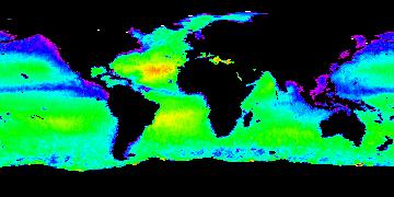
Aquarius Official Release Level 3 Sea Surface Salinity Standard Mapped Image Daily Data V5.0
NASA Test —
Aquarius Level 3 sea surface salinity (SSS) standard mapped image data contains gridded 1 degree spatial resolution SSS averaged over daily, 7 day, monthly, and... -
Aquarius Official Release Level 3 Sea Surface Salinity Standard Mapped Image 7-Day Running Mean Data V5.0
NASA Test —
Aquarius Level 3 sea surface salinity (SSS) standard mapped image data contains gridded 1 degree spatial resolution SSS averaged over daily, 7 day, monthly, and... -
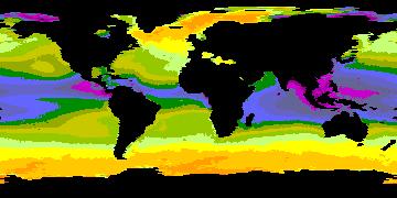
Aquarius Official Release Level 3 Sea Surface Density Standard Mapped Image Descending 7-Day Data V5.0
NASA Test —
Aquarius Level 3 sea surface density standard mapped image data contains gridded 1 degree spatial resolution density data averaged over daily, 7 day, monthly, and... -
Aquarius Official Release Level 3 Sea Surface Salinity Standard Mapped Image Descending Mission Cumulative Data V5.0
NASA Test —
Aquarius Level 3 sea surface salinity (SSS) standard mapped image data contains gridded 1 degree spatial resolution SSS averaged over daily, 7 day, monthly, and... -
Aquarius Official Release Level 3 Sea Surface Spiciness Standard Mapped Image Seasonal Data V5.0
NASA Test —
Aquarius Level 3 sea surface spiciness standard mapped image data contains gridded 1 degree spatial resolution spice data averaged over daily, 7 day, monthly, and... -
Aquarius Official Release Level 3 Rain-flagged Sea Surface Salinity Standard Mapped Image Seasonal Climatology Data V5.0
NASA Test —
Aquarius Level 3 sea surface salinity (SSS) rain-flagged standard mapped image data contains gridded 1 degree spatial resolution SSS averaged over daily, 7 day,... -
Aquarius Official Release Level 3 Ancillary Reynolds Sea Surface Temperature Standard Mapped Image Monthly Data V5.0
NASA Test —
Aquarius Level 3 ancillary sea surface temperature (SST) standard mapped image data are the ancillary SST data used in the Aquarius calibration for salinity retrieval.... -
Aquarius Official Release Level 3 Wind Speed Standard Mapped Image Ascending 7-Day Data V5.0
NASA Test —
Aquarius Level 3 ocean surface wind speed standard mapped image data contains gridded 1 degree spatial resolution wind speed data averaged over daily, 7 day, monthly,... -
Aquarius Official Release Level 3 Sea Surface Density Standard Mapped Image Ascending Monthly Data V5.0
NASA Test —
Aquarius Level 3 sea surface density standard mapped image data contains gridded 1 degree spatial resolution density data averaged over daily, 7 day, monthly, and... -
Aquarius Official Release Level 3 Ancillary Reynolds Sea Surface Temperature Standard Mapped Image Ascending Seasonal Data V5.0
NASA Test —
Aquarius Level 3 ancillary sea surface temperature (SST) standard mapped image data are the ancillary SST data used in the Aquarius calibration for salinity retrieval.... -
Aquarius Official Release Level 3 Sea Surface Spiciness Standard Mapped Image 7-Day Running Mean Data V5.0
NASA Test —
Aquarius Level 3 sea surface spiciness standard mapped image data contains gridded 1 degree spatial resolution spice data averaged over daily, 7 day, monthly, and... -
Aquarius Official Release Level 3 Rain-flagged Sea Surface Salinity Standard Mapped Image Descending 7-Day Data V5.0
NASA Test —
Aquarius Level 3 sea surface salinity (SSS) rain-flagged standard mapped image data contains gridded 1 degree spatial resolution SSS averaged over daily, 7 day,... -
Aquarius Official Release Level 3 Rain-flagged Sea Surface Salinity Standard Mapped Image Descending Seasonal Climatology Data V5.0
NASA Test —
Aquarius Level 3 sea surface salinity (SSS) rain-flagged standard mapped image data contains gridded 1 degree spatial resolution SSS averaged over daily, 7 day,... -
Aquarius Official Release Level 3 Sea Surface Spiciness Standard Mapped Image Daily Data V5.0
NASA Test —
Aquarius Level 3 sea surface spiciness standard mapped image data contains gridded 1 degree spatial resolution spice data averaged over daily, 7 day, monthly, and... -
Aquarius Official Release Level 3 Wind Speed Standard Mapped Image Descending Annual Data V5.0
NASA Test —
Aquarius Level 3 ocean surface wind speed standard mapped image data contains gridded 1 degree spatial resolution wind speed data averaged over daily, 7 day, monthly,... -
Aquarius Official Release Level 3 Sea Surface Salinity Standard Mapped Image Monthly Climatology Data V5.0
NASA Test —
Aquarius Level 3 sea surface salinity (SSS) standard mapped image data contains gridded 1 degree spatial resolution SSS averaged over daily, 7 day, monthly, and... -
Aquarius Official Release Level 3 Rain-flagged Sea Surface Salinity Standard Mapped Image 7-Day Running Mean Data V5.0
NASA Test —
Aquarius Level 3 sea surface salinity (SSS) rain-flagged standard mapped image data contains gridded 1 degree spatial resolution SSS averaged over daily, 7 day,... -
Aquarius Official Release Level 3 Sea Surface Density Standard Mapped Image 7-Day Data V5.0
NASA Test —
Aquarius Level 3 sea surface density standard mapped image data contains gridded 1 degree spatial resolution derived density averaged over daily, 7 day, monthly, and... -
Aquarius Official Release Level 3 Rain-flagged Sea Surface Salinity Standard Mapped Image Ascending 28-Day Running Mean Data V5.0
NASA Test —
Aquarius Level 3 sea surface salinity (SSS) rain-flagged standard mapped image data contains gridded 1 degree spatial resolution SSS averaged over daily, 7 day,...
111 datasets found