

1,264 datasets found
-
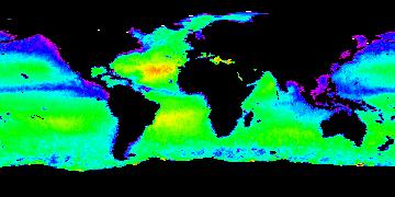
Aquarius Official Release Level 3 Sea Surface Salinity Standard Mapped Image Daily Data V5.0
NASA Test —
Aquarius Level 3 sea surface salinity (SSS) standard mapped image data contains gridded 1 degree spatial resolution SSS averaged over daily, 7 day, monthly, and... -
GHRSST NOAA/STAR GOES-16 ABI L2P America Region SST v2.70 dataset in GDS2
NASA Test —
GOES-16 (G16) is the first satellite in the US NOAA third generation of Geostationary Operational Environmental Satellites (GOES), a.k.a. GOES-R series (which will... -
GHRSST Level 3U Global Subskin Sea Surface Temperature version7.0.1a from the WindSat Polarimetric Radiometer on the Coriolis satellite
NASA Test —
The WindSat Polarimetric Radiometer, launched on January 6, 2003 aboard the Department of Defense Coriolis satellite, was designed to measure the ocean surface wind... -
First ISCCP Regional Experiment (FIRE) Atlantic Stratocumulus Transition Experiment (ASTEX) SOFIA Le Suroit Meteorological Data
NASA Test —
The First ISCCP Regional Experiments have been designed to improve data products and cloud/radiation parameterizations used in general circulation models (GCMs).... -
Moderate Resolution Imaging Spectroradiometer (MODIS) - Terra NGDA
NASA Test —
This dataset represents multiple products archived at the multiple archive centers for the MODIS (Moderate Resolution Imaging Spectroradiometer) instrument aboard the... -
Aquarius Official Release Level 3 Sea Surface Salinity Standard Mapped Image 7-Day Running Mean Data V5.0
NASA Test —
Aquarius Level 3 sea surface salinity (SSS) standard mapped image data contains gridded 1 degree spatial resolution SSS averaged over daily, 7 day, monthly, and... -
Reconstructed Sea Level Version 1
NASA Test —
The Reconstructed Sea Level dataset contains sea level anomalies derived from satellite altimetry and tide gauges. The satellite altimetric record provides accurate... -
CAR FIREACE Arctic Ice and Cloud Radiation L1 V1 (CAR_FIREACE_L1C) at GES DISC
NASA Test —
The scientific objectives of FIRE/ACE are to study impact of Arctic clouds on radiation exchange between surface, atmosphere, and space, and the influence of surface... -
Aquarius Official Release Level 3 Sea Surface Density Standard Mapped Image Descending 7-Day Data V5.0
NASA Test —
Aquarius Level 3 sea surface density standard mapped image data contains gridded 1 degree spatial resolution density data averaged over daily, 7 day, monthly, and... -
Sentinel-6A MF Jason-CS L2 Advanced Microwave Radiometer (AMR-C) NTC Geophysical Parameters F08
NASA Test —
Provides L2 non-time critical (NTC; 60-day latency) validated geophysical information from the Advanced Microwave Radiometer on the Sentinel-6A Michael Freilich... -
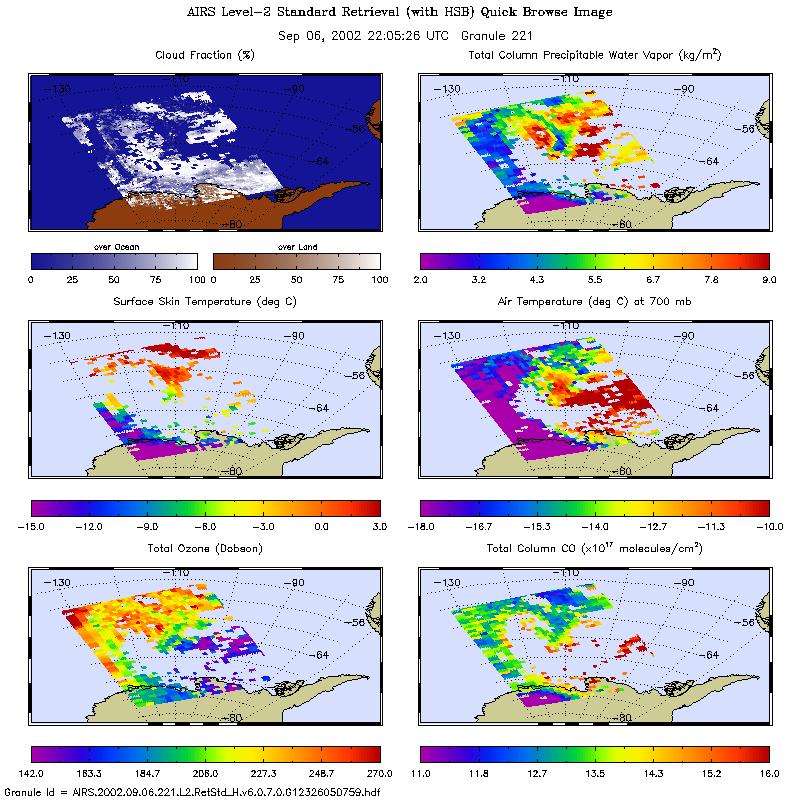
AIRS/Aqua L2 Standard Physical Retrieval (AIRS+AMSU+HSB) V006 (AIRH2RET) at GES DISC
NASA Test —
The Atmospheric Infrared Sounder (AIRS) is a grating spectrometer (R = 1200) aboard the second Earth Observing System (EOS) polar-orbiting platform, EOS Aqua. In... -
IceBridge Ku-Band Radar L1B Geolocated Radar Echo Strength Profiles V002
NASA Test —
This data set contains elevation and surface measurements over Greenland, the Arctic, and Antarctica, as well as flight path charts and echogram images acquired using... -
Suomi-NPP VIIRS Global Mapped Diffuse Attenuation Coefficient for Downwelling Irradiance (KD) Data, version R2022.0
NASA Test —
The Visible and Infrared Imager/Radiometer Suite (VIIRS) is a multi-disciplinary instrument that is being flown on the Joint Polar Satellite System (JPSS) series of... -
First ISCCP Regional Experiment (FIRE) Atlantic Stratocumulus Transition Experiment (ASTEX) ERS-1 Wind Scatterometer Data
NASA Test —
The First ISCCP Regional Experiments have been designed to improve data products and cloud/radiation parameterizations used in general circulation models (GCMs).... -
Landsat Surface Reflectance - L8 OLI/TIRS
NASA Test —
Landsat satellite data have been produced, archived, and distributed by the U.S. Geological Survey (USGS) since 1972. Users rely on these data for historical study of... -
NOAA Smith and Reynolds Extended Reconstructed Sea Surface Temperature (ERSST) Level 4 Monthly Version 5 Dataset in netCDF
NASA Test —
The Smith & Reynolds Extended Reconstructed Sea Surface Temperature (ERSST) Level 4 dataset provides a historical reconstruction of monthly global ocean surface... -
GHRSST Level 2P 1 m Depth Global Sea Surface Temperature from VIIRS on Suomi NPP (GDS2) V1
NASA Test —
A global Group for High Resolution Sea Surface Temperature (GHRSST) Level 2P dataset based on retrievals from the Visible Infrared Imaging Radiometer Suite (VIIRS).... -
ECCO Gent-McWilliams Ocean Bolus Velocity - Daily Mean 0.5 Degree (Version 4 Release 4)
NASA Test —
This dataset contains daily-averaged Gent-McWilliams ocean bolus velocity interpolated to a regular 0.5-degree grid from the ECCO Version 4 revision 4 (V4r4) ocean and... -
Sentinel-3B OLCI Level-3M Global Mapped Earth-observation Reduced-Resolution (ERR) Inherent Optical Properties (IOP) Data, version R2022.0
NASA Test —
The Ocean and Land Colour Instrument (OLCI) is the successor to ENVISAT's Medium Resolution Imaging Spectrometer (MERIS) having additional spectral channels, different...
1,264 datasets found