

1,379 datasets found
-
CARVE: L1 In-situ Carbon and CH4 Flux and Meteorology at EC Towers, Alaska, 2011-2015
NASA Test —
This data set provides ground in situ flux and meteorological science data from fixed instruments at three eddy covariance tower sites located in the Alaskan Arctic... -
SAGE III/ISS L2 Solar Event Species Profiles (HDF5) V053
NASA Test —
g3bssp_53 is the Stratospheric Aerosol and Gas Experiment III (SAGE III) on the International Space Station (ISS) (SAGE III/ISS) Level 2 Solar Event Species Profiles... -
DXC'13 Industrial Track Sample Data
NASA Test —
The sample scenarios provided here are competition scenarios from previous DXC competitions. They are identical to the competition data associated with previous years'... -
Aquarius Official Release Level 3 Sea Surface Salinity Standard Mapped Image Descending Mission Cumulative Data V5.0
NASA Test —
Aquarius Level 3 sea surface salinity (SSS) standard mapped image data contains gridded 1 degree spatial resolution SSS averaged over daily, 7 day, monthly, and... -
Aquarius Official Release Level 3 Sea Surface Spiciness Standard Mapped Image Seasonal Data V5.0
NASA Test —
Aquarius Level 3 sea surface spiciness standard mapped image data contains gridded 1 degree spatial resolution spice data averaged over daily, 7 day, monthly, and... -
Cloud-Precipitation Hybrid Regimes (MODIS-IMERG) in 15S-15N
NASA Test —
Cloud-Precipitation Hybrid Regimes with MODIS C6.1 2D joint histogram of CTP and COT (total 42 bins) and IMERG v06B precipitation histogram (total 6 bins) derived in... -
CERES ERBE-like Instantaneous TOA Estimates NOAA-20 FM6 Edition1
NASA Test —
CER_ES8_NOAA20-FM6_Edition1 data are ERBE-like instantaneous TOA estimates. Edition1 data are for instrument validation and are not suited for science publications.... -
A Concise Experiment Plan for the Arctic-Boreal Vulnerability Experiment
NASA Test —
This document presents the Concise Experiment Plan for NASA's Arctic-Boreal Vulnerability Experiment (ABoVE) to serve as a guide to the Program as it identifies the... -
System for Award Management (SAM) Public Extract - Entity Registration
State of Washington —
This dataset contains the information available under the Freedom of Information Act (FOIA) for those entities registered to do business with the Federal government in... -
Aquarius Official Release Level 3 Rain-flagged Sea Surface Salinity Standard Mapped Image Seasonal Climatology Data V5.0
NASA Test —
Aquarius Level 3 sea surface salinity (SSS) rain-flagged standard mapped image data contains gridded 1 degree spatial resolution SSS averaged over daily, 7 day,... -
Aquarius Official Release Level 3 Ancillary Reynolds Sea Surface Temperature Standard Mapped Image Monthly Data V5.0
NASA Test —
Aquarius Level 3 ancillary sea surface temperature (SST) standard mapped image data are the ancillary SST data used in the Aquarius calibration for salinity retrieval.... -
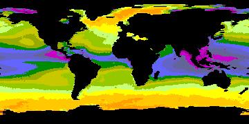
Cloud Regime for CRE Feedback Study
NASA Test —
Cloud-only regimes (and 3 sub-regimes of CR15) originally derived from Terra and Aqua observations in 50S-50N, and corresponding "regime numbers on map" files assigned... -
Aquarius Official Release Level 3 Wind Speed Standard Mapped Image Ascending 7-Day Data V5.0
NASA Test —
Aquarius Level 3 ocean surface wind speed standard mapped image data contains gridded 1 degree spatial resolution wind speed data averaged over daily, 7 day, monthly,... -
Aquarius Official Release Level 3 Sea Surface Density Standard Mapped Image Ascending Monthly Data V5.0
NASA Test —
Aquarius Level 3 sea surface density standard mapped image data contains gridded 1 degree spatial resolution density data averaged over daily, 7 day, monthly, and... -
CERES A-Train Integrated CALIPSO, CloudSat, CERES, and MODIS (CCCM) Merged Release D1 NGDA
NASA Test —
CER_CCCM_Aqua-FM3-MODIS-CAL-CS_RelD1 is the Clouds and the Earth's Radiant Energy System (CERES) A-Train Integrated Cloud-Aerosol Lidar and Infrared Pathfinder... -
NARSTO PAC2001 Langley Site Gaseous, Particle, and Meteorological Data
NASA Test —
NARSTO_PAC2001_LANGLEY_GAS_PM_MET_DATA was obtained between August 8 and September 2, 2001 during the Pacific 2001 Air Quality Study (PAC2001).The Langley Ecole... -
HIRENASD Experimental Data
NASA Test —
Experimental Data for HIRENASD configuration Zip files below contain the experimental data for the pressure coefficients, both the static and the forced oscillation... -
Aquarius Official Release Level 3 Ancillary Reynolds Sea Surface Temperature Standard Mapped Image Ascending Seasonal Data V5.0
NASA Test —
Aquarius Level 3 ancillary sea surface temperature (SST) standard mapped image data are the ancillary SST data used in the Aquarius calibration for salinity retrieval.... -
NARSTO SOS99 Nashville Tennessee Valley Authority (TVA) Surface Meteorology and Chemistry Data
NASA Test —
NARSTO_SOS99NASH_SURFACE_MET_CHEM_DATA is the North American Research Strategy for Tropospheric Ozone (NARSTO) SOS99 Nashville Tennessee Valley Authority (TVA) Surface... -
Aquarius Official Release Level 3 Sea Surface Spiciness Standard Mapped Image 7-Day Running Mean Data V5.0
NASA Test —
Aquarius Level 3 sea surface spiciness standard mapped image data contains gridded 1 degree spatial resolution spice data averaged over daily, 7 day, monthly, and...
1,379 datasets found